Today began as another spectacular summer day, and again I thought of spending some time hiking in the woods. I couldn’t travel as far afield as the Cape, so I decided to check out two properties in Petersham, a small community a few miles to the northwest of my town, on the eastern edge of the Quabbin Reservoir.
 Shortly before noon, I headed first for the Brooks Woodland Preserve, a property owned and managed by the Trustees of Reservations. A half-hour’s drive via 67 and then 32-122 brought me to Petersham Center, where I turned right on East Street and then parked by the side of the road, at the entrance to the Roaring Brook tract. As the name implies, this property, once agricultural, is now heavily forested, with streams and wetlands also prominently featured.
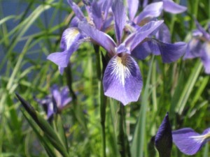
The preserve includes 13 miles of trails, so from the trail map I had downloaded, I picked what looked like a short loop with numbered markers at regular intervals. The map was misleading: I didn’t even see over half the markers and was never really sure of where I was. I stumbled through the forest mostly on instinct, and eventually ended up back where I began. Shortly after I started out, I came upon a wetland where a great blue heron was fishing; I also stopped to photograph these Larger Blue Flags, Iris versicolor, a water-loving plant.
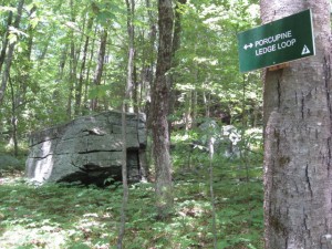
 Adjacent to the Preserve is the 1500 acre Rutland Brook Sanctuary owned and managed by the Massachusetts Audubon Society; on my way home I stopped for a visit. Just off Route 122 in Petersham is Connor Pond, a prominent landmark that points to the Sanctuary entrance. The Audubon trail map was a bit more detailed, and fortunately, the trails were clearly marked. I decided to hike to Porcupine Ledge and then loop back: I followed the John Woolsey Trail to the Rutland Brook Loop, picked up the Ridge Trail to the Sherman Hill Loop, then went around Porcupine Ledge Loop back to the Ridge Trail, where I picked up the House Pond Trail, followed that back to the Rutland Brook Trail, then walked back to the entrance. The Sanctuary includes woodlands, wetlands, brooks, and ledges, and I passed through most of these landscapes.
I took a photo of Rutland Brook, as this is the Sanctuary’s namesake:

The trail up to Porcupine Ledge is fairly steep (I saw no porcupines, though):
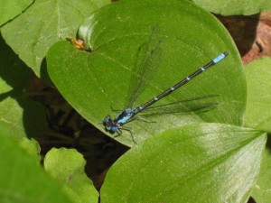
This may be an Aurora Damsel, Chromagrion conditum. According to my field guide, this species perches on vegetation, wings partially spread; frequents small vegetated streams and swamps; flies in spring to early summer. But I’m terrible at insect identification so don’t take my word for it; this could also be a Skimming Bluet or possibly a Blue-fronted Dancer:
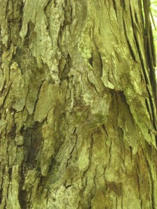
A Shagbark Hickory, Carya ovata, is noted on the trail map, and I did see it. This large deciduous tree is common in the eastern United States. Shaggy bark is characteristic of mature trees, not the younger specimens:
I thought I would end this post the way I began, with a flower photo. The Yellow Iris, Iris pseudacorus, is an alien, a European native which escaped from gardens to colonize our marshes and streamsides. These plants were growing at the edge of the House Pond, which I passed on my way back to the sanctuary entrance:

On my way home in the late afternoon, I spotted an ice cream place, Pine Ridge Ice Cream Shop, in Barre Center, and decided to treat myself to a dish of pistachio ice cream. Mmm!

