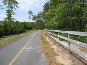
 I recently downloaded a Trail Guide to the Chatham Conservation Foundation lands in Chatham and decided this morning that walking one of these trails would be a fine thing to do on this hot summer day. I started to walk to one of the trail heads from George Ryder Road but was immediately distracted by a sign for the Old Colony Rail Trail, an extension of the Cape Cod Rail Trail. The wide paved trail, off-limits to motorized traffic, proved irresistible, and I started down the asphalt path. This is a typical sightline:

The bike trail took me west toward Harwich, so at Sam Ryder Road, I turned north toward Old Queen Anne Road and the ponds. Across from “The Triangle” formed by Old Queen Anne Road, Training Field Road, and Old Comers Road is a 47 acre parcel featuring glacial kettle ponds, upland birds, and shade-loving plants.  One of the first birds I saw in the woods was a beautiful Baltimore Oriole!
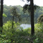
Though narrow and at times blocked by fallen branches, I found these trails fairly easy to follow, and I had no trouble finding all three ponds, Schoolhouse Pond (left), Mary’s Pond (center), and Barclay’s Pond (right), perhaps because signs naming each pond were nailed to trailside trees just as I arrived at each shoreline.
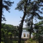
The photo below doesn’t do justice to Schoolhouse Pond — it’s by far the largest of the three, and the water looked fresh and inviting. I saw a beach on the far shore of that pond, so it seems that swimming is permitted. But I didn’t have my swimsuit with me, and I couldn’t linger; within an hour I had finished my walk where I began.


Now, what’s with these ponds? As is apparent to even the most casual visitor, Cape Cod consists almost entirely of sand, gravel, silt, clay, and boulders, material consistent with its glacial origins. Even the many lakes and large ponds scattered about the outwash plain owe their origins to the great Laurentide ice sheet which once covered all of New England. When the ice started rapidly melting thousands of years ago, large blocks of glacial ice remained here and there, with meltwater streams flowing around them, building up sand around them. Later, when the ice blocks themselves melted, cavities remained; geologists call the ponds and lakes thus formed ice-block lakes, or kettles. These ponds that I saw are typical of the genre.
As for Chatham itself: settled as early as the mid-seventeenth century and incorporated in 1712, it’s a pretty little town of about 7,000 year-round residents. Situated in the elbow of the Cape, the town welcomes a large influx of visitors each summer. Of particular interest to tourists are the Monomoy National Wildlife Refuge, the Chatham Lighthouse, and the Chatham Railroad Museum. As I was in the area for only a hour or so, I don’t have any personal comments or recommendations with respect to these attractions. I can say that I wished I had my bike with me, as the roads leading out from the town center are not designed for pedestrians. Walking to and from the Conservation Foundation lands was not pleasant because I had to walk on the road with a lot of vehicular traffic speeding by me.