Hart Prairie Day One

Locale: The first non-native person to settle here in the 1860s was a man named Frank Hart; he put up four walls for a building, then disappeared into the dustbin of history.  Next came German immigrants Augustus Dillman Freudenberger and his wife Lena.  Their log home, now known as the Homestead, still stands on the property.  The Dillman Ranch at Hart Prairie, as it came to be known, was a stop for the stagecoach that ran between Flagstaff and the Grand Canyon, with famous passengers such as President Theodore Roosevelt pausing for refreshment. Other early Hart Prairie homesteaders tried for a time to grow potatoes, barley, and hay, but farming here was tough-going, and after the Great Depression nearly all of them were gone.

The ranch then passed into the hands of Suzanne Colton, sister of Harold Colton, founder of the Museum of Northern Arizona; she changed its name to Fern Mountain Ranch. It then went to her son Dick Wilson and his wife Jean.  In 1994, after protracted discussion and negotiations, the Wilsons donated 245 acres of Hart Prairie to The Nature Conservancy.

At 8,500 feet, the Preserve is considered a high altitude meadow; it is home to a large stand of Bebb willows, a centrally-located aspen grove with a hidden rock pile, and encroaching Ponderosa pines (Pinus ponderosa).  Conservancy scientists believe that in the not too distant past, this area looked more like open savannah, but fire suppression and livestock grazing changed the landscape to favor forest cover.

Looking directly east from Preserve cabins, the eye is drawn upward to the San Francisco Peaks, the results of volcanic eruptions that began millions of years ago and continued into recorded history.  These mountains, including Mount Humphreys, at 12,633 feet the highest point in Arizona, are examples of strato-volcanoes, or cone-shaped volcanoes formed by eruptions of molten lava alternating with layers of cinder and ash.  Mt Agassiz, to the south of Mt Humphreys, has been developed as a ski area; the lifts and trails are clearly visible.

Protect, Transform, Inspire:  The current research projects at the Prairie can be considered links in a scientific chain which stretches back over a hundred years.  In 1889, a biologist named C Hart Merriam studied plant and animal life on the San Francisco Peaks, in the Painted Desert, and in the Grand Canyon.  From his observations, he developed the theory of “life zones,” which proposes that biological communities change in a predictable way as one moves north or rises in elevation.  The Merriam classification is not much used today, except perhaps in the American Southwest, although the concept remains important in describing and classifying ecoregions.  At Hart Prairie, ecological research continues with sophisticated weather monitoring and even a pheno-camera, which is used to track plant phenology (phenology is the study of periodic plant and animal life-cycle events that are influenced by climate and seasonal change in the environment).

So what is a prairie anyway? By one definition, a prairie is an area of flat, predominantly treeless grassland, especially in a large plain with deep fertile soil; it is a region of extensive grasses and forbs, maintained in its natural state by climate, grazing, and fire. In the United States, prairies were once widespread but are now highly endangered.  Not only here in Northern Arizona but also in the Midwest, TNC is working hard to restore and maintain these unique ecosystems.

Weather:  High 82, Low 52.  Cloudy, drizzle

Creatures: Rufous Hummingbird (Selasphorus rufus), Mule Deer (Odocoileus hemionus)

Itinerary: Flagstaff, via N San Francisco St to US 180, right onto FR 151 to dirt road

Excursions:  Hart Prairie Preserve Research Area

Speaker: Blair Foust, TNC, Introduction to Hart Prairie Preserve (afternoon)

Reflections: We are a group of eight TNC supporters at the Prairie this week: myself (Worcester), Julie and Sam (Seattle), Julia and David (northwest Arkansas), Ann (Washington DC), niece Melinda (Colorado Springs) and aunt Linda (Sacramento Foothills).  So pleased to meet everyone!

Images:

Mariposa Lodge at Hart Prairie

Mariposa Lodge at Hart Prairie

Restored cookhouse (it is not currently used)

Restored cookhouse (it is not currently used)

Two large ponderosa pines near the Homestead

Two large ponderosa pines near the Homestead

Rocky volcanic soil at the Prairie
Rocky volcanic soil at the Prairie
Visiting San Diego Day Two

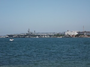
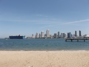
I awoke this morning refreshed after an uninterrupted night’s sleep, and then my friend and I took the dog and went for another walk to the beach.  On the way back to the house, we stopped at the Villa Nueva to pick up some fresh croissants. At home, we enjoyed a hearty breakfast, then headed out for a day of sight-seeing.  I had made a list of the standard tourist attractions that I wanted to see, and my friend made sure we saw them.  Just so you’re convinced I really was there, here’s the skyline of San Diego from Coronado Beach:
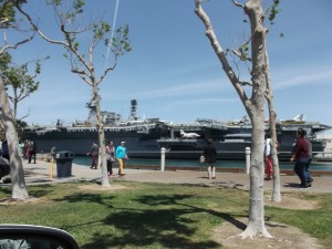
SAN15-03We first crossed the bridge into the city proper and in the photo below, we’re looking at the USS Midway Museum.  The museum is a real naval aircraft carrier that was converted into a museum and educational center; the non-profit organization incorporated in 1992 and after raising funds and publicizing its mission, opened the museum in 2004.
SAN15-04I took this photo from the car as we drove past:
SAN15-05At this time, we were on our way to Point Loma and the Cabrillo National Monument.  If you look at a map like this one, you’ll see that we were heading for the spit of land to the southwest of the City that creates San Diego Bay; you’ll see Coronado Island due east.  We drove through the ecological reserve and parked at the Visitor Center (the small entrance fee was waived today, for some reason), then walked over to see the statue of Cabrillo (it’s an iconic sight, by the way).  According to the National Park Service website:

Juan Rodriguez Cabrillo led the first European expedition to explore what is now the west coast of the United States. Cabrillo departed from the port of Navidad, Mexico, on June 27, 1542. Three months later he arrived at “a very good enclosed port,” which is known today as San Diego Bay. Historians believe he anchored his flagship, the San Salvador, on Point Loma’s east shore near Cabrillo National Monument. Cabrillo later died during the expedition, but his crew pushed on, possibly as far north as Oregon, before thrashing winter storms forced them to back to Mexico.

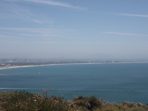
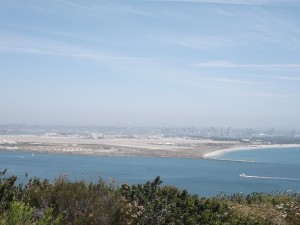
From this vantage point, we could look at the city sprawling in the distance:
SAN15-06and there in the haze to the south is Mexico:
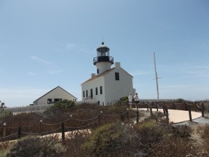
SAN15-07We stopped in at the Point Loma Lighthouse but didn’t climb it:
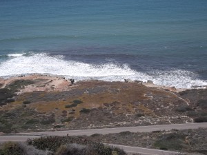
SAN15-09This national monument also encompasses more than 600 acres of native habitat and is a well-known stopover for birds migrating along the Pacific Flyway.  On the west side of the park are the tide pools, which my friend said her kids enjoyed visiting when they were young.  According to the website, “A myriad of marine plants and animals, including lacy red and slimy green algae, sluggish sea hares, leggy octopi, darting fish, and the always entertaining hermit crabs, live in this rocky intertidal area.”  We didn’t walk the trail down to the beach but gazed down at it from the heights.
SAN15-08
Then it was time for lunch.  Near Point Loma is a retail area with both stores and restaurants that was converted from a federal facility.  Here we stopped at Tender Greens, one of those wonderful locavore, farm-to-fork restaurants where I enjoyed a Happy Vegan salad, consisting of farro wheat with cranberry, hazelnuts, quinoa with cucumber, beets, green hummus, tabbouleh, and tender greens.

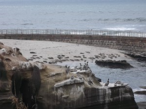
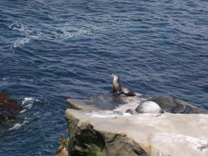
After lunch, we headed for La Jolla, which I also wanted to see because I kept hearing about it.  Of course I wanted to see the beach, so we drove along the shore road, parked on a side street, and got out to stroll along the waterfront near Cove Beach.  Everyone comes to see the seals, though it’s quite obvious from their smells that their diet is mainly fish.  Here they are sunning themselves:
SAN15-10
I tried taking a closeup of one seal:
SAN15-11And here are some others that blend in with the rocks (look closely):
SAN15-12
On our way out of the city, we drove by the world-famous Scripps Institution of Oceanography.  As you may already know, it is part of the University of California at San Diego, which we also drove by.  My friend’s son graduated from UCSD a few years back, so she knows the area well.  In fact, on our way back to Coronado, we stopped at the son’s condo, where he and his wife are living as they renovate it.  They were busy painting and working on the bathroom, so we went out to get them some sandwiches to fortify themselves, then we headed back, stopping first to shop for running shoes and then dresses at the Ross discount store (yes, I bought a dress).  Dinner that night was at Miguel’s Cocina; I had the portobello mushroom fajitas, which is a signature dish — mmm!

Then we sped along to the airport, which is only a ten-minute drive from my friend’s house in Coronado, and I boarded the red-eye for the flight back to the East Coast.