Alexander Alfano- Building and Construction Technology

Matthew Faucher- Turf grass science and management

Brendan Clark- Environmental Science

In many places across the U.S. families are facing a crisis, a lack of clean drinking water. Water is the key to all life, so you would think that in a wealthy country like America, every citizen would have access to clean drinking water. This is not the case. In recent years there has been a growing issue of a lack of clean water in many parts of the country. Heather Blevins and her 7 and 8-year-old children are residents of Lovely, Kentucky. Unfortunately, as of recently, Lovely’s water has become less and less lovely. Their town water has become yellow and gives off a smell of bleach. When Heathers children take a bath their skin becomes red and itchy. With Heather only making $980/month from social security, buying bottled water can be an economic struggle. This is not a freak occurrence; many other parts of the country are facing the same problem. From Flint, MI to Lovely, KY, water quality is being degraded at rapid rates, and will only continue to become worse in the future.   Continue Reading

Controlled Burns; The solution to California’s Wildfire Problem

Picture of Camp Fire in California

Picture of Camp Fire in California

On Thursday November 8th, 2018, more than 52,000 people’s lives were changed forever. Northern California was rocked by a wildfire that consumed thousands of homes and businesses.

Wildfires In the United States are mainly concentrated in the Western forests (National Geographic, 2018), where wildfire activity, frequency, severity and size are seeing an increase in recent years, and is expected to further increase in years to come (Van Mantgem, Nesmith, Keifer, Knapp, Flint, Flint, & Penuelas, 2013 and Riley & Loehman, 2016). Climate change is the main driver of this trend (Abatzoglou & Williams, 2016), and as wildfires increase, so do the damages they inflict on natural, economic, and human resources (Barrett, 2018 and Kousky, Greig, Lingle, & Kunreuther, 2018).The cost of wildfires are buoyed by the additional factors of under-burned forests as a result of too much fire suppression, and the rapid encroachment of human settlement in areas bordering forests, known as the wildland urban interface (WUI) (Moseley, 2018). Due to the increasing activity, size, intensity, and severity of wildfires and their associated costs in the Western U.S. and particularly California, a well-funded, rigorous regime of prescribed burning should be implemented at federal, state, and local levels in order to cull accumulated forest fuels, and thus decrease future wildfire severity and intensity. Continue Reading

Wildfires and Climate Change, what can we do?

Ivan Chukarov, Chris Clark, Amelia Midgley, Jeffrey Trainor

The devastating Camp fire in California that raged in November of 2018 has left more than 70 people dead and more than 1,000 people missing. In Butte county, the Camp fire has destroyed 12,784 structures, including 9,891 homes (Holpuch & Anguiano 2018). The emotional and physical stress these large wildfires put on residents of burned areas is unimaginable. Lilly Batres, a 13 year old resident of Magalia, a town affected by the California Camp wildfire, was evacuated to a shelter nearby.  Lilly doesn’t know whether her home is still standing and while she seeks refuge at a camp, she cannot grieve in privacy. To Lilly, the camp is “cold and scary”,  and even to some extent she feels like “people are going to come into our tent,” she explains (Anguiano 2018). The Camp Fire is not the only fire that has burned massive plots of land in 2018. The Carr and Ferguson fires in California, burning more than 80,000 hectares, and in Oregon and Colorado have orched more than 100,000 hectares collectively (Selby 2018).   Continue Reading

Urban golf courses as refuge for red-headed woodpeckers in Chicago

Authors: Vincent Frano, Horticulture Major; Cian Gulsen, Horticulture Major; and Anna Ashe-Simmer, Natural Resource Conservation Major.


In 1827, John J. Audubon published Birds of America, a 435 page book of full-color bird illustrations and accompanying field notes for each species (Audubon, n.d.).  There are ten pages devoted to American woodpeckers, including one small, Midwestern native: the red-headed woodpecker (Melanerpes erythrocephalus) (Audubon, n.d.).  In his observations, Audubon wrote, “It is impossible to form any estimate of the number of these birds seen in the United States during the summer months…” (Audubon, n.d.).  He claims he observed someone shoot more than one-hundred red-headed woodpeckers from a cherry tree in a single day (Audubon, n.d.). Clearly, they were abundant.

Though Audubon believed the bird to be common when he wrote his book, the red-headed woodpecker was already experiencing declines within its native range (Audubon, n.d.; Kaufman, n.d.).  A variety of factors are responsible for the decline of this species, but loss of critical oak-savanna habitat has been particularly detrimental (Koenig, Walters, & Rodewald, 2017). The red-headed woodpecker is native to the Midwestern oak-savanna, a habitat type that consists of a grassland understory interspersed with large, old-growth oak trees (Santiago, 2004).  The oak-savanna is important for this species for food resources (this species feeds on insects, invertebrates, berries, and acorns) and nesting habitat (they primarily nest in cavities in dead or decaying trees) (Dey & Kabrick, 2015; Kaufman, n.d.).  Prior to European colonization, the oak-savanna covered an estimated 27-32 million acres across the Midwest, an area roughly the size of Mississippi (Santiago, 2004; IPL.org, n.d).  But by 1985, only 6,442 acres of this critical habitat remained–0.02% of the original area (Santiago, 2004). The land was primarily cleared for lumber, farmland, and housing developments (Santiago, 2004).  

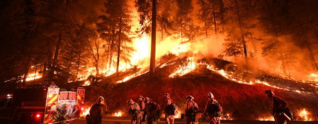
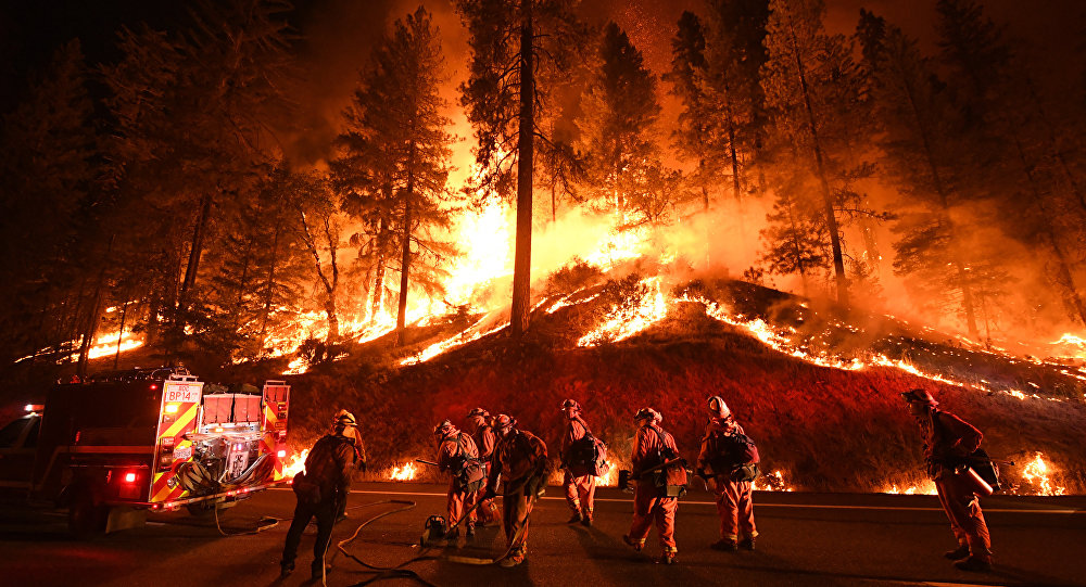
As urbanization has increased during the last century, the red-headed woodpeckers have simultaneously experienced more drastic population declines than ever before (Koenig, et. al., 2017).  Once a common and abundant species, red-headed woodpecker populations have declined by 60% since the 1960’s (Anderson & LaMontagne, 2016). It is currently listed on both the 2015 State of the Birds Report’s Yellow Watch List and as ‘near threatened’ in the International Union for Conservation of Nature’s 2017 report (Koenig, et. al., 2017).  Urban spaces are often void of adequate green space with dead or decaying trees for nesting or an abundance of oak trees as food supply, and are therefore unlikely to be inhabited by the red-headed woodpecker (Anderson & LaMontagne, 2016; Rodewald et al., 2005; Washington Department of Fish and Wildlife, 2011; Kaufman, n.d.).

Large metropolitan cities can pose particular problems for the red-headed woodpecker due to high human population density and expansiveness (Santiago, 2004).  Chicago, Illinois is the third largest metropolitan area in the United States and the largest within the range of the red-headed woodpecker, with a footprint of over 227 square miles (145,280 acres) (U.S. Census, 2010).  During the mid-1800s, Chicago experienced dramatic urbanization (Dreyfus, 1995). Between 1850 and 1860 the city’s population tripled and continued to grow with the advent of railroads, which led to the rapid transformation of land into urban area (Dreyfus, 1995). While population growth has slowed in the last century, population density has increased. The human population density in Chicago has increased by more than 1.2% between 2010 and 2016 (Kolko, 2017).  In comparison, New York’s density only rose by 0.5% in the same time (Kolko, 2017). As population density intensifies, so does housing development, and green space has become increasingly hard to find (Kolko, 2017). And while human development is expanding, only 8.5% of the land area in Chicago is designated public parks, compared to more than double this in New York City (Harnik & Donahue, 2012, p. 10). As urbanization expands, adequate habitat for the red-headed woodpecker has become increasingly limited.

Red-headed woodpeckers are important to the urban environment due to their ability to create wildlife habitat for other species (Wenny, et. al., 2011).  Woodpeckers forage and nest in snags, and as a result, create cavities in the tree that can be utilized by other species (Gentry & Vierling, 2008). In a study conducted in South Dakota, American kestrels, black-capped chickadees, nuthatches, bats, and Northern flying squirrels were found nesting in cavities created by red-headed woodpeckers.  These species are all secondary cavity nesters, meaning that they rely on excavators like the red-headed woodpecker to create cavities in snags (Gentry & Vierling, 2008). In urban areas, where biodiversity tends to be low, this species can provide important habitat for a variety of species that would otherwise not exist in the urban landscape.  

Red-headed woodpeckers can have positive impacts on the local urban ecosystem by improving the health of the surrounding oak trees (Santiago, 2004).  In Chicago, the native oak tree population has been in decline in recent decades (Nowak, et. al., 2013). Many of Chicago’s large, old oaks were planted before the city was urbanized, and are now reaching the end of their lifespans (Nowak, et al., 2013).  They have had difficulty seeding due to the large expanses of impervious surfaces (i.e. roads and sidewalks) and lack of acorn dispersers (Nowak, et. al., 2013; Wenny, et. al., 2011). Studies have shown that avian acorn dispersers (like the red-headed woodpecker) are key species in urban parks with large oak stands (Wenny, et. al., 2011).  In Stockholm, Sweden, Eurasian Jays (Garrulus glandarius) were found to be responsible for over 85% of acorn dispersal in an old-growth oak forest in an urban park (Hougner, Colding, Söderqvist, 2006, p. 370).  The oaks in this landscape consequently support communities of nesting birds and bats, lichens, and insects (Hougner, et. al., 2006). Red-headed woodpeckers also feed on oak acorns in the Midwestern US, and, like the Eurasian Jay, create large stores of acorns to feed on during winter months when insects are sparse (Smith, 1986).  Oaks in the Midwest rely on birds like woodpeckers to disperse their seeds, and woodpeckers benefit from the existence of oaks for winter food resources (Smith, 1986). In an urban landscape like Chicago, there are limited seed resources for woodpeckers and limited seed dispersers for oaks (Santiago, 2004). The mutualistic relationship between the two can be especially beneficial in an urban environment where biodiversity and resources are limited.

Red-headed woodpeckers are also important in urban environments for pest control.  In Chicago, for instance, there has been a significant rise in the emerald ash borer (Agrilus planipennis, abbv. EAB). EAB is an invasive beetle that devours the bark of ash trees, and is responsible for killing more than 54 million ash trees in Indiana, Michigan, and Ohio alone (Koenig & Liebhold, 2017).  This poses a significant problem in Chicago–ash trees make up more than 17% of the city’s street trees, not including the more than 300,000 ash that exist on private lands (i.e. private golf courses) (City of Chicago Department of Streets and Sanitation, 2018).  Breakouts of EAB are extremely costly due to the limited effectiveness of insecticides and the high cost of cutting down infected trees (Streets and Sanitation, 2018). However, studies have shown that woodpeckers significantly reduce EAB populations (Koenig & Liebhold, 2017).  Red-headed woodpeckers feed heavily on EAB larvae during breakouts. During winter, when EAB larvae are most accessible to insectivorous birds, red-headed woodpecker population increased more than 48.5% (Koenig & Liebhold, 2017). In Chicago, improving habitat for red-headed woodpeckers has the potential to reduce future outbreaks of EAB in the city.

Green spaces within urban environments are important for species like the red-headed woodpecker.  Golf courses are a particularly useful as habitat due to their abundance and size (Santiago, 2004). They are continuing to increase in number, with an 18% increase between 1987 and 1996 (Tanner & Gange, 2004, p. 138). Within the Chicago metro area there are over 200 golf courses, six of which are part of the city’s 8,100 acre municipal park district (Golf Advisor, n.d.). An average 18-hole golf course sits on 133 acres, and up to 70% is considered to be out of play areas that hold the potential to support wildlife (Saarikivi, 2016, p. 9). This translates to a potential 558 acres of wildlife habitat available on golf courses within Chicago’s municipal parks alone. However, the design and maintenance of golf courses are important factors that determine whether they can support a red-headed woodpecker population (Koenig, et. al., 2017). Water use, chemical applications, water features and habitat modifications are all concerns that must be addressed in determining ecological benefits. A number of studies show that golf courses can benefit biodiversity under sustainable and ecologically-friendly management practices (Colding et al., 2009; Jim & Chen, 2016; Kohler et al., 2004; Mankin, 2000; Salgot & Tapias, 2006; Tanner & Gange, 2005; Yasuda & Koike, 2004).

In urban settings, golf courses with forest cover can support a thriving red-headed woodpecker population by providing habitat that is scarce in the surrounding environment. Red-headed woodpeckers favor landscapes with forest cover, open understories, lower canopies, and proximity to open grassland (Anderson & LaMontagne, 2016; Rodewald et al., 2005). Given this, golf courses have the potential to support these birds by providing ideal habitat. Open areas, like fairways, allow the woodpeckers to forage for insects in flight (Anderson & LaMontagne, 2016). Additionally, waterways, such as constructed wetlands and fairway ponds, act as breeding sites for insects, the primary summer food of red-headed woodpeckers (Anderson & LaMontagne, 2016). Studies have shown that the red-headed woodpecker prefers nesting sites within close proximity to waterways, which may be related to insect abundance (Anderson & LaMontagne, 2016; Rodewald et al., 2005). This further suggests that golf courses, with their varied landscapes, can allow the species to thrive in urban environments.

One concern is the effect that daily use of courses by golfers and frequent maintenance activities might have on nesting woodpeckers. However, nesting activity on golf courses seems more related to the presence of favorable nesting sites than levels of human activity ((Rodewald, Santiago, & Rodewald, 2005). Of 17 golf courses studied in Ohio, 49 active nest were recorded, suggesting the woodpeckers are not likely dissuaded by golf course activity (Rodewald, Santiago, & Rodewald, 2005, p. 451). Courses with resident red-headed woodpeckers had twice as many snags and trees with dead branches compared to courses that lacked woodpeckers (Rodewald, Santiago, & Rodewald, 2005, p. 451). Therefore the preservation of naturalistic forest areas that allow for some dead and decaying trees is most important when determining the viability of a golf course as suitable habitat.

Golf courses seem promising as urban habitat for the red-headed woodpecker, although the ecological value of golf courses is hotly debated. Opponents assert that golf courses are ecologically barren and useless to wildlife (Saarikivi, 2016). The arguments against golf courses cite heavy chemical inputs of fertilizers and pesticides, combined with intensive management and resource use, as degrading any ecological value (Saarikivi, 2016). Indeed management styles are an important consideration that needs addressing in determining the ecological value of golf courses. Pesticide use is of particular concern in supporting red-headed woodpeckers since their primary food source is insects. Plants only take up about 5% of applied pesticides, meaning the rest ends up as runoff (Royte, 2017). When runoff reaches waterways, insect breeding grounds become contaminated, killing insect larva (Royte, 2017). This can impact bird populations by reducing available food sources provided by insects not considered pest of turf (Royte, 2017). Red-headed woodpeckers have been observed foraging for insects from turf areas, which could potentially expose them to insecticides used on golf courses (Rodewald, Santiago, & Rodewald, 2005). As little as a single corn seed coated in imidacloprid, a common pesticide also used for turf grass, is enough to kill birds the size of the red-headed woodpecker (Royte, 2017). Furthermore, imidacloprid has been shown to have toxic effects on sparrows, even at doses considered sublethal (Royte, 2017). Three days following exposure, the birds had lost 25% of their bodyweight (Royte, 2017). While sublethal doses may be larger for woodpeckers due to their difference in size from sparrows, this study shows that insecticides may have negative impacts on birds like red-headed woodpeckers. Improved chemical management plans that reduce pesticide and fertilizer inputs and emphasising naturalistic landscape designs allow golf courses to become thriving ecosystems capable of supporting a diversity of life (Mankin, 2000; Saarikivi, 2016).

Even with ecological management, one may argue that golf courses do not provide suitable habitat for birds like the red-headed woodpecker due to their specific habitat requirements. Generally the snags are removed for safety reasons, as rotting and dead trees or branches can fall and pose a hazard (Washington Department of Fish and Wildlife, 2011). Golf courses may also remove older or damaged trees due to management concerns. Large, older trees near tees and greens can compete with turf grass for water and produce extensive root systems that may disrupt greens (Lucas, n.d.). Damaged trees can take up canopy space, thus reducing sunlight available to nearby trees, which can reduce the growth of younger, healthier trees (Lucas, n.d.). These are legitimate concerns for golf course managers who wish to maintain the health and playability of turf areas. However, both older trees and damaged trees offer potential habitat to woodpeckers and other species (Gentry & Vierling, 2008; Washington Department of Fish and Wildlife, 2011). Dead limbs can provide nesting habitat; fungus infected trees provide both food and habitat; and old trees have the potential to become large snags capable of supporting diverse animal communities (Anderson & LaMontagne, 2016;  Gentry & Vierling, 2008; Washington Department of Fish and Wildlife, 2011). Adequate habitat can be maintained through careful design and management practices that allow for the preservation of snags without having to compromise golf course safety and turf grass health. Snags and decaying trees can be kept in the interior of wooded areas so that golfer safety is not compromised (Purcell, 2007). Midwestern savanna are dominated by oak species and by increasing tree density, these habitats promote species diversity in the understory vegetation (Dey & Kabrick, 2015). Woodland edges with a selection of shrubs can act as a screen for untidy natural woodland interiors and help improve golf course aesthetics (Purcell, 2007).

Integral design features, like forested areas and constructed wetlands, can create a favorable ecosystem to help support red-headed woodpecker diversity. (Love, 2008). A typical 18-hole golf course has an average of 93 acres that are considered to be rough areas of the hole or out of play (Saarikivi, 2016, p. 9). These areas are unused by golfers, and have the potential to provide habitat for a variety of birds including the red-headed woodpecker (Saarikivi, 2016). Species like the eastern bluebird, tree swallow, purple martin, red-cockaded woodpecker, and osprey can utilize these rough areas as habitat if it is improved for wildlife (Saarikivi, 2016; Rodewald et al., 2005; Washington Department of Fish and Wildlife, 2011). Naturally existing trees are an integral component of golf courses that provide specific areas of vegetation required for connectivity of adjacent wildlife (Love, 2008). While populations of the red-headed woodpecker have plummeted due to urbanization, the species thrives in the habitats of golf courses due to the sheltering canopy of large trees in the area (Saarikivi, 2016). In a study focused on the red-headed woodpecker population in Cook County, IL (a county that includes the city of Chicago), researchers found that only 7 of the 34 nesting trees were located in city parks while the remaining 27 appeared in forested areas of the city (Anderson & LaMontagne, 2015, p. 305). This suggests that the woodpecker needs large, uninterrupted areas of green space as opposed to isolated parks (Anderson & LaMontagne, 2015).  A golf course is a large enough green space to act as habitat for the woodpecker if the area of forest cover is increased (Saarikivi, 2016).

To effectively promote the red-headed woodpecker population in Chicago, golf course managers should convert rough areas and out-of play areas to mimic the oak-savanna ecosystem.  Woodpeckers need low tree density, with low to moderate canopy cover, and sufficient abundance of insects, acorns, and visible fungus on trees (food source) in order to nest in the area (Kaufman, n.d.; Anderson & LaMontagne, 2015). Mid-western oak-savannas are dominated by oak species, but tree reproduction is patchy, resulting in a spacious layout of trees (Dey & Kabrick, 2015). The uneven distribution of the tree canopies in savannas and low density creates a range of canopy cover from full to open space (Dey & Kabrick, 2015).  A complete management system must be instituted in order to promote an artificial oak-savanna habitat on golf courses. Introducing long-lasting oak species like the Post Oak (that lives over 400 years), can distribute a number of seeds for regeneration, and then be removed before it dominates the landscape (Dey & Kabrick, 418). Highly monitored prescribed burning or chemical applications, as well as tree removal, can aid in the decrease of tree density when it becomes too high (Dey & Kabrick, 2015). Over time, the habitat will thrive with a varying age-range of its tree species which can sustain the ideal tree density required by the red-headed woodpecker (Dey & Kabrick, 2015; Anderson & LaMontagne, 2015).  Restoration of these oak-dominated ecosystems on golf courses would promote the population of red-headed woodpeckers, which would then promote acorn dispersal of oaks in the area, and the health of both oaks and red-headed woodpeckers would be vastly improved (Dey & Kabrick, 2015; Wenny et. al., 2011). By creating an artificial oak-savanna habitat on golf courses within the city of Chicago, critical habitat area for the red-headed woodpecker can expand, leading to potential increases in its population (Dey & Kabrick, 2015; Santiago, 2004).

Proper water quality is one of the most vital components for maintaining suitable woodpecker habitat, and specific design features can improve this (Love, 2008). Constructed wetlands and water features are important design components that ensure uncontaminated water. Clean water promotes tree and vegetation development, which in turn allows for a clean environment and drinking water for the woodpeckers. Constructed wetlands can potentially remove between 95% and 100% of nitrogen and up to 74% of phosphorus resulting from fertilizer applications (Kohler et al., 2004, p. 291- 294). Without proper water quality, the tree density and fungal requirements favored by red-headed woodpeckers wouldn’t be as readily available because the habitat itself wouldn’t grow. Wetlands are habitat for many protected wildlife and plants and can be implemented on golf courses (Love, 2008). Constructed wetlands can positively affect surrounding waterways by acting as a filtration system, reducing contaminants in runoff from golf courses and surrounding urban areas (Kohler, Poole, Reicher, & Turco, 2004). Sand caps, bioswales (sloped mounds on the course), wet cells (low areas that collect water), and tall grass buffers also help to reduce surface runoff (Miltner, 2007). Sand caps are a set depth of sand underneath the course that allow for infiltration and stormwater storage and bioswales, wet cells, and tall grass buffers are strategically placed on the course to trap water in the turfgrass where it is filtered out by microorganisms and plant roots (Miltner, 2007). Tall grass buffers located on the edge of bodies of water intercept polluted runoff between the golf course and the body of water and can significantly reduce nutrient and sediment runoff (Mackay, 2001).  A buffer is maintained with plants that reduce stormwater flow and pollution runoff (Mackay, 2001). Water features provide aesthetic appeal as well as improve erosion control and stormwater management which aids in the quality of the watershed of the area (Love, 2008). If properly designed to coordinate with pre-existing drainage patterns, constructed wetlands can help reduce fertilizer and pesticide runoff (Love, 2008). Grass cover also helps to reduce runoff; when turf is properly managed to maintain ample coverage, runoff can be reduced by 8mm per year compared to unmanaged conditions (Mankin, 2000, p. 265). This is because the turf forms a tightly compact system of roots and a grass canopy that make it very difficult for surface runoff to “run”and leach into soil or waterways (Mugaas, Agnew, Christians, 2005). Sustainable management practices benefit biodiversity by preserving a thriving ecosystem that can also improve water quality, making golf courses a potential safe-haven for the declining woodpecker population.

However, not all golf course owners are willing to voluntarily make changes to their courses for the sake of threatened species like the red-headed woodpecker (Looney, 2017; Rubin, 2017).  Conservation easements offer a promising framework to incentivise land conservation and encourage golf course owners to adopt these sustainable management practices (Rubin, 2017). In 1976, Congress passed the Tax Reform Act, which included a conservation easement program to incentivize landowners to donate their land to conservation organizations (Parker, 2005).  In return, landowners receive a tax deduction equal to market value of the land that is donated (Looney, 2017). Landowners agree to permanent development restrictions on their land, and all development rights are donated to a land trust (Rubin, 2017). Essentially, this ensures that the land is protected from any further development (even if the land is later sold or divided), but the landowner still has the rights to continue managing it for certain government-approved uses (Parker, 2005).  These uses are intended to be of low impact to the environment, such as for historical importance, agricultural use, wildlife habitat, and/or outdoor recreation (Parker, 2005). Golf courses, being primarily used for outdoor recreation and having the potential to provide wildlife habitat, are therefore eligible for this conservation easement program (Parker, 2005). Golf courses that are protected under conservation easement programs can never be converted to housing developments, which is especially important in urban spaces like Chicago, where green space is scarce (Rubin, 2017; Harnik & Donahue, 2012).  

The conservation easement program has been effective at promoting wildlife habitat on some golf courses.  The Merit Club is an example of a golf course that has successfully converted out-of-play areas into wildlife habitat after enrolling in the conservation easement program (Taggart & Roe, 2010). Located in the Chicago suburbs, the golf course is part of a network of protected lands that are home to 14 endangered species (Taggart & Roe, 2010, p. 393). The 318 acre property includes 165 acres of restored tall-grass prairie, wetlands, and oak-savanna. This land provides valuable habitat for native species (Taggart & Roe, 2010, p. 393). The Eagle Ridge Golf Club in Ocean County, New Jersey is another example of conservation easement success. The coastal golf club maintains native grasslands, riparian habitats, and wetlands that are home to 58 species of birds and numerous other wildlife (NJ Audubon Society, 2014, p.13) . In addition to offering a pristine environment for playing golf, the golf club provides opportunities to educate the public on land stewardship and conservation. In this way they encourage members of the community to implement habitat improvements on their properties, thus creating interconnected habitat (NJ Audubon Society, 2014). Both golf clubs are a testament to conservation easement programs at work. While regular monitoring and maintenance are required to ensure natural areas remain intact, money gained from the conservation easement program is intended to support the enhancement of natural areas (Rubin, 2017).

However, conservation easements have been misused in recent times, especially when concerning golf courses (Rubin, 2017). Kiva Dunes is a 368 acre golf course located along the coast of Alabama.  Shortly after constructing the course in 1992, the property owner donated the land as a part of a conservation easement and consequently received a $29 million tax deduction (Deal, 2013, p. 1590; Looney, 2017, p. 19).  President Donald Trump received a $39.1 million tax deduction in 2005 for a conservation easement on one of his New Jersey golf courses (Rattner, 2016). These easements were incredibly lucrative for landowners, yet their benefits towards conservation are debatable (Looney, 2017). Currently the IRS is the primary organization providing oversight of conservation easements (Moorhead, 2016). They have contested and brought to court questionable tax deductions, such as the one claimed by Kiva Dunes (Moorhead, 2016). However, the IRS is not well equipped to monitor conservation easements regularly and they are not always successful in contesting golf course tax deductions (Moorhead, 2016).

Critics of the easement program have argued that golf courses should be excluded from tax deduction incentive altogether due to their costliness and ineffectiveness (Rattner, 2016).  However, in urban spaces, golf courses have incredible potential to act as wildlife habitat (Saarikivi, 2016). By creating clearer standards and specific management requirements, conservation easement programs can effectively promote habitat for the red-headed woodpecker on golf courses in Chicago.  Organizations like Audubon International are already working with some golf course owners on a voluntary basis to improve the quality of wildlife habitat (Audubon International, n.d.). Currently the non-profit organization works with golf courses to become a Certified Audubon Cooperative Sanctuary (Audubon International, n.d.). There are already 8 golf courses within Chicago that are active members of this program (Audubon International, n.d.). Interested golf courses must undergo stringent habitat, water management, and pest management practice reviews in order to be approved (Audubon International, n.d.). Every three years a review process is required in order to maintain membership (Audubon International, n.d.). Those that do not meet their criteria are rejected from the program (Audubon International, n.d.). For those that do not yet meet the necessary criteria, Audubon International consults with golf course owners to develop an ecological management and land stewardship plan (Audubon International, n.d.).

A similar model could be used by the federal government to create a Conservation Easement Oversight Commission (CEOC) that could oversee and approve all land donations by golf courses, ensuring that donated land is maintained for conservation purposes (State Auditor of Colorado, 2012). As part of this, the CEOC must keep detailed records of conservation easement holders that includes annual reviews of donated land. Like the Audubon International program, golf courses under conservation easements would be required to uphold certain standards. In addition to the CEOC, the Fish and Wildlife Service would partner with golf courses to ensure that donated land is properly maintained. Golf courses would be obligated to develop an environmental plan that is required to include wildlife and habitat management, water conservation, chemical use reduction and safety, and water quality management (Audubon International, n.d.).  Each golf course would have a management plan that focuses on species or community of concern in the area (i.e. red headed woodpecker on Chicago golf courses), and management techniques would be tailored to meet their habitat requirements (Audubon International, n.d.). Through these additional oversight measures and well defined requirements, golf course conservation easements can become effective in incentivising golf courses to create wildlife habitat.

Some may argue that improving habitat on the course will be costly due to the costs of hiring maintenance staff and landscape designers.  However, the long term costs of maintaining open woodland habitat instead of turfgrass can reduce overall costs (Audubon International, n.d.; Kiss, 1998; Purcell, 2007). Reduced chemical inputs, such as fertilizers and pesticides, will reduce overhead costs (Kiss, 1998). Additionally, taking a hands off approach to out of play areas will allow for naturalistic environments, and can reduce costs associated with tree and landscape maintenance (Kiss, 1998). Golf courses are a large economical resource that have the ability to make significant environmental impacts just by purposefully designing and managing for biodiversity and ecological improvements (Saarikivi, 2016). Furthermore, tax incentive dollars can be utilized to cover the initial costs associated with design and maintenance improvements.

The red-headed woodpecker plays an important role in ecosystem dynamics in the Midwest, and has the potential to benefit the city of Chicago if golf course habitat is improved (Anderson & LaMontagne, 2015).  Woodpeckers are important for pest control within cities and can positively impact local biodiversity through seed dispersal,  (Koenig & Liebhold, 2017). However, as urbanization expands in the Midwest, critical oak-savanna habitat is becoming increasingly limited, leading to significant declines of red-headed woodpecker populations in the past decades (Blewett & Marzluff, 2005; Kight, et. al., 2012). Expanding woodland on a golf course that mimics oak-savanna habitat can create habitat for this woodpecker, and consequently create habitat for other species of birds, mammals, and insects (Dey & Kabrick, 2015).  However, an incentive program is needed to promote sustainable golf course management techniques (Looney, 2017). Conservation easements are promising options to incentivise land stewardship, but currently lack sufficient oversight (Gilligan, 2018; NJ Audubon Society, 2014; Taggart & Roe, 2010; Looney, 2017). With stricter standards and specific management requirements, conservation easement programs can effectively promote habitat for the red-headed woodpecker on golf courses in Chicago.  Implementation of this revised program on a nationwide scale could create important areas of refuge for other wildlife besides the red-headed woodpecker, and contribute to habitat restoration across the country Washington Department of Fish and Wildlife, 2011; Saarikivi, 2016; Santiago, 2004).


References

Audubon International (n.d.). Audubon Cooperative Sanctuary Program for Golf Courses FAQ.  Retrieved from https://auduboninternational.org/acspgolf-faq

Audubon, J.J. (n.d.) Plate 27: Red headed woodpecker.  National Audubon Society.  Retrieved from https://www.audubon.org/birds-of-america/red-headed-woodpecker

Christina M. Blewett, & John M. Marzluff. (2005). Effects of urban sprawl on snags and the abundance and productivity of cavity-nesting birds. The Condor: Ornithological Applications, 107(3), 678-693. Doi: https://doi.org/10.1650/0010-5422(2005)107[0678:EOUSOS]2.0.CO;2

City of Chicago Department of Streets and Sanitation (2018).  Emerald Ash Borer.  Retrieved from https://www.cityofchicago.org/city/en/depts/streets/provdrs/forestry/svcs/emeral_ash_borerpestofashtrees.html

Colding, J., Lundberg, J., Lundberg, S., & Anderson, E. (2009). Golf courses and wetland fauna. Ecological Applications, 19(6), 1481-1491. doi:10.1890/07-2092

Deal, K. (2013).  Incentivizing conservation: restructuring the tax-preferred easement acceptance process to maximize overall conservation value.  The Georgetown Law Journal, 101, 1587-1618.  Retrieved from https://georgetownlawjournal.org/articles/113/incentivizing-conservation-restructuring-tax-preferred/pdf

Dey, D. & Kabrick, J. (2015). Restoration of Midwestern oak woodlands and savannas. United States Forest Service.  Retrieved from https://www.fs.fed.us/nrs/pubs/jrnl/2015/nrs_2015_dey_001.pdf

Dreyfus, B. (1995).  The City Transformed: Railroads and Their Influence on the Growth of Chicago in the 1850s. Retrieved from https://www.hcs.harvard.edu/~dreyfus/history.html

Gilligan, G. (2018). Most of River’s Bend golf course put under conservation easement.

Retrieved from http://www.richmond.com/business/local/most-of-river-s-bend-golf-course-put-under-conservation/article_9d3dcfb5-19be-502e-b1cc-a34d6ee6e8e0.html

Golf Advisor. (n.d.). Chicago Golf.  Retrieved from https://www.golfadvisor.com/destinations/56-chicago-il/

Harnik, P., & Donahue, R. (2012).  2012 City Park Facts. The Trust for Public Land.  Retrieved from https://www.tpl.org/sites/default/files/cloud.tpl.org/pubs/ccpe-cityparkfacts-2012.pdf

Hougner C, Colding J, Söderqvist T. 2006. Economic valuation of a seed dispersal service in the Stockholm National Urban Park, Sweden. Ecological Economics, 59, 364–374.  https://doi.org/10.1016/j.ecolecon.2005.11.007.

IPL.org. (n.d.). States Ranked by Size and Population. Retrieved from http://www.ipl.org/div/stateknow/popchart.html

Jim, C., & Chen, W. (2016). Legacy effect of trees in the heritage landscape of a peri-urban golf course. Urban Ecosystems, 19(4), 1717-1734.  doi:10.1007/s11252-016-0562-0

Kaufman, K. (n.d.). Red-headed woodpecker.  Audubon Guide to North American Birds.  Retrieved from http://www.audubon.org/field-guide/bird/red-headed-woodpecker

Kiss, D. J. (1998). An environmental frame of reference: Golf course design in out-of-play areas. Retrieved from http://hdl.handle.net/10919/36683

Koenig, W.D., Walters, E.L., & Rodewald, P.G. (2017).  Testing alternative hypotheses for the cause of population declines: the case of the red-headed woodpecker.  The Condor: Ornithological Applications, 119(1), 143-154.  doi: 10.1650/CONDOR-16-101.1

Koenig, W.D., & Liebhold, A.M., (2017).  A decade of emerald ash borer effects on regional woodpecker and nuthatch populations.  Biological Invasions, 19(7) 2029–2037. Doi: https://doi.org/10.1007/s10530-017-1411-7

Kohler, E. A., Poole, V. L., Reicher, Z. J., & Turco, R. F. (2004).  Nutrient, metal, and pesticide removal during storm and non-storm events by a constructed wetland on an urban golf course. Ecological Engineering, 23(4), 285-298.  doi:10.1016/j.ecoleng.2004.11.002

Kolko, J. (2017, May 22).  Seattle climbs but austin sprawls: the myth of the return to cities.  The New York Times.  Retrieved from https://www.nytimes.com/2017/05/22/upshot/seattle-climbs-but-austin-sprawls-the-myth-of-the-return-to-cities.html

Looney, A. (2017).  Charitable contributions of conservation easements.  Economic Studies at Brookings.  Retrieved from https://www.brookings.edu/wp-content/uploads/2017/05/looney_conservationeasements.pdf

Lucas, L. (n.d.). Problems Associated with Trees on Golf Courses. Retrieved from https://www.carolinasgolf.org/images/CarolinasGolf/site/agronomy/tree.htm

Mackay, J. (2001). On course with nature: what is a buffer? USGA Green Section Record.  Retrieved from http://gsrpdf.lib.msu.edu/ticpdf.py?file=/2000s/2001/010924.pdf

Mankin, K. R. (2000). An integrated approach for modelling and managing golf course water quality and ecosystem diversity. Ecological Modelling, 133(3), 259-267. Retrieved from Science Direct.

Miltner, E. (2007). Protecting Water Quality On and Off the Golf Course: Design features for filtering fertilizer nutrients.  Retrieved from http://gsrpdf.lib.msu.edu/ticpdf.py?file=/2000s/2007/070107.pdf

Moorhead, J. (2016). Trump’s Golf Courses Expose Conservation Quagmire.  Retrieved from https://www.landthink.com/trumps-golf-courses-expose-conservation-quagmire/

Mugaas, R., Agnew, M., Christians, N. (2005). Turfgrass management for protecting surface water quality. Regents of The University of Minnesota. Retrieved from http://cues.cfans.umn.edu/old/extpubs/5726turf/DG5726.html

NJ Audubon Society. (2014). NJ Audubon Corporate Stewardship Annual Meeting. NJDEP. Retrieved from www.njaudubon.org.

Nowak, D.J., Hoehn III, R.E., Bodine, A.R., Crane, D.E., Dwyer, J.F., Bonnewell, V., & Watson, G. (2013).  Urban trees and forests of the Chicago region. United States Forest Service.  Retrieved from https://www.fs.fed.us/nrs/pubs/rb/rb_nrs84.pdf

Parker, D. (2005). Conservation easements: a closer look at federal tax policy. Perc Policy Series, PS(34), 1-23. Retrieved from www.perc.org

Rattner, S. (2016, May 13).  Donald Trump and the art of the tax loophole.  New York Times.  Retrieved from https://www.nytimes.com/2016/05/13/opinion/campaign-stops/donald-trump-and-the-art-of-the-tax-loophole.html

Royte, E. (2017).  The same pesticides linked to bee declines might also threaten birds.  Audubon Magazine.  Retrieved from http://www.audubon.org/magazine/spring-2017/the-same-pesticides-linked-bee-declines-might

Rubin, R. (2017, June 1).  When a conservation tax break protects backyards and golf courses.  Wall Street Journal.  Retrieved from https://blogs.wsj.com/economics/2017/06/01/when-a-conservation-tax-break-protects-backyards-and-golf-courses/

Saarikivi, J. (2016). Biodiversity in golf courses and its contribution to the diversity of open green spaces in an urban setting. Retrieved from http://ethesis.helsinki.fi

Salgot, M., & Tapias, J. C. (2006). Golf courses: Environmental impacts. Tourism and Hospitality Research, 6(3), 218-226. Retrieved from Sage Journals.

Santiago, M.J., (2004).  Conservation of Red-headed woodpeckers (Melanerpes erythrocephalus) on Midwestern golf courses: A case study in Ohio. Retrieved from: https://senr.osu.edu/sites/senr/files/imce/files/TWEL/Santiago%2C%20Melissa-Thesis.pdf

Smith, K. (1986).  Winter population dynamics of three species of mast-eating birds in the eastern United States.  The Wilson Bulletin, 98(3) 407-418.  Retrieved from https://sora.unm.edu/sites/default/files/journals/wilson/v098n03/p0407-p0418.pdf

State Auditor of Colorado. (2012). Performance Audit. Conservation Easement Tax Credit  Department of Revenue Division of Real Estate. Retrieved from http://www.leg.state.co.us

Taggart, J. B., & Roe, C. E. (2010). Golf course conservation easements with natural habitats: a need for clarity. Natural Areas Journal, 30(4) 392-395.  doi: https://doi.org/10.3375/043.030.0404

Tanner, R., & Gange, A. (2005).  Effects of golf courses on local biodiversity.  Landscape and Urban Planning, 71, 137-146.  doi:10.1016/j.landurbplan.2004.02.004

United States Census Bureau. (2010). Census 2010 Population Profile. Retrieved from http://www.census.gov/2010census/popmap/

United States Department of Agriculture (2012).  National Agricultural Statistics Service.  Retrieved from https://www.agcensus.usda.gov/Publications/2012/Online_Resources/Highlights/Farms_and_Farmland/Highlights_Farms_and_Farmland.pdf

Wenny, D. G., Devault, T.L. , Johnson, M.D., Kelly, D., Sekercioglu, C.H., Tomback, D.F., & Whelan C.J. (2011).  The need to quantify ecosystem services provided by birds. The Auk, 128(1), 1-14.  DOI: 10.1525/auk.2011.10248

Yasuda, M., & Koike, F. (2006). Do golf courses provide a refuge for flora and fauna in Japanese urban landscapes? Landscape and Urban Planning, 75(1), 58-68. 10.1016/j.landurbplan.2004.12.004


Using Mangroves to Mitigate Hurricane Damage to the Southern US Coast

Authors:

Jodie Berezin, Natural Resource Conservation

Samantha Gray, Pre-Veterinary

James Woodward, Building & Construction Technology


In August of 2005, hurricane Katrina made landfall in New Orleans, Louisiana. Sitting directly on the Gulf Coast, New Orleans is no stranger to tropical storms. Katrina, however, hit the city like no other. The levees, which were the city’s primary defense for keeping storm surge out, failed. Wind and water devastated the once vibrant streets and shops, leaving the same streets that hold the famous Mardi Gras celebrations each year completely underwater. By the time the storm passed, the ocean had claimed eighty percent of the city, submerging people’s homes beneath ten feet of flooding (Plyer, 2016). Katrina left nearly a thousand bodies in New Orleans’s streets, with drowning accounting for 40% of the death toll. About half of these victims were elderly citizens taken by surprise, who failed to prepare themselves for the terrifying waters rushing over them (Brunkard, J., Namulanda, G., & Ratard, R., 2008, p. 2-3). This tragic scene plays itself over and over as large hurricanes continue to ravage the Gulf Coast, and something must be done. Continue Reading

Say “Neigh” to Feral Horses: How to Control the Overpopulation of an Iconic Species


(©Gail H. Collins/USFWS)

According to Mark Wintch, a farmer in Nevada, “If I put my cows out here they will starve” (Philipps, 2014, para. 3). Farmers play a key role in producing food for all of us to eat. This difficult job of ensuring that there is sufficient land and food for their animals shouldn’t come with any more obstacle, but their job gets even harder with the increasing population of wild horses. Feral horses pose numerous threats to not only United States ecosystems, but also to those using public lands for agricultural purposes.

Although horses impact farmers, it is difficult to manage them because they are considered a charismatic or iconic species in many places including the United States (Bhattacharyya, Slocombe, & Murphy, 2011). A charismatic species is one that humans place a unique value upon in regards to cultural, historical or personal significance, or based on aesthetics.  In places like British Columbia, horses pose similar threats, yet management actions became restricted due to political and cultural values placed on horses due to historical significance (Bhattacharyya et al., 2011).

Even though a majority of American society admires feral horses, wild horses still degrade soil and destroy vegetation cattle farmers use to feed their animals. This problem of limited space and vegetation for cattle will only get worse as horse populations grow. Without proper management, the horse population may near 100,000 wild horses by 2019-2020 (Philipps, 2014, para. 7). Since feral horses share 60-80% of the diet of cows, an increase of horse population will affect a farmer’s life even more (Beever & Brussard, 2000, p. 238). Mark Wintch now needs to import his cattles’ food from elsewhere because he can’t put cattle out on pasture due to destroyed land (Philipps, 2014).  Today, 155 million acres of land gets leased out to cattle farmers, which is nearly 25% of the total 640 million acres of United States public land (Bureau of Land Management [BLM], n.d;Vincent, Hanson & Argueta, 2017).  Feral horses inhabit approximately 34 million acres of grasslands and fields on public land in Montana, Idaho, Nevada, Wyoming, Oregon, Utah, California, Arizona, North Dakota and New Mexico as well the Shackleford, Sable, Assateague, and Cumberland Islands (Bradford, 2014). Farmers can lease public land and increase their contributions to the economy when horses reach a manageable population size.

Feral horses in the United States are causing approximately five million dollars in damage to the United States ecosystems’ vegetation (Pimentel, Lach, Zuniga, & Morrison, 2000, p. 54). Since these animals do not belong to any organization, people or group, they are not contributing to the economy and only inflicting ecological damage. In contrast, farmers who use federal land to graze are required to pay the Forest Service or the Bureau of Land Management for leases and permits to graze.  Feral horses pose an economic threat as they are causing only damage to vegetation found on public lands and contributing nothing.

Horses follow no invisible boundary where one farmer’s land ends and another begins, which is one of the reasons why feral horses negatively impact cattle farmers in the United States. Cattle farmers are forced to sue the government just so that the feral horses get removed from the land that they lease. Farmers are even encouraged to “voluntarily” reduce their herds to half of their original size just so that they can keep up with the damage done by feral horses on grazing land  (Philipps, 2014).

There has been a long history of horses in our country. While interwoven with United States culture, their ecological clash negatively affected the United States’ ecosystem.  Horses were introduced to North America by Spanish explorers in Mexico during the early 1500s and slowly roamed northwards into the American heartland (Kirkpatrick & Fazio, 2010). Horses overpopulated these areas because of the lack of natural predators coupled with an abundant amount of grassland (Bradford, 2014). Currently, the government wonders what’s the best way to combat this overpopulation. Managing these horses needs to become a bigger focal point for federal regulators. For proper management of wild horses, the United States government must classify wild horses as an invasive species. The definition of an invasive species is an organism that causes ecological harm where it isn’t native (National Oceanic and Atmospheric Administration [NOAA], 2017, para. 1). Horses fit this definition as they affect the U.S ecosystem while they originally came from overseas. The federal government does not define horses as an invasive species, but is currently under growing pressure to add horses to the invasive species list. Due to the dwindling wild horse population in the 1970s, wild horses were initially protected by the Horse and Burro Act of 1971, but with added protection the wild horse population exponentially grew and caused dramatic impacts to the United States ecosystem (Committee to Review the Bureau of Land Management Wild Horse and Burro Management Program, 2013, p. 15). These horses are feral and a nuisance to ranchers because of their effects on prairie grasslands, which in turn limits the amount of food for cattle.

(The National Wild Horse and Burro Center at Palomino Valley)

Before the Horse and Burro Act of 1971, there was growing widespread public concern about the wellbeing of horses (Committee to Review the Bureau of Land Management Wild Horse and Burro Management Program, 2013, p. 15). Unlike the current state of feral horses where they are viewed as a nuisance, wild horses used to have a declining population. Horses died due to livestock competition and roundups, where the horses were sold for slaughter (p. 15). The public looked for a way to provide a more stable environment for these creatures. The Wild Horse and Burro Act was established in 1971, giving horses allocated federal lands to roam and graze (National Wild Horse and Burro Program, 1971). The act entails the difficult process of controlling the horse population. Horses have no natural predators and under such circumstance reproduce rapidly (Bradford, 2014). The legislation makes it illegal to harm or kill horses on Federal land (National Wild Horse and Burro Program, 1971, Sec. 8). While the act seemed great at first, it became clear that there was far too many horses for the allotted land. Updated legislation includes the Stewart Provision, a law enacted in Utah that relocates horses to greener pastures to save the ecological integrity of the rangeland (St. George News, 2016). This is a good idea to start, but there are way too many horses for relocation. The number of horses needs to decrease by 32,768 to meet the target for manageable rangelands (Bureau of Land Management [BLM], 2017a, table 1). The government has recognized the issue of feral horses with legislative measures, but more action needs to be taken to effectively reduce their numbers and stop their negative impact on the United States Ecosystem.

United States ecosystems have suffered immensely due to the presence of feral horses over the years. Soil quality is an important and influential factor for successful agriculture.  The overpopulation of feral horses degrades soil quality in different ways. Due to trampling the soil around watering holes or common grazing sites, horses impacted the soil (Davies, Collins, & Boyd, 2014). In an experiment done by Davies, Collins and Boyd (2014), areas used for research were defined by exposure to feral horses; horse exposed or horse excluded. In areas where horses were excluded and not grazing, the soil stability was 1.5 times greater than horse exposed areas (p. 127). In horse excluded areas components of the soil, or soil aggregates, became more resistant to naturally occurring causes of erosion such as rain or wind. In horse exposed areas, the amount of force required to penetrate the soil was 2.5 times greater than in areas not exposed to horses, showing that high concentrations of feral horses compact the soil to a significant level (Davies et al., 2014, p. 127).  Due to the presence of horses, horse included areas are at a higher risk of erosion due to degraded soil quality (Davies et al., 2014). Erosion directly impacts agriculture as it removes the top-soil, the most productive and important part of the “soil profile” for agriculture (Queensland Government, 2016).

Feral horses degrade soil quality and thus inhibit agricultural productivity. With increasing soil compaction due to high densities of feral horses, vegetation is unable to penetrate the soil and grow. This leads to greater areas of bare soil exposure (Zalba & Loydi, 2014).  There is a high correlation between proximity to a horse dung pile and the amount of bare ground exposure likely due to the horses trampling areas where dung piles are found causing vegetation to not grow (Zalba & Loydi, 2014). Additionally, in areas that feral horses had access to, the amount of bare ground exposure was 7 times greater than in horse excluded areas in regards to riparian vegetation (Boyd, Davies & Collins, 2017, p. 413). This signifies that with a high density of feral horses present in an area, less vegetation can grow and thus more exposed soil is seen. Agriculture is affected by the presence of horses because vegetation cannot grow in such compacted and eroded soil.

Along with a markedly lower amount of vegetation, presence of feral horses negatively affects the species diversity of vegetation. Low soil quality and increased bare ground exposure decreases the ability of vegetation to grow which negatively impacts species diversity among vegetation. Plant species diversity was 1.2 times greater in horse excluded areas as opposed to horse included areas (Davies et al., 2014). With less vegetation present to hold the soil together and absorb moisture, the soil becomes more susceptible to water inundation and thus erosion.  Horses have the ability to degrade habitat quality over time by altering the seed stock and lower the carrying capacity of the soil for vegetation (Turner, 2015). The ability of vegetation to grow and the type of vegetation is important for ranchers as cattle require grasslands to graze (Philipps, 2014). The overpopulation of feral horses can significantly impact vegetation growth due to overgrazing and compacting the soil thus taking away resources needed for cattle farming.  

The overpopulation of feral horses negatively impacts United States ecosystems along with cattle farmers. As of March of 2017, there is a population of 59,483 wild horses in the United States which is an 8% increase from 2016. The wild horse population constantly trends upward due poor management techniques (BLM, 2017a). This population size is gravely too high and needs to decline to a manageable population of 26,715 (BLM,  2017a).  If horses get managed properly, then the impact wild horses have on the United States ecosystem will decrease (para. 1).

Horse management practices such as adoption and fertility management were used in the past, but proved unsuccessful in reducing horse populations. In the early 2000s, horses were captured and brought to Bureau of Land Management holding facilities which succeeded in making a 2:1 ratio of horses in the wild to animals removed for adoption (Committee of Bureau of Land Management, 2013, p. 16). From the total population of horses in these facilities, only around 4%, or 2,912 horses, were adopted out (BLM, 2017b; BLM, 2017a). The number of horses adopted is low because most of these horses are labeled as “unadoptable” and strict guidelines prohibit people from adoption. Unadopted horses can’t be sold out for adoption because of uncontrollable or tamable behaviors and age (Columbia Broadcasting System/Associated Press [CBS/AP], 2008, para. 8). In 2008 when there were 32,000 horses in captivity, between 500 and 2,500 horses got labeled as unadoptable (CBS/AP, 2008, para. 6-9). This means that there is approximately 2-8% of the horse population that are unadoptable.  Unadoptable horses or horses waiting to get adopted get brought to long term holding facilities where they are provided proper care, but uses a tremendous amount of government funding (Committee of the Bureau of Land Management, 2013, p. 212).

Although there was success with capturing, there was little success with getting the horses adopted out. In 2012, there were still 45,000 horses in holding facilities which used 60% of the Wild Horse and Burro budget (Committee to Review the Bureau of Land Management Wild Horse and Burro Management Program, 2013, p. 16). This totals close to $40 million dollar per year to maintain these horses (Committee to Review the Bureau of Land Management Wild Horse and Burro Management Program, 2013, p. 301). This would mean allotting around $900 per horse already in captivity per year. If more holding facilities got built to store the approximately 33,000 horses needed to be removed for manageable amount in the wild, it would cost the U.S. nearly $30 million extra. This process would cost nearly $70 million per year.

Not only are adoptions bad for the economy and inefficient, capturing and transporting increases horses stress levels (Independent Technical Research Group, 2015). Stress and proper handling was measured on live horses in Australia using different management techniques. The levels were measured based on human interaction with the horses and the time it took for the management technique to take place per horse. According to studies performed on wild horse populations in Kosciuszko National Park, management practices such as trapping and transport are used to bring wild horses to holding facilities (Independent Technical Research Group, 2015, Figure 1). The study discovered that both capture and transport affected the horses’ behavior, social structure, health, and stress (Independent Technical Research Group, 2015, p. 19-22; p. 33-39). Trapping horses normally takes several hours to perform. Transport to holding facilities can take hours to days with limited food and water for the horses. Also, these horses were never handled by humans which increases the fear and stress of the animals. The stress of capturing and transporting horses to holding facilities and the economic impact of these facilities are reasons why these practices don’t manage horses properly. With a more efficient management strategy, the horse population will decrease which, in turn, will free up land and resources for cattle farmers and ranchers.

Similar to capturing horses for adoption, fertility control is another method used in the past yet unsuccessful in decreasing the population to a manageable size.  The two main contraceptives used are Porcine Zona Pellucida (PZP) and Gonadotropin releasing hormones (GnRH). Both drugs control the estrous cycle in horses manipulating a female horse’s (mare) ability to get pregnant (Committee to Review the Bureau of Land Management Wild Horse and Burro Management Program, 2013). Contraceptives proved unpredictable with repeated use and the difficulty of hand injections (Committee to Review the Bureau of Land Management Wild Horse and Burro Management Program, 2013, Table S-1). Fertility control also takes a while to decrease populations. When using PZP as a fertility control method, it took 6 years of annual injections for the horse population to stabilize and not increase (Fort Collins Science Center, 2017, para. 6). It then took around another 12 years to reduce the population size down from 150 horses to 115 horses (National Park Services, 2013, Figure 1). This horse population decreased by only 37% over the course of 12 years. With the current population of horses in the United States, it would take around 24 years to reduce the current population size to a manageable number. Also, PZP increases the average age of mortality for mares ( National Park Services, 2013, p. 123-124). Mares not treated with PZP contraception only lived to an average of 6.47 years while mares given PZP lived on average 19.94 years.  The decrease in mortality increases the age limits of the horses. Since horses live longer, the fertility control is used for a longer period of times, and the horses still affect the environment.

When trying to reduce the horse population down by around 33,000 horses, it will take a lot of time and money. The vaccine, known as PZP, costs $24 per dose and lasts for one year (Masters, 2017). The lifespan of a typical adult horse given PZP is about 20-25 years (Blocksdorf, 2017), meaning that over a horse’s lifetime birth control would cost approximately $540. Incorporating the number of horses that need to be eradicated, this would bring the total cost of the birth control method close to $18 million over a horse’s lifetime; a staggering statistic that shows fertility control isn’t a sustainable or smart choice.

Not only is fertility contraception expensive to reduce horse population size, but it is also not the best method in terms of efficacy. In order for both PZP and GnRH, horses are captured and given the drug by hand or by using a dart (Committee to Review the Bureau of Land Management Wild Horse and Burro Management Program, 2013). Capturing horses then giving the horse the contraceptive is stressful for the horse. According to Kosciuszko National Park, PZP increases the desire for stallions to stay near mares (Independent Technical Research Group, 2015, p. 64-67). When mares are given PZP they become infertile, but appear receptive to male horses (stallions). This extendeds the workload for stallions during breeding seasons because they spend more time attempting to breed with infertile females. Stallions then put forth more energy to stay with the mares, which causes the stallions to become emaciated. Stallions increased reproductive behaviors by 55% when a mare was given PZP (Independent Technical Research Group, 2015, p. 64).The stallions focus more of their time on breeding than eating food. GnRH has a side effect that encourages mares to eat more vegetation (Ransom et al., 2014). Mares act infertile, allowing for increased energy use to eat more vegetation. With the use of contraceptives, horses will continue to negatively impact public agricultural land due to consuming of vegetation. Since there are so many side effects and issues with fertility control, other methods should be used to manage horse populations.

Wild horse populations are very hard to manage and bring down to a capacity suitable for the United States ecosystems. Methods such as adoptions and fertility attempted in the past reached little success. The best option for horse management is culling. Culling is the systematic killing of animals for management purposes. Culling is cost effective, ethical if done properly, and reduces the horse population rapidly (Galapagos Conservancy, n.d). Across the globe, culling projects have been shown to reduce the population of invasive species.

Culling is a common practice used to combat the negative impacts invasive species place on an ecosystem. For instance, culling eradicated an invasive species of goats on Isabela island in the Galapagos. The goats ate plants that hindered the natural ecosystem of the tortoises (Galapagos Conservancy, n.d). The islands infestation totaled around 100,000 goats. The culling project called the Isabela Project brought the number of goats down to 266 on Isabela island and other small surrounding islands. The project achieved this by getting funding to form a hunting team to eradicate the goat population. Helicopters served their purpose by quickly ridding areas of goat populations. By using helicopters, it took only one year to eliminate all goats from Santiago Island. After all the goats got culled, they were left to decompose (Hirsch, 2013, para. 8). The decomposing goats helped to give nutrients back to the Isabella Islands ecosystem that the goats originally destroyed. This concept of leaving the body of an animal in the environment to restore an ecosystem would work well after horse cull.

The removal of goats on Santiago island cost $8.7 million (Cruz, Carrion, Campbell, Lavoei, & Donlan, 2009, p. 1). Santiago Island had over 79,000 goats killed which meant it cost approximately $110 per goat. This amount of money can be compared to a case study on the cost of culling kangaroos in Australia. The government of Australia conducted culls with kangaroos due to their extremely high numbers (500 million) and consequent overgrazing of the land (Sosnowski, 2013). In 2013 there were 1,504 kangaroos shot at a total cost of $273,000, which averages to $182 per kangaroo (Raggatt, 2013).

The data from the two case studies can help predict the cost of culling horses.  This would translate to a total of $5,963,776, a substantial savings over the $18 million birth control method and $70 million captivity cost. The urgency to cull the horse population is due to the rate at which it is increasing by: doubling in size every 4-5 years (National Horse & Burro Rangeland Management Coalition, 2016). A cull seems harsh, but it’s a feasible option that is the quickest way to revert our rangelands back to their original state.


Helicopters used to control the wild goat population on the Isabela islands was the quickest and least stressful way of controlling invasive populations as it allowed for the most rapid means of rounding up and killing the goats (Galapagos Conservancy, n.d). This practice works well with culling large population of horses on rangelands. According to data collected from studies performed at Kosciuszko National Park, aerial shooting was the most humane method of reducing and managing an overpopulation of wild horses (Independent Technical Reference Group, 2015, Table 1). When using aerial shooting, there is no need to capture the horses (Independent Technical Research Group, 2015, p. 11) which decreases the amount of stress on the animals. Aerial shooting involves trained shooters to target horses in smaller groups and deliver instantaneous killing head shots (Independent Technical Research Group, 2015, p. 52-59). The head shots quickly kills the horse and leads to less suffering over time for each individual horse.  Aerial shooting takes an average of 73 seconds to chase and kill the horses (Independent Technical Research Group, 2015, p. 3). Aerial shooting is a quick method of reducing the population size of wild horses in a way that leads to less stress over long periods of time.

Although horses are a beloved and charismatic species to the United States, the wild horses have overpopulated and in turn negatively impact the United States ecosystems.  These animals degrade the soil and the ability of vegetation to growth. These issues negatively affect the lives of cattle farmers that reside in the Western United States. To combat the overpopulation of wild horses, culling initiatives should rapidly, efficiently and ethically decrease the population of horses. A culling initiative is the most effective and feasible means of combating overpopulation of wild horses. Lethal management will drastically decrease the population of wild horses in a short amount of time. Bringing the horse population down to 26,715 by the end of the year will allow the ecosystems to rebound to a more natural state (BLM, 2017a). Cattle farmers and agriculture will recover as the ecosystems bounce back from all of the years of exploitation by the overpopulation of feral horses.

AUTHORS

Lydia Graham – Natural Resources Conservation

Samuel Katten – Pre-Veterinary/Animal Science

Samuel Petithory – Environmental Science


REFERENCES

Beever, E. A., Brussard, P. F. (2000). Examining ecological consequences of feral horse grazing using exclosures. Western North American Naturalist, 60, 236-254. Retrieved from https://scholarsarchive.byu.edu/cgi/viewcontent.cgi?referer=https://www.google.com/&httpsredi=1&article=1146&context=wnan

Bhattacharyya, J., Slocombe, S. D., Murphy, S. D. (2011). The “wild” or “feral” distraction: effects of cultural understandings on management controversy over free-ranging horses (equus ferus caballus). Human Ecology, 39, 613-625. Doi: 0.1007/s10745-011-9416-9

Blocksdorf, K. (2017). Ever wonder how long horses live? Retrieved from https://www.thespruce.com/how-long-do-horses-live-1887384

Boyd, C.S., Davies, K.W., & Collins, G.H. (2017). Impacts of feral horse use on herbaceous riparian vegetation within a sagebrush steppe ecosystem. Rangeland Ecology & Management (Elsevier Science), 70(4), 411-417. doi:10.1016/j.rama.2017.02.001

Bradford, A. (2014). Mustangs: Facts About America’s Wild Horses. Retrieved from https://www.livescience.com/27686-mustangs.html

Bureau of Land Management [BLM].  (n.d.). Livestock grazing on public lands. U.S. Department of the Interior. Retrieved from https://www.blm.gov/programs/natural-resources/rangelands-and-grazing/livestock-grazing

Bureau of Land Management [BLM]. (2017a). On-Range population estimates as of March 1, 2017. U.S Department of the Interior. Retrieved from https://www.blm.gov/programs/wild-horse-and-burro/about-the-program/program-data

Bureau of Land Management [BLM]. (2017b). Wild horse and burro adoptions into private care. U.S Department of the Interior.  Retrieved from https://www.blm.gov/programs/wild-horse-and-burro/about-the-program/program-data

Columbia Broadcasting Services/Associated Press [CBS/AP]. (2008). Horse population control may be euthanasia. CBS Interactive INC. Retrieved from https://www.cbsnews.com/news/horse-population-control-may-be-euthanasia/  

Committee to Review the Bureau of Land Management Wild Horse and Burro Management Program. (2013). Using science to improve the BLM wild horse and burro program. National Academies Press, 1-436. Retrieved from: https://www.fs.usda.gov/Internet/FSE_DOCUMENTS/stelprd3796106.pdf

Cruz, F., Carrion, V., Campbell, K., Lavoie, C., & Donlan, C. (2009) Bio-economics of large scale eradication of feral goats from Santiago Island, Galapagos. Journal of Wildlife Management, 73(2), 191-200. Doi: https://doi.org/10.2193/2007-551

Davies, K. W., G. Collins, and C. S. Boyd. (2014). Effects of feral free-roaming horses on semi-arid rangeland ecosystems: an example from the sagebrush steppe. Ecosphere
5(10): 1-14. doi:10.1890/ES14-00171.1

Fort Collins Science Center. (2017). Reducing population growth rates: fertility control in wild horse mares. United States Geological survey. Retrieved from https://www.fort.usgs.gov/wildhorsepopulations/contraception

Galapagos Conservancy (n.d). Project Isabella. Retrieved from https://www.galapagos.org/conservation/conservation/project-areas/ecosystem-restoration/project-isabela/

Hirsch, J. (2013). Exterminating the goats of galapagos. Modern Farmer. Retrieved from https://modernfarmer.com/2013/09/killing-goats-galapagos/

Independent Technical Reference Group. (2015). Assessing the humaneness of wild horse management methods. Office of Environment and Heritage, 1-70. Retrieved from http://www.environment.nsw.gov.au/resources/protectsnowies/knp-sssessing-humaneness-wild-horse-management-methods-2804.pdf

Kirkpatrick, J., & Fazio, P. (2010). Wild Horses as Native North American Wildlife. Retrieved from https://awionline.org/content/wild-horses-native-north-american-wildlife

Masters, B. (2017). Can fertility control keep wild horse herds in check? National Geographic Society. Retrieved from    https://www.nationalgeographic.com/adventure/features/environment/wild-horses-part-three/

National Horse & Burro Rangeland Management Coalition. (2016). Horse and burros: overview. 1-14. Retrieved from http://www.wildhorserange.org/uploads/2/6/0/7/26070410/nhbrmc_combinedfactsheets-may.16.pdf

National Oceanic and Atmospheric Administration [NOAA]. (2010). What is an invasive species? National Department of Commerce. Retrieved from https://oceanservice.noaa.gov/facts/invasive.html

National Park Services. (2013). Assateague island seashore resource management brief. U.S Department of the Interior. 1-2. Retrieved from https://www.nps.gov/asis/planyourvisit/upload/Horse-Brief.pdf

National Wild Horse and Burro Program. (1971). The wild free-roaming horses and burros act of 1971. Bureau of Land Management. Retrieved from https://www.wildhorseandburro.blm.gov/92-195.htm

Philipps, D. (2014). As wild horses overrun the west, ranchers fear land will be gobbled up. New York Times. Retrieved from https://www.nytimes.com/2014/10/01/us/as-wild-horses-overrun-the-west-ranchers-fear-land-will-be-gobbled-up.html

Pimentel, D., Lach, L., Zuniga, R., & Morrison, D. (2000). Environmental and Economic Costs of Nonindigenous Species in the United States. BioScience, 50, 53-65. Doi: https://doi.org/10.1641/0006-3568(2000)050[0053:EAECON]2.3.CO;2

Raggatt, M. (2013). Annual roo cull costs $182 a head. The Canberra Times. Retrieved from http://www.canberratimes.com.au/act-news/annual-roo-cull-costs-182-a-head-20131115-2xmw9.html

Ransom, J. I., Powers, J. G., Garbe, H. M., Oehler, M. W., Nett, T. M., & Baker, D. L. (2014). Behavior of feral horses in response to culling and GnRH immunocontraception. Applied Animal Behavior Science, 157, 81-92. Doi: //doi.org/10.1016/j.applanim.2014.05.002

St. George News. (2016). Rep. Stewart’s provisions for Utah make it into spending bill. Retrieved from https://www.stgeorgeutah.com/news/archive/2016/07/16/rep-stewarts-provisions-for-utah-make-it-into-spending-bill/#.WiQ55rQ-fox

Sosnowski, J. (2013). Overview of laws governing kangaroo culling in Australia. Michigan State University College of Law. Retrieved from https://www.animallaw.info/article/overview-laws-governing-kangaroo-culling-australia-0

Turner, J. W. (2015). Environmental influences on movements and distribution of a wild horse ( equus caballus ) population in western nevada, USA: A 25-year study. Journal of Natural History, 49(39), 2437-2464. doi:10.1080/00222933.2015.1024778

Queensland Government (2016). Impacts of erosion. Retrieved from https://www.qld.gov.au/environment/land/soil/erosion/impacts

Vincent, Carol H., Hanson, Laura A., Argueta, Carla N. (2017). Federal land ownership: overview and data. Congressional Research Service, 1-25. Retrieved from https://fas.org/sgp/crs/misc/R42346.pdf

Zalba, S. M., & Loydi, A. (2014). The influence of feral horses dung piles on surrounding vegetation. Management of Biological Invasions, 5(1), 73-79. doi:10.3391/mbi.2014.5.1.07

Drilling in the ANWR and the Arctic Porcupine caribou problem

Alaska, Caribou, North Slope oil fields, Rangifer tarandus, Porcupine herd, moving past Prudhoe Bay Arctic Drilling Rig, North Slope, Alaska, 1978

The Arctic porcupine caribou has traversed the same migration path for the past 27,000 years. Surviving the last two major glaciations, the Arctic caribou once stood alongside Mastodons, Wooly Mammoths and Sabre-Tooth Tigers, but today they are being threatened (Maher, P., 2017). Chevron, British Petroleum, Arco and Exxon have begun to fight for the land the caribou have called home for decades. These companies want oil. Under the Arctic porcupine caribou, lies huge reserves of crude oil. Completely oblivious of the multi-billion dollar companies vying for the land beneath their hooves, the Arctic caribou teeters on the edge of disaster.

The Arctic National Wildlife Refuge (ANWR) established in 1960 by President Dwight D. Eisenhower, protects the Arctic’s “unique wildlife, wilderness, and recreational values” (US Fish and Wildlife Service, 2014). The ANWR expanses 19.64 million acres on the northern coastline of Alaska (National Park Service, n.d.). In 1980, this area’s future was solidified as President Jimmy Carter expanded the protection, designating much of it as “protected wilderness” under the Alaska National Interests Lands Conservation Act (ANILCA) (“A Brief History of the Arctic National Wildlife Refuge”, 2017). Protected wilderness, defined as the “wildest of the wild”, is “an area where the earth and its community of life are untrammeled by man, where man himself is a visitor who does not remain” (“Why Protect Wilderness”, n.d.). It contains no roads or other kinds of human development. It is the highest level of conservation protection offered by the federal government.

Within ANILCA, Section 1002 mandated a comprehensive assessment of natural resources on the 1.5 million acres of the refuge’s Coastal Plain. This assessment included research into fish, wildlife, petroleum, and the potential impacts of petroleum and gas drilling on the region. Because the ANWR Coastal Plain is discussed in Section 1002 of ANILCA, it is now referred to as the 1002 Area (U.S. Fish and Wildlife Service, [USFWS] 2014)

Much of what we know today about animal species in the ANWR comes from the ANILCA natural resource assessment. The ANWR is home to an array of 250 species of wildlife, including polar bears, Arctic caribou, grizzly bears, and various species of waterfowl (Alaska Wilderness League, 2017). The ANWR is the only national conservation area where polar bears regularly den and has become increasingly important as polar bear habitat is lost to climate change (Refuge Association, 2017). Birds from the ANWR migrate to every US state and territory, and can be found on 6 continents. The porcupine caribou herd, the largest caribou herd within the ANWR, returns every spring to the Coastal Plain to calve and raise their young (Refuge Association, 2017).

The ANWR porcupine caribou herd is one of the largest caribou herds in the world, with approximately 197,000 members (U.S. Fish and Wildlife Service, 2016). The ANWR is the only place on Earth that someone can find a porcupine caribou. The ANWR, home to a network of plains, waters and mountains, provides an environment unlike almost anywhere else. Its unique ecological composition makes it the perfect place for the porcupine caribou to live, raise their young and migrate throughout (“Frequently Asked Questions”, n.d.).

In the spring, the caribou leave their southern habitat and move north to the Coastal Plain of the ANWR. This is the preferred calving, or birthing, ground of the herd. Members of the herd travel anywhere from 400 to 3,000 miles to get to this area. After the caribou give birth in June, the herd remains on the Coastal Plain and forages until mid-July, allowing time for the calves to grow strong enough to journey south (Refuge Association, 2017).

The Coastal Plain is the preferred calving habitat of the porcupine herd for multiple reasons. The Plain has a small population of predators such as brown bears, wolves, and golden eagles. This gives calves a greater chance of survival in their youngest stages. The Coastal Plain also has an abundance of vegetation preferred by Arctic caribou. Vegetation thrives during the caribou calving period, providing pregnant and nursing caribou with the nutrition needed to survive the harsh conditions (Refuge Association, 2017). The ANWR Coastal Plain is the only place that the caribou could raise their young.

For thousands of years, the Gwich’in or “caribou people” of the ANWR have depended on the migrating arctic porcupine caribou for food, clothing, shelter and tools. The Gwich’in culture is so “interwoven with the life-cycle of the herd” that their survival as a people is completely dependent on the caribou (Albert, P., 1994). One fundamental Gwich’in belief is that “every caribou has a bit of the human heart in them; and every human has a bit of caribou heart.” Paul Josie, a member of one of the 13 Gwich’in villages, describes any “threat to the caribou is a threat to us… to our way of life” (Maher, P., 2017). Not only does the caribou satisfy these indigenous people’s spiritual needs, but the hunting and distribution of the caribou meat enhances their social interaction with other tribes in the area. The caribou has become a vital component of the indigenous people’s mixed subsistence-cash economy (Maher, P., 2017).

But the lives of both the porcupine caribou and the Gwich’in people are at risk. Oil development in the ANWR is threatening the migratory and birthing habits of the caribou, which in turn jeopardizes the Gwich’in way of life.

       If the ANWR was to be developed for oil production, it is estimated that 303,000 acres of calving habitat, or 37% of their entire natural calving habitat would be lost to human development (US Department of the Interior, p. 120). Furthermore, studies indicate there is a direct correlation between human development and a decrease in animal habitat quality of the ANWR. In areas within 4 km of surface development, caribou use of the land declined by 52% (Nelleman & Cameron, 1996, p. 26). There is an estimated 1,000 meter disturbance zone around oil wells and a 250 meter disturbance zone around roads and seismic lines (Dyer et al., 2001, p. 531). The most consistently observed behavior in response to these petroleum developments among calving caribou is avoidance of the petroleum infrastructure (Griffith et al., 2002, p. 34). Because the ANWR is currently undeveloped, drilling development would need to be widespread and has the potential to take up huge amounts of land. Roads, barracks, storage structures, well pads, and pipelines would all have to be created. The negative impacts on the caribou from human development would be amplified and enormous.

The human development would force calving caribou to move to other, less nutrient rich grounds outside of the Coastal Plain, but this would be disastrous. Caribou calf survival has been shown to be much lower in areas outside of the Coastal Plain (Johnson et al., 2005). In the late 90’s, snow cover reduced access to the foraging grounds of the Coastal Plain, forcing the Porcupine caribou herd to nearby Canada. When this happened, the calf survival rate of the herd dropped 19% (Griffith et al., 2002, p. 34).

Whether it is a good or bad thing, oil and gas are rooted in Alaskan society; oil drilling built Alaska. Much of what we know today about oil in Alaska comes from the same ANILCA research that looked into the porcupine caribou. Seismic exploration conducted to assess petroleum resources, determined that there are approximately 10.6 billion barrels of petroleum lying beneath the ANWR (U.S. Geologic Survey [USGS], 1998). For context, Alaska’s second largest oil field, Prudhoe Bay, contains only 2.5 billion barrels. (Harball, E. 2017). If drilling were to commence today, the ANWR would contribute about 2% of the total US daily oil production by 2020. By 2030, it would account for more than 10% of the US’s daily oil production. Between the years 2018 and 2030, the US would save $202 billion on foreign oil importation (Harball, E., 2016).

The impact of oil production on Alaska has been massive. Taxation on the North Slope has generated over $50 billion for the state. 80 percent of Alaska’s revenue comes from oil production. Statewide, the oil industry accounts for a third of all jobs, and is currently Alaska’s largest non-governmental industry (Alaska Oil and Gas Association [AOGA], 2017). Oil and gas generate 38% of all Alaskan wages. Even those who do not work in the oil industry benefit from Alaskan oil production. Today, Alaska’s citizens receive anywhere from $1000 to $2000 a year from the Alaska Permanent Fund. The Alaska Permanent Fund, created to ensure “all generations of Alaskans could benefit from the riches of the state’s natural resources” has paid out $21.1 billion to Alaskan residents since 1976. Oil has fueled Alaska’s meteoric rise to prominence, even catapulting the Alaska median household income to the second highest in the country (“Oil Payout”, 2015). If there was no oil, Alaska would be crippled.

A state already facing a $3 billion budget deficit, needs oil to function. With production from the North Slope already on the decline Alaska needs more oil. Alaska needs the Arctic National Wildlife Refuge. The Trans Alaska Pipeline, built to carry crude oil from Prudhoe Bay to Valdez (the northernmost point in America free of ice), stretches 48 inches in diameter. It was built this way to accommodate the large flow volumes from Prudhoe Bay, and the Arctic National Wildlife Refuge, where drilling was expected to begin shortly. At its peak, the pipeline would push almost 2 million barrels of oil a day. Today the pipeline is far below its optimum daily flow, averaging only about 515,000 barrels a day (Brehmer, E,. 2017). Around 1990, the North Slope, which supplies the bulk of the state’s oil production, peaked. Since then, oil production has been steadily decreasing and the flow through the Alaskan pipeline has been falling by 5 percent each year (Wight, P., 2017). With oil production slowing at Prudhoe Bay, the pipeline, and Alaska’s economy is in jeopardy.

With potentially ten billion barrels of oil in the 1002 region, pro-oil politicians throughout America and throughout Alaska call for the necessity to drill. They believe more drilling is the most immediate and easiest solution to the dwindling Alaskan oil production. Lisa Murkowski, the state’s senior senator and the chair of the Energy and Natural Resources Committee responsible for America’s use of natural resources, argues that oil is what has allowed for the development and upkeep of Alaskan “schools and roads and institutions”. She argues that in order to stay relevant and “to stay warm” in the face of a dwindling oil supply, drilling needs to occur in the ANWR (Friedman, 2017).

Murkowski, hoping to work around Section 1002, advocates for using Section 1003 of ANILCA which states “production of oil and gas from the Arctic National Wildlife Refuge is prohibited and no leasing or other development leading to production of oil and gas from the [Refuge] shall be undertaken until authorized by an act of Congress” (U.S. Fish and Wildlife Service [USFWS], 2014). Section 1003 basically states that ANWR can only be opened for drilling through an act of Congress.

In June, President Donald Trump announced his intention of withdrawing from the Paris climate accord, which is an international treaty focusing on fighting global warming and climate change. While other nations take steps to combat climate change, America’s current presidential administration has committed itself to fossil fuels. Donald Trump, with hopes of lessening America’s oil dependence on foreign governments, has taken up the call to open the 1002 area. The current administration has encouraged legislation that supports domestic energy expansion and has made it clear that they would like to continue America’s tradition of reliance on fossil fuels (Liptak, K., 2017).

Senate discussions led by Senator Murkowski, lean very heavily in favor of opening up the area to drilling. A referendum on the Tax Cuts and Jobs Act that was recently passed through Senate, authorizes the sale of oil and gas leases in a section of the ANWR. Soon, energy companies will be able to search for, and extract oil and gas from the frozen tundra (Meyer, R., 2017). Murkowski and the Trump administration has made ANWR drilling an almost guaranteed occurrence. With this approval of both the President and the committee chair responsible for natural resources in America, environmentalists need to recognize the real threat.

Environmentalist’s need to shift their focus from not drilling at all, to how drilling can be done in an environmentally conscious way. A practice that has the possibility to satisfy these criteria by reducing the environmental impact of oil drilling is Extended Reach Drilling (ERD). ERD is the practice of drilling non-vertical, very long horizontal wells. Extended reach drilling is a more advanced way to extract oil and is more efficient than traditional vertical well boring. Studies show that the ERD horizontal reach extends twice as far as standard vertical drilling methods (Bennetzen et al., 2010). Whereas standard reach drilling sites can only reach 4 km horizontally, an 8 km well is now considered standard depths for ERD (Finer et al., 2013). With distances of over 8 km being the norm, drill pads can be distanced at 16 km away from each other.  (“Average Depth of Crude Oil and Natural Gas Wells”, 2017) ERD wells reduce the area required to set up and drain oil reserves due to the drills extended radius. There is no need to build large amounts of drill pads to extract every oil reserve within a small area (Finer et al., 2013). Using extended reach drilling can drastically reduce the amount of land disruption caused by vertical drill wells. Habitat fragmentation, normally common around drilling sites, will be drastically reduced. Arctic caribou migration will not be affected as drastically as it would have been with standard reach drilling.

Studies from the Western Amazon have shown that half the drill pads normally used for standard reach drilling will be needed for ERD. Platforms were planned to be placed 8km away from each other, however ERD is capable of doubling that distance. All wells within a 16 km radius, were eliminated from the plan (Finer et al., 2013). The original plan consisted of 66 platforms, but 31 could be eliminated with extended reach drilling (Finer et al., 2013). Implementing ERD sites over standard platforms can save huge expanses of land from being disrupted, which directly translates to lessened environmental impacts to the ANWR.

Reducing infrastructure by using ERD sites will immediately reduce disruption of the land. Each new drilling platform requires approximately 5 to 11 acres of land, with an additional 14 acres for production phase processing stations. For example, Block 67, an area of land in the Western Amazon planned to use non-ERD sites consisting of 3 processing stations and 21 drilling platforms. This would require an environmental footprint of over 1 square kilometer. After implementing ERD sites into this scenario, 18 drilling platforms and one processing facility were eliminated, reducing land disruption by over 75% (Finer et al., 2013). ERD could preserve many acres of land for foraging caribou in the ANWR.

One concern for oil companies is the economic feasibility of using ERD platforms. Because it is a new technology, many companies are wary of its practicality. But Exxon Mobil, a leader in the world of oil production, understands it’s unique benefits. In their Russian Sakhalin-1 Project, Exxon uses ERD because they recognized the importance of the technology. To date, Exxon has drilled 43 of the world’s 50 longest-reach wells (“Extended reach technology”, n.d.). In the California OCS Santa Maria and Santa Barbara-Ventura basins, oil companies are considering using ERD to tap into 16 billion barrels of oil that lies off the California coast (California State Lands Commission [CSLC]). These oil companies would utilize ERD as an “economically and environmentally acceptable alternative” to traditional drilling sites. Fewer wells, reduced noise and air emissions, and the elimination of many new platforms incentivize these companies to use ERD. The long reach would significantly reduce the impact to the marine biology and habitats along the coast (“Oil and Gas Leases”, 2015). There would be minimal adverse effects on the environments, with most of the damage occurring in the marine survey and pre-development stage. When comparing EDR to traditional drilling, the economic benefits are enormous (Bjorklund, 2007).

With the passage of the Tax Cuts and Job Acts by the American senate and Alaska’s fossil fuel reliance, America has to prepare itself for drilling in the ANWR. America needs to understand and familiarize itself with the needs and necessities of the Arctic porcupine caribou. The caribou’s safety and livelihood must stay at the forefront of all drilling development conversations. Drilling needs to occur in the least consequential and most environmentally sustainable way possible. Extended Reach drilling is the answer. By reducing land disruption by 75%, and minimizing habitat fragmentation, ERD is the drilling practice that must be utilized to save the Arctic porcupine caribou. Alaska needs oil and the porcupine caribou need ERD.

AUTHORS

Justin Bates – Geology

Caitirn Foley – Environmental Science

Andrew Rickus – Building and Construction


REFERENCES

A brief history of the Arctic National Wildlife Refuge. (2017). Alaskawild.org. Retrieved 15 November 2017, from http://www.alaskawild.org/wp-content/uploads/2014/05/Arctic-Refuge-history-fact-sheet.1-25-17.pdf

Albert, P (April 1994). The Caribou Issue in Canadian-American Relations, Porcupine Caribou Management Board. Retrieved 1 December 2017, from http://arcticcircle.uconn.edu/ANWR/anwralbert1.html

Average Depth of Crude Oil and Natural Gas Wells. (2017). Retrieved November 28, 2017, from https://www.eia.gov/dnav/pet/pet_crd_welldep_s1_a.htm

Bennetzen, B, Fuller, J., Isevcan, E., Krepp, T., Meehan, R., Mohammed, N., . . . Sonowal, K. (2010). Extended-reach wells. Retrieved November 14, 2017, from https://www.slb.com/~/media/Files/resources/oilfield_review/ors10/aut10/01_wells.pdf


Bjorklund, T. (2007). The Case for Using Extended Reach Drilling to Develop California OCS Reserves from Onshore Locations. AAPG Database Inc., Retrieved from http://www.searchanddiscovery.com/documents/2007/07027bjorklund/


Brehmer, E., (2017). For the Alyeska team, it’s 40 years down and 40 to go. Alaska Journal of

Commerce, alaskajournal.com. Retrieved on December 1 2017, from

http://www.alaskajournal.com/2017-01-26/alyeksa-team-its-40-years-down-and-40-go#.Wh8cHrT80fF


Dyer, S., O’Neill, J., Wasel, S., & Boutin, S. 2001). Avoidance of industrial development by woodland caribou. The Journal of Wildlife Management, 65(3), 531-542. Retrieved from http://www.jstor.org/stable/3803106

Extended reach technology. ExxonMobil. Retrieved on December 2 2017, from http://corporate.exxonmobil.com/en/technology/extended-reach-technology/about/overview

Facts and Figures. (2017). Alaska Oil and Gas Association, aoga.org. Retrieved 14 November 2017, from https://www.aoga.org/facts-and-figures


Finer, M., Jenkins, C. N., & Powers, B. (2013). Potential of best practice to reduce impacts from oil and gas projects in the Amazon. PLoS ONE, 8(5), e63022. http://doi.org/10.1371/journal.pone.0063022


Friedman, L. (2017, November 1). An Alaska Senator Wants to Fight Climate Change and Drill for Oil, Too. Retrieved from https://www.nytimes.com/2017/11/01/climate/murkowski-alaska-anwr.html?_r=1

Frequently asked questions. Wilderness.nps.gov. Retrieved 15 November 2017, from https://wilderness.nps.gov/faqnew.cfm

Griffith, B., Douglas, D.C., Walsh, N.E., Young, D.D., McCabe, T.R., Russel, D.E.,…Whitten, K.R. (2002). The Porcupine caribou herd. U.S. Geological Survey, Biological Resources Division, Biological Science Report USGS/BRD/BSR-2002-0001.

Harball, E (2017). Alaska’s 40 Years Of Oil Riches Almost Never Was. npr.org. Retrieved on November 29 2017, from https://www.npr.org/2017/06/24/533798430/alaskas-40-years-of-oil-riches-almost-never-was

Harball, E., (2016). How much oil is really in ANWR?. alaskapublic.org. Retrieved on November 30, 2017, from https://www.alaskapublic.org/2016/12/07/how-much-oil-is-really-in-anwr/

Johnson, C., Boyce, M., Case, R., Cluff, H., Gau, R., Gunn, A., & Mulders, R. (2005). Cumulative effects of human developments on Arctic wildlife. Wildlife Monographs, (160), 1-36. Retrieved from http://www.jstor.org/stable/3830812

Liptak,K., (2017). WH: US staying out of climate accord. CNNpolitics, Retrieved on December 1 2017, fromhttp://www.cnn.com/2017/09/16/politics/trump-paris-climate-deal/index.html

Nellemann, C., & Cameron, R. (1996). Effects of petroleum development on terrain preferences of calving caribou. Arctic,49(1), 23-28. Retrieved from http://www.jstor.org/stable/40511982

Management of the 1002 Area within the Arctic Refuge Coastal Plain – Arctic – U.S. Fish and Wildlife Service. (2014). Fws.gov. Retrieved 15 November 2017, from https://www.fws.gov/refuge/arctic/1002man.html

Meyer, R., (2017). The GOP Tax Bill Could Forever Alter Alaska’s Indigenous Tribes. The Atlantic, theatlantic.com. Retrieved on December 2 2017, from https://www.theatlantic.com/science/archive/2017/12/senate-tax-bill-indigenous-communities/547352/

Oil and Gas Leases. (2015). California State Lands Commission, slc.ca.gov. Retrieved 15 November 2017, from http://www.slc.ca.gov/Info/Oil_Gas.html

Oil Payout: Alaskans find out how much they get (2015). Cbsnews.com. Retrieved on December 1 2017, from https://www.cbsnews.com/news/alaskans-eager-to-learn-amount-of-upcoming-oil-payout/

Maher, P (June 2017). Alaska’s Porcupine Caribou Herd – and the People it Helps Sustain. Retrieved on December 1 2017, from https://www.newsdeeply.com/arctic/articles/2017/06/09/alaskas-porcupine-caribou-herd-and-the-people-it-helps-sustain

US Department of the Interior (1987). Arctic National Wildlife Refuge, Alaska, Coastal Plain Resource Assessment. pubs.usgs.gov, pg 120. Retrieved from https://pubs.usgs.gov/fedgov/70039559/report.pdf

Why Protect Wilderness | Wilderness.org. Wilderness.org. Retrieved 15 November 2017, from http://wilderness.org/article/why-protect-wilderness

Wight, P., (2017). How the Alaska Pipeline Is fueling the push to drill in the Arctic Refuge. Yale Environment 360, e360.yale.edu. Retrieved on December 2 2017, from http://e360.yale.edu/features/trans-alaska-pipeline-is-fueling-the-push-to-drill-arctic-refuge


*The arguments/opinions expressed in this entry do not necessarily reflect the opinions/align with the author(s) own views.

Fighting Fire with Fire: Effective Fuel Reduction Treatments Preventing Severe Wildfires


Northern California residents are used to dealing with large-scale wildfires erupting near and within their hometowns. However, this past October saw dozens of extreme wildfires simultaneously sweeping across Napa, Sonoma, and Solano counties (Holthaus, E., 2017). Soon after these eruptions, thousands of people were forced to evacuate their homes, 1,500 structures had been destroyed, and eleven people were reported dead. Governor Jerry Brown promptly declared California in a state of emergency making the National Guard available. After one week, one of these fires named the Tubbs Fire, became California’s most destructive wildfire in history, taking 21 lives and destroying 5,643 structures (The California Department of Forestry and Fire Protection [CALFIRE], 2017). Thousands of wildland firefighters worked day and night attempting to contain this fire, only receiving on average three hours of sleep a night (Westervelt, 2017). Ultimately the wildfires were uncontrollable, subsequently destroying thousands of wineries significantly hitting local economies. California Lt. Gov. Gavin Newsom stated that enormous fires interfacing with high population areas is unfortunately the new norm. Just this year, California fires have burned twice as many acres than 2016, and the average amount burned over the past five years (CALFIRE, 2016).

Contrary to popular belief, low severity and frequent wildfires that occur every 1-25 years are key to perpetuating healthy stands of certain forest types, especially in the western U.S (Pacific Northwest Research Station, 2015). Just one hundred years ago, the Northwestern forests contained many gaps in their canopies, and their understories were not very dense (Hessburg et al, 2005, p. 117).  Low severity fires sculpted these forests by keeping the buildup of vegetation at bay which created breaks in continuous fuel, also known as combustible vegetation (Washington, G.W). Breaks in fuel deter mega fires from spreading across the landscape (Hessburg et al, 2005, p. 132). Fire is imperative to forested ecosystems of the Pacific Northwest because it not only reduces stand density and accumulation of vegetation, but there are many ecological benefits such as nutrient recycling, reproduction, and germination, (Hessburg et al, 2005, p. 118).

Approximately a century ago, the U.S. Forest Service (USFS) began putting these important fires out leading to a plethora of excessively dense stands with continuous, built-up fuels (Stephens et al., 2012., p. 549). The USFS were allotted money from an emergency fund allowing them to fight fires without chewing into their own budget (Houtman et al, 2013, p.A) During this century, the West entered a period of intensive logging where the largest trees were repeatedly cut, and many small trees all filled the gaps left behind simultaneously, cutting system called highgrading (Hessburg et al, 2005, p.120; p. 122). Years of fire suppression plus highgrading has transformed the forested landscapes of the Pacific Northwest to be now overly stocked stands, or groups of trees with uniform characteristics, of similar age (Snyder, M., 2014).

Wildfires in the US have been strongly affected by all aspects of global climate change. Climate change has altered current atmospheric patterns especially average air temperatures significantly impacting fire regimes (Huang et al, 2015, p. 89). Warming means that regions will experience drier than normal conditions conducive to extreme fire outbreaks (Harvey, C., 2017). The amount of moisture in vegetation decreases under warmer conditions because of a decrease in relative humidity, and an increase in evapotranspiration rates, or the process in which water is transferred from the land and foliage to atmosphere through evaporation (Huang et al, 2015, p. 89). Wildfires feed off dry fuels because fuels with lower moisture levels take less time to burn, therefore making wildfire behavior more erratic and unpredictable (Flannigan et al, 2009, p. 492) Studies show that in response to drier climatic conditions, the frequency of large fires in the Northwestern US has increased by 1000% since 1970 (Schoennagel et al, 2017, p. 4538) Warming also increases fire severity in being a sharp increase in the amount of area burned in  future predicted fires. In fact, this year alone has seen approximately a 23% increase of acres burned nationally compared to the average amount from 2006-2016 (National Interagency Fire Center [NIFC], 2017).

Not only do extreme wildfires kill off enormous amounts of trees, they also destroy thousands of homes and structures annually. Since 2011, there has been eleven wildfire outbreaks each causing at least one billion dollars in damages (Center for Climate and Energy Solutions, 2011). This October, over 20,000 citizens were evacuated from Santa Rosa California and the neighboring communities to flee from the devastating flames that destroyed everything in their path (Fuller et al, 2017, October 10). Due to past land use history coupling climate change, management through prescribed burning must be implemented at a fast rate to reduce the accumulation of dry fuels, or this megafire trend will only continue to worsen.

One of the most common means of managing forest fires as mentioned before is through prescribed burning. This is where a section of the forest, typically the understory, is purposely ignited to allow for the reduction of fuel to ultimately decrease the size, severity, and frequency of wildfires. (United States Geological Survey, 1999). This is usually done by small federal or state-level ground crews that are trained to maintain control of the fire. This form of management may not work on all landscapes, however it is a proven method in reducing fuel loads effectively.

On the coast of Southern Alabama, multiple prescribed burns were administered every 2-3 years in a Longleaf Pine dominated forest (Outcalt & Brockway, 2010, p. 1615). After eight years, the resulting forest structure and composition consisted of an open Longleaf Pine dominated overstory with a reduction in a woody understory and increase in an herbaceous layer (Outcalt & Brockway, 2010, p. 1622). This description is an ideal Longleaf Pine ecosystem because the build-up of a woody and dense understory heavily increases severe wildfire risk.

Much of the public is concerned about prescribed burning due to a lack of understanding. Some people fear of the chance prescribed burns might go awry and become impossible to contain. However, during the period of 2002-2006, the USFS could not contain 38 out of 3,640 controlled burns performed, which is a 99% success rate (Deirdre, D & Black, A., 2006). Considering how damaging wildfires can be, the chance of a prescribed burn becoming uncontrollable and destructive is quite negligible.

Due to negative opinions regarding prescribed burning and political constraints, there has not be and is not nearly enough prescribed burning being conducted throughout the U.S., especially on Pacific Northwestern national and state forests. After thirteen years, the USFS did prescribed burning on only 4.7% of Oregon’s 15.7 million acres of national forests and administered an even slimmer 1.4% of Washington’s 9.3 million acres (Brunner, J & Bernton, H., 2015, October 20). When broken down by region, of the 11.7 million acres burned using prescribed burning in 2014, the Southeast burned 8 million acres, 69% of the total amount performed throughout the U.S. When compared with western agencies, they only performed 27% of the total acres burned (Coalition of Prescribed Fire Councils, Inc., 2015).

With the expansive amount of information covering the effectiveness of prescribed burning, the question remains why the West is conducting significantly less prescribed burning than the South. Part of the reason lies in fire being an accepted component of southern culture, in fact many southern laws support prescribed burning being done on private property by private non-commercial practitioners and private contractors (Kobziar et al, 2015, p. 565). There are much stricter laws in some regions of the Pacific Northwest limiting the amount of prescribed burning allowed. For instance, the Clean Air Act requires the EPA to enforce states to mandate certain levels of six common pollutants determined by the National Health-based Ambient Air Quality Standards (Engel K.H., 2013, p. 647). For states implementing significant amounts of prescribed burning, the EPA enforces them to carry out smoke management plans (SMPS) that include ways of minimizing smoke from prescribed burns and topics such as what agency will authorize burn permits (Engel K.H., 2013, p.656).

As mentioned earlier Oregon is conducting more prescribed burning than Washington state; Oregon federal and state agencies burned over 450,000 acres between 2010-2015 while Washington state and forest agencies burned less than 150,000 acres (Banse, T. 2016, February 3). Washington State Senator Linda Evans Parlette told the Northwestern News Network that the answer lies partially in these strict smoke management laws the Washington Department of Natural Resources (DNR) imposes on the agencies and people of Washington. To get a prescribed burning plan approved in the state of Oregon, an agency or forest landowner must submit it to the District of Forestry state forester (Battye et al, 1999, p. 101). In order to get a plan approved in Washington state involved a lot more steps: agencies doing prescribed burns of 100 tons of fuel or more, which an average timber burn exceeds, must submit a permit to the DNR complete with pre-burn data and steps for collecting post-burn data (Battye et al, 1999, p. 141). In addition, the DNR region manager must screen the burn site and review the atmospheric conditions the day before the scheduled burn. Finally, the region manager must provide the final approval the day of the planned burn (Battye et al, 1999, p. 142). A solution to these inflexible smoke management laws that date back to the 90’s is modifying the clauses within each state’s’ SMP to allow for more prescribed burns to occur, especially in the west.

House Bill 2928 is a bill recently passed by Washington State Legislature in March 2016, aiming to make prescribed burning authorization more lenient (House Bill 2928, 2016). In summary, the bill calls for burn plans to be approved 24 hours before the scheduled burn as opposed to the day of. In addition, it reclassifies prescribed burning as “forest resiliency burns” allowing for controlled burns to be conducted on days that regular outdoor fires are prohibited. Finally, the bill states that burn permits can only be revoked by the DNR when the prescribed burn is highly likely to result in heavy air quality violations or other safety issues.

With projected warmer temperatures and less precipitation in the future due to global climate change, wildfires will likely increase in many areas of the country, especially of those in the western United States. However this does not necessarily have to mean that the severity of these wildfires has to increase as significantly as projected. Prescribed burning offers an effective treatment to reduce hazardous fuel loads. Moving towards the future we must increase knowledge of the public and politicians on fire ecology, which is a natural process in many western ecosystems.  We also must pass bills that concentrate around the initiative that fire management, both proactive and active, is needed and will be needed even to a greater extent in the future.  If this does not happen, key funding and initiatives may be lost because costs will only increase with more frequent, high severity wildfires. Fire has always been a part of the Western United States ecology and with the changing climate, precautions must be taken to insure low severity prescribed burns are administered to reduce the likelihood of frequent and severe wildfires looking towards the future.

AUTHORS

Gerald Barnes – Natural Resources Conservation with a Concentration in Wildlife Conservation

Oscar Hanson – Building Construction and Technology

Rebecca Holdowsky – Natural Resources Conservation with a Concentration in Forest Ecology and Conservation

REFERENCES

Banse, T. (2016, February 3). Washington state lawmakers want to fight fire with fire more often. Northwest News Network. Retrieved from http://nwnewsnetwork.org/post/washington-state-lawmakers-want-fight-fire-fire-more-often

Battye, R., Bauer, B., & MacDonald, G. (1999 September).Features of prescribed fire and smoke management rules for Western and Southern states. EC/R Incorporated, 1-156. Retrieved from https://www.wrapair.org//forums/fejf/documents/woodard.pdf

Brunner, J & Bernton, H. (2015, October 20). Fighting fire with fire: State policy hampers use of controlled burns. Seattle Times. Retrieved from https://www.seattletimes.com/seattle-news/environment/fighting-fire-with-fire-state-policy-hampers-use-of-controlled-burns/

The California Department of Forestry and Fire Protection [CALFIRE]. (2017, November 29). Top 20 most destructive california wildfires. Retrieved from http://www.fire.ca.gov/communications/downloads/fact_sheets/Top20_Destruction.pdf

CALFIRE. (2016, September 23). Incident statistics. Retrieved from http://cdfdata.fire.ca.gov/incidents/incidents_stats

Center for Climate and Energy Solutions. (2011). Wildfires and climate change. Retrieved from https://www.c2es.org/content/wildfires-and-climate-change

Coalition of Prescribed Fire Councils, Inc (2015). 2015 NATIONAL PRESCRIBED FIRE USE SURVEY REPORT. Retrieved from http://stateforesters.org/sites/default/files/publication-documents/2015%20Prescribed%20Fire%20Use%20Survey%20Report.pdf

Deirdre, D & Black, A. (2006). Learning from escaped prescribed fires – lessons for high reliability. Retrieved from https://www.fs.fed.us/rm/pubs_other/rmrs_2006_dether_d001.pdf

Engel, K.H. (2013). Perverse incentives: The case of wildfire smoke regulation. Ecology Law Quartely. (40)3, 622-672. Retrieved from http://scholarship.law.berkeley.edu/cgi/viewcontent.cgi?article=2023&context=elq

Ensuring that restrictions on outdoor burning for air quality reasons do not impede measures necessary to ensure forest resilience to catastrophic fires, House Bill 2928. (2016) Retrieved from http://lawfilesext.leg.wa.gov/biennium/2015-16/Pdf/Bill%20Reports/House/2928%20HBR%20AGNR%2016.pdf

Flannigan, M.D., Krawchuk, M.A, de Groot, W.J., Wotton, M.B., & Gowman, L.M. (2009). Implications of changing climate for global wildland fire. International Journal of Wildland Fire, 18(5), 483-507. doi:10.1071/WF0818

Fuller, T., Perez Pena, R., & Bromwich, J.E., (2017, October 10). California fires lay waste to 140,000 acres and rage on. Retrieved from https://www.nytimes.com/2017/10/10/us/california-fires.html?action=click&contentCollection=U.S.&module=RelatedCoverage&region=Marginalia&pgtype=article

Harvey, C. (2017) Here’s what we know about wildfires and climate change. Scientific American. Retrieved from https://www.scientificamerican.com/article/heres-what-we-know-about-wildfires-and-climate-change/

Hessburg, P.F., Agee, J.K., & Franklin, J.F. (2005). Dry forests and wildland fires of the inland Northwest USA: Contrasting the landscape ecology of the pre-settlement and modem eras. Forest Ecology and Management, 211, 117-139. doi: l0.1016/j.foreco.2005.02.0

Holthaus, E. (2017). The firestorm ravaging northern california cities, explained. Retrieved from http://www.motherjones.com/environment/2017/10/the-firestorm-ravaging-northern-california-cities-explained/

Houtman et al (2013). Allowing a wildfire to burn: estimating the effect on future fire suppression costs. International Journal of Wildland Fire. A-L. doi: 10.1071/WF12157

Huang, Y., Wu, S., & Kaplan, J.O (2015). Sensitivity of global wildfire occurrences to various factors in the context of global change. Atmospheric Environment, 121; 86-92; doi: 10.1016/j.atmosenv.2015.06.002

Kobziar, L.N., Goodwin, G., Taylor, Leland., & Watts, A.C. (2015). Perspectives on trends, effectiveness, and impediments to prescribed burning in the Southern U.S. Forests. (6)3, 561-580. doi: 10.3390/f6030561

Outcalt, K.W & Brockway, D.G. (2010). Structure and composition changes following restoration treatments of longleaf pine forests on the Gulf Coastal Plain of Alabama. Forest Ecology and Management, 259, 1615-1623. doi: 10.1016/j.foreco.2010.01.039

Pacific Biodiversity Institute. (2009). Benefits of fire in ecosystems. Retrieved from http://www.pacificbio.org/initiatives/fire/fire_ecology.html

Pacific Northwest Research Station (2015, September 14). Fuel treatments: thinning and prescribed burns. Retrieved from https://www.fs.fed.us/pnw/research/fire/fuel-treatments.shtml

Schoennagel et al, (2017). Adapt to more wildfire in western north american forests as climate changes. Proceedings of the National Academy of Sciences of the United States of America, 114(18), 4582-4590. doi: 10.1073/pnas.1617464114

Stephens et al. (2012). Effects of forest fuel-reduction treatments in the United States. Bioscience, 62, 549-560. Doi: 10.1525/bio.2012.62.6.6

Snyder, M. (2014, July 2). What is a forest stand and why do foresters seem so stuck on them. Retrieved from https://northernwoodlands.org/articles/article/forest-stand

United States Geological Survey. (1999, September 22). USGS studies wildfire ecology in the Western United States. ScienceDaily. Retrieved from www.sciencedaily.com/releases/1999/09/990922050418.htm

Washington, G.W. Fire and fuels management: Fire and fuels management: Definitions, ambiguous terminology and references. Retrieved from https://www.nps.gov/olym/learn/management/upload/fire-wildfire-definitions-2.pdf

Westervelt, E. (2017, October 14). In Northern California, exhausted firefighters push themselves ‘to the limits’. Retrieved from https://www.npr.org/sections/thetwo-way/2017/10/14/557620863/exhausted-firefighters-make-progress-against-northern-california-wildfires?utm_campaign=storyshare&utm_source=facebook.com&utm_medium=social

The Arctic National Wildlife Reserve: Save the Caribou


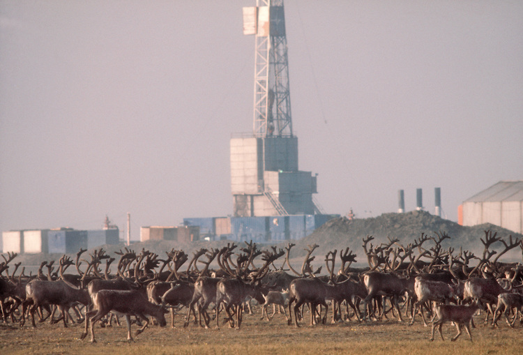
Every year in April, there is a herd of nearly 197,000 caribou that travel more than 400 miles to reach the plain on Alaska’s northernmost coast. This massive herd is known as the Porcupine Caribou herd and for several months of the year, this Alaskan coastal plain will be their home. It is where the females give birth every June and where the young spend the first weeks of their lives. This area is known as the Arctic National Wildlife Refuge (ANWR) and it provides vital habitat for the Porcupine herd every spring and summer as the place where they can safely birth their calves and begin to raise them (U.S. Fish and Wildlife Service, 2016).  

The National Wildlife Refuge System was first put into place by President Theodore Roosevelt more than a century ago (“Political History of the Arctic Refuge,” 2014). Wildlife Refuges are meant to serve the sole purpose of providing and restoring habitat for animals in the wild (Berman, 2015, para. 9). Several decades later in 1954, the National Park Service began surveying areas in Alaska that would be worth protecting under the Refuge System based upon their wildlife diversity, aesthetic values, and recreational opportunities. Almost nine million acres in the northeastern corner of Alaska were deemed valuable according to these standards and in 1960, ANWR was established. Today, this preservation area has expanded to nearly 19 million acres. The Refuge is home to a diverse collection of wildlife that includes eight types of marine mammals, 37 species of land mammals, 42 fish species, and over 200 bird species with its most notable species being caribou, polar bears, and muskoxen (U.S. Fish and Wildlife Service, 2013).

The northernmost piece of the ANWR is a one and a half million acre plain that borders the coast of the Arctic Ocean. This particular part of the Refuge is referred to as the 1002 area (U.S. Geological Survey, 2016). Currently, it is not considered Wilderness because it is a vast frozen coastal plain without trees, mountains, or lakes (Energy Research, n.d.). However, this is the esteemed coastal plain that the Porcupine Caribou herd migrates to each spring and relies upon as the habitat in which more than 40,000 calves are born each year (U.S. Fish and Wildlife Service, 2016; Warden and Johnson, 2015).

Unfortunately, the 1002 area in the ANWR has been being considered for oil exploration since 1980. Today, there is a strong push being made by Alaskan politicians to open up this area for oil drilling. It is estimated that this coveted coastal region holds anywhere from four to twelve billion barrels of oil (Reiss, 2017). According to the U.S. Geological Survey (2016), approximately 10.4 million barrels of this oil are actually recoverable, which translates into about one million barrels per day for the 1002 area. Based on these estimates, ANWR would be producing more oil than any other field in North America. Within the ANWR, 7.16 million acre are currently protected under the Wilderness Act and that does not include the 1002 area (Energy Research, n.d.).

One of the most outspoken proponents for drilling in the ANWR is Alaska’s Republican senator, Lisa Murkowski. She is fighting hard for the rights to drill in the 1002 Area of ANWR as a means to boost the Alaskan economy (Murkowski, 2017). Murkowski argues that opening the 1002 Area to drilling would lead to a massive increase in jobs available for Alaskans and that it will mean billions of dollars of revenue for the state as well (Murkowski, 2017, para. 6). While oil drilling may benefit the state in the short term, it would only make Alaskans more dependent on fossil fuels at a time when the fossil fuel industry is becoming less and less popular (Grant, 2017, para. 3). Meaning that in the long run, the jobs created now for drilling would not last as less oil becomes used worldwide and greener technologies emerge to take its place. In addition to this, the drilling would also create a series of negative impacts to the environment that include excessive noise levels, slow ecological recovery, emissions, and sea ice danger.

The negative ecological effects of oil drilling in the ANWR 1002 area far outweigh the benefits, therefore it should be declared a Wilderness area in order to protect wildlife and the environment from the impacts of drilling activities. The distinction of Wilderness gives the strictest regulations possible for public land protection. Becoming designated Wilderness would make it illegal to drill for oil in the 1002 area (Sanders, 2015, para. 3). Keeping oil rigs out of the area would prevent harm to the caribou herds and other wildlife that rely on the 1002 area for habitat because they would not have to migrate elsewhere to avoid the noise levels and pollution. The Porcupine caribou are an important part of the ecosystem of the 1002, both depending on the environment they live in as well as enriching it (PCMB.ca, 2017).

Ecologically, we should care because of the negative effects oil exploration and drilling will have on the surrounding ecosystem. Noise pollution from oil fields in the 1002 area causes the Porcupine Caribou to cease migration to the coastal plains for calving season. When noises from the drilling exceed 75 decibels, many animals are unable to tolerate it and will avoid those areas (Drolet, Côté, and Christian , 2016). Thus, oil drilling will cause a decrease in the caribou population because it would drive them away from the calving grounds that they have relied upon for generations to raise their young in. Caribou are one of the most prominent animals in the northern Alaskan landscape. One study simulated what would happen to their populations if onshore oil rigs develop near their habitat. The study found that when subjected to the harshest development scenario of 15 rigs, all open for leasing, the caribou lost 34% of their habitat used for calving grounds when they were forced out of it by drilling the effects (Wilson et al., 2015). Excessive noise levels from the drilling activity causes these animals to migrate from their high-quality sites into areas that are less suitable for their needs (Drolet et al., 2016).

According to Griffith et al. (2002), pregnant female caribou will not cross over or under oil industry infrastructure during calving season (p. 40). This creates a large problem since the females are usually pregnant when they migrate to Area 1002 every June (U.S. Fish and Wildlife Service, 2016, para. 4). This could mean that they are unable to reach the area and may not be able to properly give birth and raise healthy calves. Additionally, caribou forced to migrate from their habitat in the safe coastal plains to the mountains may likely run into many more predators, such as grizzly bears and wolves. According to Griffith et al. (2002), grizzly bears’ habitat is primarily in the mountainous foothills and there has never been a report of wolf dens on the coastal plains (p. 51). Without trees or mountains in the 1002 area, these animals are not very present on the plain, thus making it safer for the caribou to be there than further inland where those predators are more abundant.

The environment in the ANWR is very sensitive to anthropogenic disturbances due to the brutal climate that allows for a short growing season for vegetation to recover from any damage. This slow ecological recovery puts the wildlife, such as the caribou previously discussed, in danger of not having enough food supply. The anthropogenic changes in the ANWR will be detrimental to the vegetation, like grasses, mosses and small shrubs. The pollution released by these oil sites causes death or illnesses that eventually lead to death to surrounding animals (Arctic National Wildlife Refuge, 2016). Therefore, the overall pollutants from oil exploration have negative impacts on both the habitat and migration of wildlife in the ANWR 1002 area.

Being how remote and wild this land truly is, it is not often traveled. This is also true for Prudhoe Bay, where there is currently oil drilling occurring. According to Barringer (2006), there was a spill comprised of 267,000 gallons of crude oil across two acres along Alaska’s North Slope (para. 1). The spill took five days to detect due to it starting as pin sized hole that expanded under pressure and most of the oil seeping under the snow (Barringer, 2006, para. 3-4). Inspections of the pipe showed that the almost 40 year old pipe had increased corrosion but not enough to worry about. The leak was also too small for system to detect so nobody knew (Barringer, 2006, para. 9-10). This is not the only spill from this pipeline however, there was an 11 million gallons spill in 1989, a 700,000 gallon spill in 1978 and a 285,000 gallon spill in 2001 (para. 7). Spills happen no matter how careful the companies are. A spill like this could force the Porcupine Caribou out of even more of their habitat.

Oil drilling in the ANWR would have economical value to Alaska, however in the grand scheme this value is outweighed greatly by the negative ecological impact it would have. The noise from the oil rigs is too loud for the Porcupine Caribou herd to tolerate and would force them out of their environment (Drolet et al., 2016). This would also disrupt their migration patterns because a pregnant female will not cross under or over any oil infrastructure (Griffith et al., 2002, p.40). This makes the routes that they can take even more selective if not impossible. In addition the herd would have to move into the mountains, where their predators are, which would lead to fewer offspring surviving (Griffith et al., 2002). If all of this still isn’t enough the herd could end up running out of food. The Arctic has a slow ecological recovery with a very short growing season due to the nature of the climate (Arctic National Wildlife Refuge, 2016). Not only is their land being taken by the oil rigs, but also their food sources. Making the ANWR completely designated as Wilderness would make drilling illegal (National Parks, 2012, para. 6) protect this herd for years to come while also preserving the pristine piece of land that is truly left without human interference.

AUTHORS

Adam Mergener – Building Construction Technology

Ashley Casello – Natural Resource Conservation

Kevin Boino – Environmental Science


REFERENCES

Arctic National Wildlife Refuge. (2016, September 19). Retrieved from http://www.defenders.org/arctic-national-wildlife-refuge

Barringer, F. (2006, March 15). Large Oil Spill in Alaska Went Undetected for Days. Retrieved from http://www.nytimes.com/2006/03/15/us/large-oil-spill-in-alaska-went-undetected-for-days.html

Berman, A. (2015, September 28). Park vs. refuge: What’s the difference? Retrieved from  https://www.mnn.com/earth-matters/wilderness-resources/stories/park-vs-refuge-whats-difference

Drolet, A., Côté, S. D., & Christian, D. (2016). Simulated drilling noise affects the space   use of a large terrestrial mammal. Wildlife Biology, 22(6), 284-293. doi://dx.doi.org/10.2981%2Fwlb.00225

Energy Research, I. F. (n.d.). ANWR. Retrieved from https://instituteforenergyresearch.org/topics/policy/anwr/

Grant, M. (2017, October 19). Oil Drilling in Arctic National Wildlife Refuge Imperils Wildlife, Won’t Solve Economic or Energy Challenges. Retrieved from http://www.nwf.org/Home/Latest-News/Press-Releases/2017/10-19-17-Arctic-Oil-Drilling

Griffith, B., D. C. Douglas, N. E. Walsh, D. D. Young, Jr., T. R. McCabe, D. E. Russell, R. G. White, R. D. Cameron, and K. R. Whitten. 2002. The Porcupine caribou herd. Pages 8-37 in D. C. Douglas, P. E. Reynolds, and E. B. Rhode, (eds.). Arctic Refuge coastal plain terrestrial wildlife research summaries. USGS Biological Science Report USGS/BRD/BSR-2002-0001

Murkowski, L. (2017, November 01). Time is right to open a slice of ANWR to drilling. Retrieved from https://www.adn.com/opinions/2017/11/01/time-is-right-to-open-a-slice-of-anwr-to-drilling/

National Parks, National Forests, and U.S. Wildernesses. (2012, April 18). Retrieved from http://www.pbs.org/wnet/nature/river-of-no-return-national-parks-national-forests-and-u-s-wildernesses/7667

Pcmb.ca. (2017). Porcupine Caribou Management Board. Available at: http://www.pcmb.ca.

Political History of the Arctic Refuge. (2014, November 23). Retrieved from http://anwr.org/2014/11/political-history-of-the-arctic-refuge/

Reiss, B. (2017, September 15). Bolstered by Trump, big oil resumes its 40-year quest to drill in an Arctic Wildlife Refuge. Fortune. Retrieved from http://fortune.com/2017/09/15/donald-trump-big-oil-alaska-arctic-wildlife-refuge/

Sanders, S. (2015, January 25). Obama Proposes New Protections for Arctic National Wildlife Refuge. Retrieved from https://www.npr.org/sections/thetwo-way/2015/01/25/379795695/obama-proposes-new-protections-for-arctic-national-wildlife-refuge

U.S. Fish and Wildlife Service. (2013). Arctic: Wildlife & habitat. Retrieved from http://www.fws.gov/refuge/arctic/wildlife_habitat.html

U.S. Fish and Wildlife Service. (2016, December 6). Caribou – Arctic – U.S. Fish and Wildlife Service. Retrieved from https://www.fws.gov/refuge/arctic/caribou.html

U.S. Geological Survey. (29 November 2016). Arctic National Wildlife Refuge, 1002 Area, Petroleum Assessment, Including Economic Analysis. Retrieved from https://pubs.usgs.gov/fs/fs-0028-01/fs-0028-01.htm

Warden, A. and Johnson, D. (2015). Wilderness is the right designation for ANWR’s coastal plain. Alaska Dispatch News. Available at: https://www.adn.com/commentary/article/keep-arctic-refuge-wild/2015/12/18/

America’s Proposed Border Wall: Effective or Deadly?

Donald Trump ran his campaign with the promise of significantly stopping illegal immigration by building a concrete border wall.

The 2016 presidential election, as highlighted by republican candidate Donald Trump, saw the rise in the desire for a U.S.-Mexico border wall among American voters.  The reason for building a wall is to prevent immigrants from illegally entering the United States. One of the largest misconceptions is the negative association between immigrants and crime rates (Jones, 2012).  However, almost all crimes committed in the U.S. were by citizens, not illegal immigrants (Carson & Anderson, 2016).  The main crimes committed in the United States by illegal immigrants include drug trafficking, rape, assault, reckless driving, and driving under the influence (Federation for American Immigration Reform, 2017).  However, Carson and Anderson (2016) state that only about 5% of inmates in the state and federal prisons consist of noncitizens.  This means American citizens account for 95% of the crimes committed in the United States. Of the total, only 1.67% are noncitizen federal inmates in prison for immigration offenses (Carson & Anderson, 2016 p. 33). In former president Barack Obama’s keynote speech, he discussed current crimes rates and illegal immigration, and stated that the illegal immigration and crime rates are lower than they have been in decades (Emery, 2016).  

Continue Reading