Since this blog was last updated, we have worked on the south coast of Haiti surveying reefs and learning about the challenges for biocultural diversity in this region that has suffered so many social and environmental upheavals. There, we had the pleasure of working with and learning from a great team from Reef Check. From Haiti, our family undertook its first “solo” passage to the offshore islands of Colombia where lies the Seaflower Protected Area and then onto Panama, and then by land to Costa Rica. It has been an incredibly eventful and stimulating couple of months.
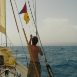
- Raising the Haitian Courtesy Flag
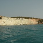
- White Cliffs of Haiti
- Haiti
- Polar Bear Rock
- Coastal Diving
- Jacmel
- Haitian Fisherman
- Jacmel
- Jacmel Harbor
- Jacmel Park
- Jacmel
- Funeral Procession
- Fishing boat
- ReefCheck Southern Haiti Expedition
After a productive and pleasurable few weeks in DR, we were both eager and anxious to get underway to Haiti to work with Reef Check on surveying the country’s south coast. For the past 2 years, Dr.Greg Hodgson, the executive director of Reef Check, has been working with associates in Haiti under a MacArthur grant and the auspices of the Haitian government surveying the coastlines to identify reefs that might be set aside as marine protected areas. This was their first investigation in this area.
Coral reefs, along with rainforests, are considered the most biodiverse habitats on Earth. Scientists are only beginning to understand these complex ecosystems, and ocean conservation actions in general lag far behind land-based ones. We do know that coral reefs are nurseries for tropical oceans and are estimated to feed over 1 billion people worldwide, along with providing many other ecosystem services. Reef Check research along Haiti’s other coastlines had confirmed that fish stocks were depleted and subsistence fishers rarely find fish over 6 inches anymore. Local and global stressors combine force to erode these ecosystems. Scientists and reef managers debate where best to apply energy to save coral reefs, and even whether or not reefs can be saved at all.
We left DR with Reef Check member Edward J. Beucler. EJ has been working with Reef Check in Haiti from the beginning of their project, bringing his many skills including computer mapping expertise and speaking Creole. In addition, he has worked with Reef Check to train a group of Haitians as SCUBA divers and then Ecodivers, as part of building a local constituency of people who can continue reef conservation efforts in Haiti over the long term. Working with Google Earth images, we had several sites along the south coast that were of interest for investigation. This data also suggested, however, that we might find high turbidity on the eastern end of the coast. We anchored in a beautiful area called Pointe de l’Acul. The coast had white limestone cliffs at sea’s edge, framed by a massive mountain range inland. At our anchorage, there was an incredible limestone formation bearing striking resemblance to a pair of polar bears. The setting was stunning.
Connor, Janis, Rowan and EJ headed out in Llyr’s tender (dinghy), “Nereus” to conduct our first manta tow. This involves a surveyor being towed behind the tender on a board which they use like an airplane wing to adjust their depth. A GoPro camera is attached to the front and aids the researcher in data collection. The process is efficient, gathers a lot of data rapidly, provides an overall picture of what lies below the surface and helps determine sites for in depth surveys on SCUBA. Data collected is a rough calculation of substrate and fish species diversity, size and quantity. Points along the tow are recorded with GPS and uploaded to Reef Check GoogleEarth maps.
Our manta tow findings confirmed high turbidity, possibly due to the limestone, agitated sea state, and poor reef habitat. We saw very few fish, low coral coverage, and overall poor visibility.
Aboard Llyr that afternoon, we were visited by some fishermen in their dugout canoe. They had caught lobster, shrimp and a surprisingly large red snapper! We purchased the lobster and shrimp and declined the snapper which was too much food for the six of us. Spiny Caribbean Lobster are an indicator species in Reef Check surveys. That means that their presence or absence is an indication of fishing pressures. We were sensitive to the paradox of enjoying our fine lobster grill aboard Llyr while researching effects of fishing pressures on this species. This would not be our last lobster dinner on the coast.
Eastern Haiti has few protected anchorages for boats and the sturdy southeast trade winds bring swell directly to shore which made it challenging for the crew to conduct our research. Large waves rolled in constantly and the cliff-lined shore sent them right back out creating large standing waves or “lumpy seas” and pitching the boat in unexpected ways. At one point EJ and Connor dropped below on SCUBA to attempt a survey in an area understood to be 30 feet deep according to charts. The dive team quickly resurfaced; they’d crunched unexpectedly into the bottom at about 8 feet with zero visibility!
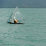
As we progressed towards Jacmel where we’d be joined by the rest of the team, each morning we were met by the site of many small fishing boats heading out in their dugout canoes, some equipped with sails made from scavenged cloth and plastic. We spent a significant amount of time dodging fishing nets and long lines supported by plastic water bottle floats. We were reminded of evasive maneuvers we made in the Gulf of Maine last summer, dodging dense fields of lobster pots. There seems to be little open ocean for fish or boats anymore near the fishing coasts. Notably, we did not see any FADs (fish aggregation devices) such as we had encountered along the coast of DR. (Those FADS were made by tying many bottles into a bundle and attaching them to palm fronds to provide cover where fish like to gather and can be more easily collected with nets.)
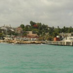
We arrived in the harbor of Jacmel where we were joined by Dr. Greg Hodgson, Reef Check’s executive director, and Romain Louis, a graduate of the Haitian Ecodiver program and a teacher in Port Au Prince. Jacmel is located at the end of a large bay and its architecture is a legacy of the French colonial era. Today, its buildings are worn and the city was a casualty of the recent earthquake with much debris still to be removed. We found fairly good anchorage right off the town, although the constant wave action made each foray to shore a somewhat stressful one as we tried to avoid tearing up Nereus’ bottom on the rocks, metal and trash along the broken docks the earthquake and poverty had brought to ruin. With EJ and Romain’s skills and Creole, we were able to employ a local “fixer” to mediate and buffer for us during our 3 day stay.
We explored Jacmel bay for possible survey sites but found little to pursue. We took Llyr out to the mouth of the bay where Greg and EJ completed a Reef Check survey below the cliffs on what they described as a fairly healthy reef, even though it was also short on fish. While the rest of us circled on Llyr, Janis caught site of a large object in the water. Thinking at first it was a manatee, we all quickly realized we were privileged to be seeing a massive Leatherback turtle. Brooks determined that his sighting of a large “body” in the water a couple of days previous was also a Leatherback. Leatherbacks are the largest of all living sea turtles and their range is extensive across the world. Although they are hunted less than other sea turtles for their meat, which is fatty and oilier, habitat loss, predators, and other factors have placed them on endangered species lists.
On the eastern shores of the Baie d’Aguin we found a beautiful and sheltered anchorage. Brooks, EJ, and Romain set off on the tender to visit a small village nearby to inquire about fish. It turned out not to be a fishing village but rather a rugged spot where men were turning mangroves into charcoal! They had left a small patch of mangrove in front of the village for storm protection—which is what mangroves do worldwide– but were in the process of taking everything else around them.
More to come….


Just watched a NYT video about these ecodivers. Much-needed and valuable work!
http://video.nytimes.com/video/2011/09/01/world/americas/100000001030590/ruin-and-hope-on-haitis-reefs.html