A Vessel for the Vanua-tai, fundraising campaign

In an era of collapsing biological and cultural diversity, Vanuatu is one of our planet’s last great places. Lying west of Fiji and on the eastern edge of The Coral Sea, this remote archipelago of 83 islands and open ocean is home to a vast treasure trove of biological riches — from coral reefs to mangrove and rain forests — and an enduring interdependence between its people and their natural environment. The archipelago’s conservation champions and best hope are the Vanua-tai (Land & Sea), a remarkable Indigenous group of 400 environmental stewards crafting local solutions to global crises. The Vanua-tai have asked Island Reach, a unique, US-based conservation project operating in Vanuatu, to provide a vessel for the Vanua-tai. Working on board Research Vessel Llyr, Island Reach is partnering with them to fill transportation gaps and provide a mobile work platform, skilled and professional services and training, and greater opportunities for collaboration and exchange among the Vanua-tai.

The intimate relationship between Ni-Vanuatu (the people of Vanuatu) and their lands and seas finds expression in the densest language diversity on the planet, with over 120 languages in active use! In most of Vanuatu’s 1000 villages, there is no electricity, there are no roads, and small boat motors are rare. Work — from fishing to forest farming — is done with skilled hands. Vanuatu is in a race to protect this rich heritage from the rapidly intensifying effects of climate change, extractive industries such as logging, mining, and foreign fishing fleets, and population shifts.

Now, more than ever, there is urgent need for these volunteers to work with their village Chiefs, farmers, fishers, and families to build sustainable solutions. The Vanua-tai are eager to engage; they know what they need: but for many of them, especially those in remote locations, access to resources, training, and opportunities for exchange is insufficient to meet the sheer number of mounting challenges. As a result, many Vanua-tai are struggling with projects that are stalled or under-developed.

What is Island Reach?

Island Reach is a volunteer, ocean-going project in Vanuatu, conceived and built by a New England farming family headed by a couple of social scientists trained in Human Ecology and Cultural Anthropology.

As forest farmers, we’ve spent many years developing strategies to support small-scale harvesters and we’ve spoken widely about food, economies, culture, and the environment. In 2010, with dire reports about the state of the planet and our oceans on the rise, we were compelled to greater action.

Our plan was to target the resource shortages that impede conservation efforts in island and coastal settings. This was a personal and professional decision that involved mortgaging the farm, purchasing and refitting Research Vessel Llyr, and training as offshore “bluewater” mariners. Harvesting a perennial crop meant that our work schedule could be adjusted so that we could be on the farm for half the year and spend the other half working in a biological and cultural conservation hotspot.

Island Reach now operates Research Vessel Llyr and partners with local communities and regional groups in Vanuatu — a vast archipelago of islands spanning 600 nautical miles — to build social and environmental resilience from ridge to reef.

Island Reach was conceived and built precisely to serve an Indigenous group of conservation stewards like the Vanua-tai.

In crisis lies opportunity

We can all respond and get the Vanua-tai conservation champions the core services and resources they need to thrive in one of our world’s biocultural hotspots; or… they risk being “snowed under” by the escalating intensity of changes on their doorstep.
What your donation will do

Your contribution will fuel Island Reach’s direct actions for the Vanua-tai. We’ll provide them with a broad range of essential resources, services, and actions, at no-cost to them:

  • Live-aboard and transport costs for Vanua-tai and training partners as well as participating marine biologists and other specialists.
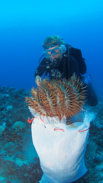
  • Fabrication of collection hooks and bags, and purchase of injection guns for Crown of Thorns starfish mitigation; supplies to construct coral gardening frames.
  • Transportation of conservation and food & water security materials: e.g., water collection tanks & systems; construction supplies; agroforestry/agriculture & aquaculture resources such as seedlings, fish stocks, erosion control plants.
  • Operation and maintenance of snorkel equipment, dive compressor, tanks and gear and RV Llyr’s First Responder dive tender.
  • Educational outreach: e.g., maintenance of portable video equipment and generator for community presentations; reef survey and coral gardening training and tool kits; Crown of Thorns mitigation; copying of DVD and paper instructional materials concerning climate change, coral reefs, agroecology, and food security strategies.
    Identifying species at risk and options for establishing community-managed conservation areas.
  • Cultural anthropology-oriented documentary film productions for a) filming village reefs & actions for local community awareness and school presentations; and b) films for wider audiences & supporters.
  • Delivery of construction skills for conservation projects: electrical, mechanical, building, plumbing, motors, alternative energy.
  • Delivery of intellectual resources: expertise in agroforestry, permaculture & food security adaptations; reef ecology and reef husbandry; experience in climate change adaptation and carbon farming; artisanal harvesting and direct market practices that advantage family-scale producers; citizen science methodologies for surveying coral reefs, marine, and forest ecosystems.

Who are the Vanua-tai?

The Vanua-tai Resouce Monitor Network was created 20 years ago by the renowned community arts and activist organization, Wan Smolbag (read: “one small bag”). Initially established to address the decline of turtle populations around the main island of Efate, the group has greatly expanded its mission in response to mounting pressures in the archipelago.  Today, the Vanua-tai work with their communities across Vanuatu to develop strategies for dealing with issues ranging from coastal erosion to coral reefs in crisis, from climate change impacts on food and water security to sustainable tourism, to protecting species at risk and establishing marine and land conservation areas.

The network has grown to over 400 community volunteers, individuals woven into the social fabric of their villages and islands who have stepped forward to be agents of positive change.  They act as cultural mediaries, building connections between traditional ecological knowledge and practices that have evolved over generations and Western science-based information and methods.

By helping their own communities and ecosystems, the Vanua-tai are benefiting all of us by helping stem the great wave of extinctions.  By some estimates, we are losing up to 140,000 plant and animal species a year.  On average, one language disappears every 14 days, and with it usually goes unique ecological knowledge about the Earth.  80% of the planet’s biological diversity and 95% of its cultural diversity resides in the homelands of Indigenous peoples.  Empowering the Vanua-tai is a critical part of achieving global conservation goals.

Internationally, the Vanua-tai are a model of Indigenous Peoples designing and implementing locally appropriate and culturally sensitive adaptive strategies. Their work can enrich global dialogues and strengthen global alliances responding to the collapse of biological and cultural diversity.

What makes Island Reach Different?

  • We’re efficient

— Island Reach is lean and focused on direct action.

–We work with our hands and have mechanical and construction skills.  We do our own maintenance and refit on RV Llyr, allowing more funds to go directly to projects.

–Island Reach is ready to multitask, folding numerous projects into the same expedition, saving resources and encouraging collaboration.

–Offshore marine vessels are notoriously costly to operate and maintain.   Conditions are rough, the ocean is relentlessly corrosive, and complex, rugged materials must be well maintained with backups for safety.  This is one important reason such vital resources are mostly unavailable to conservation workers in archipelagos.  Research Vessel Llyr, built in Europe, is a modest sized, heavy displacement, steel work-yacht, ketch-rigged for sail with sturdy hardware.  Llyr was carefully selected and fitted for proven efficiency, durability and low cost of operations.

  • We’re a family of farmers

–Internationally, family farming is recognized for its important economic, cultural, and environmental roles (2014, International Year of Family Farming).  Most Ni-Vanuatu are skilled subsistence and artisanal harvesters, feeding their families and securing small incomes from working land and sea.

–We know first hand about connections between labor and the land.  We’re sensitive to the economic, generational, and environmental challenges that farm & fisher families face around the globe.

–As a vessel with kids on board, we aim to make forest and ocean conservation cool and fun for young people! Today’s youth need to be inspired by possibilities and instilled with hope and a sense of adventure.

  • We take a holistic approach

–We’re human ecologists which means we focus on relationships between people and our environments.  Our approach is interdisciplinary.  Advanced training in the social sciences of cultural anthropology and psychology gives us deeper understandings of forces which shape collective action, and the importance of self-representation for Indigenous Peoples.

  • We engage risk through careful planning and training

After roughly 15,000 nautical miles at sea and five years of training and volunteer work from the coast of Maine to Dominican Republic, Haiti, Panama, and across the South Pacific Ocean States of French Polynesia, Cook Islands, Tonga, and Fiji, working towards our destination of Vanuatu, we’ve build a dynamic project that:

–attests to our resourcefulness and fortitude when encountering adversity.

–demonstrates creativity, passion and dedication.

–has been well received in both the US and Vanuatu with new partners, like Mission Blue, coming on board to pitch in.

  • We keep you connected!

–We stay in touch with  Island Reach Videos  and social media!

–Half of the year we’re in the US engaged in Island Reach development and public/professional outreach, working the farm, and meeting BSG-Farm’s community of customers.  We bring all of us a little closer to land and sea; from ridge to reef!


Summary of Island Reach Expedition Activities 2014 Research Vessel Llyr, Vanuatu, Melanesia

This report is a companion piece to the Island Reach (IR) introductory video, https://www.youtube.com/watch?v=sOH2OpfKDBE  and summarizes the range and variety of activities IR has undertaken to date to meet its mission in Vanuatu during the 2014 fieldwork season. IR is designed to operate in partnership, offering support to existing conservation projects in Vanuatu. We are indebted to the villages, groups and individuals mentioned for their support, welcome and guidance.
——————————————–
Port Vila, Efate, Capital of Vanuatu, May-June
Orientation; meetings with government, civil, and private sector stakeholders; intensive Bislama language training with Teri Firiam.

350 Vanuatu, Pacific Climate Warriors, May
Produced video documenting climate action campaign.

Buninga Water Project, Live & Learn, June
Assisted with implementation of water security project on the remote and hard-to-access island of Buninga, Shepherd Group: technical design and sourcing of materials, transportation of Live & Learn personnel and 11 x 1100 liter water tanks and gutter collection systems (project material weight estimated @ 4tons); installation of collection systems with community; and video documentation for Live & Learn and project funders

Partnership with Sarah Graham, M.Sc Marine Ecology, Marine Biodiversity Project Officer Vanuatu Department of Tourism, Shefa Province Office, July
Ms. Graham joined RV Llyr for a 4 week expedition (free of charge) focused on Crown of Thorns Starfish (COT) surveying, community awareness, and mitigation. IR also provided Ms. Graham pro-bono Reefcheck Pacific Ecodiver training and certification.

Loru Community Conservation Area, REDD+ project with Live & Learn, August
Filmed and produced a 30 minute video for Live & Learn and project funders, documenting the REDD+ project at the Loru Community Conservation Area, Espiritu Santo Island.

Crown of Thorns Starfish (Acanthaster Planci) Mitigation, March-September

– In consultation from the US with Peter Whitelaw in Vanuatu, researched and acquired 5 low-cost NJ Philips 15ml Dial-a-Dose Injection Guns with added 6′ stainless-steel needle extenders and 5 liter flexi packs to be trialed for COT mitigation in Vanuatu. These injection gun units cost 70% less than available equipment currently marketed internationally for COT management. They are easy to use at both dive and snorkel depths and can be used with readily available, low cost, natural toxins. As a result of IR’s work, numerous stakeholders across government, civil, and private sectors are now
adopting this equipment.

–Training on COT culling methods in Havannah Harbor, Efate, and COT mitigation literature review with Peter Whitelaw, Secretary of the Vanuatu Scuba Operator’s Association and Captain of SV Goldenwing.

– Produced 60 Crown of Thorn Starfish (COT) culling kits, (hook/bag/glove) in collaboration with Peter Whitelaw. Total material cost of kits: US$300. To date, 45 kits distributed, with training in their use, to community members and environmental monitors throughout Vanuatu.

– Educational presentations on coral reefs ecology, including (where relevant) Crown of Thorns behavior and management:
Emae, Marae Community Center
Emae, Primary School
Lamen Bay primary school
Lutes church, Maskelyne Islands.
Pelonk Community Center, Maskelyne Islands
Bwatnapni Primary/Seconday school, Pentecost
Ranputor Community Center, Pentecost
Pangi Primary School, Pentecost

– Worked with Marae village members and conservation area managers to build an educational coral garden.

– COT Culling Activities:

* Emae Island, Shefa Province & Sangalai, Maskelyne Islands, Malampa Province:

Teamed up with village-based environmental monitors, conservation area chairmen, and community members to survey and cull COTs. Produced short videos for the communities on their collaborative efforts.

* Crab Bay Conservation Area, Malekula Island:

Conducted field trials on COT injection using the injection guns IR brought from the US employing various natural acids in association with the Vanuatu Dept. of Fisheries. Five day campaign from RV Llyr, including surveys, 32 tank dives, 5 snorkel sorties, 8 georeferenced video transects, and 3 parallel 50 meter replicate injection transects (this last, specifically on behalf of fisheries). COT mitigation by the IR team over this period was highly successful, resulting in 3200 COTs culled over 29,000 square meters of reef. A report of activities and results was produced for Fisheries.

Additional COT culling sites:
Lelepa Island, Havannah Harbor, Efate, Shefa Province
Cook Reef x 2 sites
Lamen Bay, Epi Island
Turtle Island, Arore Island, Sanma Province
Ratua Resort, Aore Island

Total Cots culled via injection Gun or hook/bag: 4,300

– Promoting Awareness with Visiting Yacht Cruisers:

In collaboration with Eric & Ann Simmons, NZAid VSA Volunteers, Vanuatu Tourism Office, generated daily SSB radio net announcements for Vanuatu cruising yachts promoting COT data collection for the Dept. of Fisheries and VSOA as well as culling participation.

– “Crown of Thorns Starfish in Vanuatu” (working title). COT Mitigation training Video in production.

SPC-GIZ Coping with Climate Change in the Pacific Islands Region & National Advisory Board on Climate Change:
IR disseminated print and video educational resources for Dr. Christopher Bartlett to over a dozen communities throughout Vanuatu. Integrated coral reef ecology and COT mitigation with climate change awareness and El Nino/La Nina weather impacts in school and community multimedia presentations. Video documentation of the Nguna-Pele MPA Coral Gardening Project.

Coral Gardening Project: Tanoliu Primary School, with Wan Smolbag’s Vanua Tai director Donald James, Peace Corp volunteer Robert Lee (North Efate): Established 3 mobile, educational coral garden frames, donated by IR along with 5 snorkel packs. The frames were assembled, stocked with coral fragments and sited within the Tanoliu taboo conservation reef with Tanoliu primary students, alongside their giant clam project. Ongoing project development will be led by Vanua Tai director Donald James and Robert Lee.

AquaLung USA:
Distributed 23 snorkel kits, donated to IR by Aqualung USA, to schools and Wan Smolbag Vanua-Tai environmental monitors throughout the islands.

Completed 29 GoPro HD Geo-Referenced Coral Reef Benthic Substrate Video Transects and 2 Reefcheck surveys, filling in core data gaps for government and private sector concerns on reef health and COT distribution in Vanuatu

60 Kilos general medical supplies distributed at the request of Michael Schugg, Director,Vanuatu Society of Disabled People to:

* Marae Village medical outpost, Emae Island
* Emae Island Primary School Clinic
* Lutes clinic, Maskelyne Islands
* Lamen Bay clinic, Epi Island
* Lamap Medical Center, Malakula
* Vao Island clinic, Malakula Island
* Bwatnapni medical Clinic, Pentecost Island
* Ranputor medical outpost, Pentecost Island
* Ranon medical outpost, Ambrym Island

Additional training, research, and volunteerism:

RV Llyr First Mate and EMT Connor Steele-McCutchen & 2nd Mate Rowan Steele-McCutchen advance dive training to PADI Rescue Divers in Luganville, Santo.
Site visit with Pierro Bianchessi, Director of the Venui Vanilla Company, Espirito Santo , investigating permaculture farming, marketing, and conservation challenges in Vanuatu.
Connor Steele-McCutchen volunteered with Promedical Ambulance and the Port Vila Hospital.

Summary of Videos published or in current production onboard RV Llyr:

Island Reach introductory video, https://www.youtube.com/watch?v=sOH2OpfKDBE
350 Vanuatu, Pacific Climate Warriors https://www.youtube.com/watch?v=vqixK_V1DS8
Buninga Water Security Project, video documentation for Live & Learn Vanuatu
Loru Forest Carbon Project, video documentation for Live & Learn Vanuatu
Crown of Thorn Starfish in Vanuatu
IR ongoing expedition and capacity-building activities including food security and climate change adaptation
IR transit to Vanuatu video: https://www.youtube.com/watch?v=fzkGX7ljVg0

Here is the video we’ve been working on for the past while. We completed it about a month ago, and then left the capital on an island circuit and haven’t had sufficient internet to load it. So in the meantime, we’ve added a bit from the work we’ve been doing throughout July. ( New videos already in the works….) We hope you enjoy!

Controlling Crown of Thorns and Promoting Sustainable Fisheries in Vanuatu, Melanesia

COT collection

diver with COT

Project Summary
Vanuatu is experiencing an infestation of Crown-of-thorns, an indigenous coral-eating starfish. Successful mitigation efforts by stakeholders have required all-out and sustained campaigns; however, such responses have been limited due to a shortage of resources and educational outreach. This project will fill gaps and help build local capacity. Phase 1: A multi-island circuit aboard RV Llyr to a) assess the COT infestation, b) engage with communities about controlling COT populations through sustainable fisheries practices, c) demonstrate simple culling techniques, d) share and produce videos about the issue. Phase 2: Facilitate emergency culling in key locations as COTs aggregate to spawn.

Project Background
A major aggregation of COTs was first observed on the island of Efate in 2005. As the infestation advanced, large areas of coral reefs were destroyed. Local Scuba operators and village communities became active culling COTs from healthy reefs and developed several distinct and effective COTs-culling techniques, suitable to both snorkelers and divers. Their proactive efforts at COT removal combined with ongoing maintenance — over 6000 COTs were removed between November 2012 and May 2014 — stopped a frontal line in its tracks and resulted in the protection of important coral reefs. The Nguna-Pele Marine Reserve removed 10,000 COTs in 2010 and developed a project using COTs for fertilizer production.

These efforts were models of what can be achieved, however, the lack of integrated resources across stakeholders, including available boats and effective local education and communication, has impeded coherent management of the COTs infestation throughout Vanuatu. Secondary outbreaks have been documented throughout the islands, with a recent plague identified on Espiritu Santo. A recent culling by the Dept. of Fisheries (DoF) using village manpower resulted in 1500+ COTs removed over a matter of days.

The DoF is establishing a COTs database, enlisting villagers, dive operators and tourists in a citizen-science campaign to monitor reefs and report information. Additionally, the Tourism Office has created a new position to work specifically on the development and implementation of awareness campaigns for local communities. However, resources remain limited and outreach difficult. The proposed project can help fill critical gaps and build capacity.

Project Description

On healthy reefs, Crown-of-thorns starfish (Acanthaster Planci) help maintain biodiversity. When a reef is compromised by anthropogenic vectors and/or by natural events, the ecosystem is disrupted and less resilient — as well as more conducive — to a COTs infestation. It is difficult to stop aggregations once underway and generations of COTs may plague a region, reducing coral cover by 95% and disrupting the marine food chain. Potential exists for the collapse of reefs into rubble, dooming recovery and destroying vital coastline susrge protection.

Many stakeholders around Efate and nearby islands developed campaigns to cull COTs. With sustained efforts, some of these were successful in reducing COT impacts. However, with a shortage of resources in the country, it has been difficult to implement a comprehensive and sustained management program. Many important ingredients are sorely lacking: data on the outbreak; strategic and widespread coordination of culling campaigns; and engagement with villages on sustainable fishing practices that make the best use of local ecological knowledge and scientific knowledge to protect COT predators from overfishing and increase reef resilience.

Beginning in the Austral Springtime, COTs aggregate to spawn and commence more active feeding behaviors. Now, ahead of spawning season, is an important time to collect data, cull, and offer outreach to villages.

We seek funding for a 2 Phase project.

Phase 1: Transect

A circuit of reefs and islands aboard RV Llyr, with the following goals:

a) Data collection on COT presence and impact on reefs across the archipelago. Via SCUBA and snorkel, the team will produce video transects and Reef Check survey data for sites as well as COT population counts based on the quantity removed and/or destroyed on site. This information will benefit a new database being developed by the Fisheries department in their efforts to control the epidemic.

b) Community visits. Coral reefs provide many ecosystem services to the people of Vanuatu, from food security, to storm protection, and income from tourism. The COT outbreak threatens all this. The team will meet with community representatives to hear their perspectives, speak about COTs management and mitigation using adaptive ridge-to-reef methodologies (sustainable fisheries and agricultural practices, and coastal erosion control), and demonstrate culling techniques where indicated. These visits will be video documented and footage used for production of educational films in the Bislama language. Video has been shown to be one of the most effective tools to raise awareness in Vanuatu.

Phase 2: Emergency Response

An all-out assault with snorkelers and divers to remove COTs at the onset of spawning season. Properly equipped teams, including divers and snorkelers, can effectively cull large numbers of COTs at different depths as they aggregate to spawn. Such campaigns are costly, requiring boats, dive equipment and materials, and labor. In prior efforts, these costs have been absorbed by the stakeholders, and therefore campaigns have been limited in scope. Financial support will help reinforce and facilitate the expansion of the volunteer emergency response to renewed outbreaks in Efate and the plague in Santo during a critical period.

Local Partners:

Peter Whitelaw, Secretary, Vanuatu Scuba Operators Association & Director of Sailaway Cruises.Peter is widely recognized as a local COT expert and coordinates volunteer mitigation efforts.
Sarah Graham, (MSc. Marine Ecology), Marine Biodiversity Project Officer, Vanuatu Dept of Tourism. Sarah works on the development and implementation of community awareness campaigns about COTs. Sarah joins RV Llyr as Marine Conservation Community Educator, diver and surveyor.
Local Advisers:
Vanuatu Department of Fisheries
Eric & Anne Simmons, Master Divers, producing Vanuatu Cruising Guide for the Dept. Of Tourism

This is one of the projects we’re developing this season in Vanuatu. The text is from a grant proposal we’ve submitted, so the wording is brief!

The Heath Woods

One of my greatest pleasures as a maple farmer is the opportunity to range the forest in different seasons. After nearly two decades of farming these hills, they are deeply familiar to me and yet, with changing seasons, I can sometimes find myself “lost in the woods”, a delicious sensation that reminds me that this forest is alive and changing.

As I trek through the woods, pulling taps at the end of the harvest, I am struck by how many memories are stirred, what gifts and frights these woods have given me, how they’ve shaped my life. I recently read an essay in National Geographic by Garrison Keillor, storyteller and humorist (and host of Prairie Home Companion). It’s a personal geography, recounting his 70-some years of life in Minnesota, and in his unique poetic way, Keillor paints a portrait of a lived life through the places it has inhabited. I inhabit these woods, but I am just one small life form that does so and ultimately I am just passing through, a negligible being in an environment altered by so many forces through the ages.

It was on this spot in the North Bush, I recall, where many years ago my father-in-law and I stopped tapping on a still and grey winter day to sit on a rock and eat our lunch. The dog’s hackles rose and we looked up to see a large silent shape gliding across the nearby slope. It took us a moment to realize it was a wolf. I held tight to the dog’s collar but she seemed in no hurry to race after the animal, as if joining us in wonder at the rarity and majesty of this creature.

It was also in the North Bush one April that I once came upon a clutch of eggs – perhaps partridge – nestled in a small cave of roots at the base of a maple. Now, when pulling taps at the end of the harvest, I’m always careful to look at the tree base to see if I might ever find another such treasure.

On a sunny winter’s day last year in the Back Bush, Gavin and I were tapping trees and as we drilled, the sap was already running. We wrapped our arms around the trees, our faces close to the bark, and stuck out our tongues to catch the sweet dripping sap.

Earlier this winter, up high on the top of the ridge in the West Bush, a snowstorm was moving in fast. As I gently tapped the spile into the tree, mere inches from my hand a red squirrel darted from a crevice to scamper away from my intrusion. Startled, I stepped back and waited a few moments to watch it return to his shelter to escape the building winds. I came back to this tree in April, the woods so different with the onset of Spring, and wondered if I might spy the squirrel again as I removed the tap, but he was nowhere to be seen.

Down the Main Bush trail, or Tita Trail (named after a great aunt), three growing sons have flown countless times on their sleds, alternately paddling along by hand where the slopes flatten out, then zipping down the steep curves to come flying into the front yard and on down the driveway.

On the upper slopes of the North Bush there is a beautiful white quartz rock. In the Fall, the leaves create a tapestry on its hard white surface, in the winter, it disappears under snow, and in late Spring, it emerges again, with fresh soft mosses growing upon it, tempting my hand to rest on the green down that blankets its ancient and durable form.

Up high near the ridge, an escarpment of tumbled rocks is always a thrilling sight, no matter what the season. In winter, large ice flows cascade down its face creating a dramatic high alpine scene; in summer, thick green forest hides its caves and shelter the animals that seek refuge there.

Not everything brings pleasure in these woods.

I’ll never forget the forest tent caterpillar outbreak. The tiny invaders munched their way through the canopy of the entire Main Bush. Trunks vibrated with their marching bodies and one could hear their frass falling to the ground as they ate their way through the forest. By early June, the leaves were gone. The trees limbs and trunks were draped in webs, turning the forest into a haunted, dark and alien place.

And then there was the ice storm. A mid-December storm brought a thick coating of ice that wreaked havoc on the forest. Limbs encased in ice crashed down and whole trees ripped up from the earth. The sound alone was remarkable. When all was done, the devastation overwhelmed. Bringing in a crop in the short months to come seemed an impossibility. Good friends and neighbors came out in the snow and helped us lift fallen sap lines as best we could, allowing us to recover enough for the harvest. But we lost over 1000 taps, a fifth of our production, and it is only now that some of those trees can be tapped again. The debris in the woods still lies thick and many areas in the forest have changed their character where holes in the canopy opened up, allowing new types of undergrowth.

My livelihood depends upon this forest, but it has become much more than that. With each passing year, memories build and my life story becomes more deeply entwined with these trees, slopes and rocks.

IMAG0248IMG_0467IMG_0473

A Harvester’s Dilemma

0 degrees this morning! A long way from and an alien climate compared to the setting of my last blog entry. Our maple trees are nearly all tapped and we had two days of limited harvesting prior to this most recent cold spell. Long range forecast isn’t favorable for the maple harvest: we may be facing the 3rd short crop in a row. However, it’s a little soon to predict so we’ll do our best to have a tight line system with no vacuum leaks and we have been able to recover about 500 taps that were lost during the epic 2008 ice storm which will improve our yield.

Weather isn’t climate, so no season or event can be easily attributed to climate change. This may end up as a big crop, or next year’s might; even so, the knowledge we’ve gained about our forest from working with local foresters, and from following climate science, is enough to tell us that things are changing.

These realities connect me emotionally with farmers everywhere. While farming has always been subject to climate patterns and weather events, today the stories come fast and furious about threatened livelihoods, disappearing habitats, diminishing food security, and water shortages. As I stand before each tree in the forest, I find myself gauging its apparent health and capacity, considering its resilience in a time of growing stressors, and weighing the decision to tap it or not against the immediate risks to my family. At times, I deliberately try to saturate myself with this “me or the tree” angst because I believe these feelings lay at the root of so many sustainability problems. While I know that in the long run, survival can only happen with a “me AND the tree” approach, I can identify, for example, with all the fishers I’ve met on expedition aboard Llyr who’ve told me that they know the fish are disappearing from their reef, but they need to feed their families today. What can they do?

Now, as time approaches for us to go to Vanuatu, the setting where we’ve determined to work long term on ridge to reef conservation efforts as Island Reach, I’m reading about how communities are experiencing sea level rise, salt water intrusion into their fresh water sources, more frequent and devastating storms, the decline of their inshore fisheries, and much more. Focus is on building local capacity and resilience in the face of such changes. I’m glad I know, viscerally, that dilemma that often goes with harvesting: to act in the short term for immediate personal survival or to act for the longer term with the aspiration to protect an ecosystem, and thereby ensure real survival through a relationship of interdependency.

Ridge to Reef, Part III

This is an article we are submitting to our local newspaper.


The wind and seas have calmed down today from the 25 knots and 15 foot ocean swells of yesterday. Those kinds of days make it challenging to move about the cabin, cook ,or sleep aboard our 53′ sailing research vessel Llyr. We are currently making passage from the remote island of Suwarrow in the northern Cook Islands in the central South Pacific to Vava’u in the Kingdom of Tonga. It is a 6 day passage and we are amusing ourselves with the technicalities of crossing the dateline: “if today is tomorrow, then what is yesterday?” It doesn’t take much to entertain you way out here in the middle of the ocean. RV Llyr and crew are well into our second season of work and study on coral reefs and coastal communities. This year finds us crossing the mighty, blue Pacific Ocean, from Panama to Fiji, over 6500 miles of ocean at a speed of about 6 to 7 mph!

RV Llyr, a steel sailing ketch, is the project boat of Berkshire Sweet Gold Maple & Marine and the Steele-McCutchen family. Right now, we have a crew of seven: our family of five, an intern from Four Rivers School in Greenfield, and a climate change speaker/ photographer from Minnesota. The purpose of our expedition is to link from ridge to reef, combining our interests and concerns about sustainable harvesting, small-scale economies, and the support for biological and cultural – or biocultural – diversity in a time of climate change.

We arrived in Panama right on the heels of completing our 2013 maple harvest in Heath to prep the boat for the Pacific. Our route this year has taken us through the remarkable Panama Canal, followed by a month-long offshore trip to the Marquesas in French Polynesia. From there, we traveled south the the low-lying coral atolls of the Tuamotus, and then westward to the Society Islands. We left French Polynesia from Bora Bora, bound for Suwarrow, an uninhabited island in the northern Cooks. Our final destination for 2013 is Fiji, where we’ll haul Llyr out of the water and “plant” her in a trench, there to sit out the cyclone season of the southern hemisphere (roughly October – April). In Spring 2014 our plan is to sail RV Llyr to Vanuatu in Melanesia where we hope to begin long-term work with coastal communities.

Above the waterline, we’ve been interviewing a variety of people – fishers, farmers, teachers, community leaders, scientists – to learn about their pressing concerns and their knowledge of these land- and seascapes. We’ve heard about overfishing by industrial fleets – mostly Asian, but American as well – that threaten the long term foodstocks of these traditionally seafaring people who still rely, to a large extent, on subsistence fishing. We’ve also heard that the local catch of reef fish is getting smaller, as are the sizes of individual fish caught. In some places, fishing livelihoods have almost entirely collapsed and they now have to import fish from other island groups. We’ve learned about the collapse of Black Pearl farming and the unemployment crisis. We’ve heard reports and witnessed the devastation to coral reefs from a multitude of impacts. We’ve visited islands that are mere feet above current sea level, where people will have no recourse except to relocate from their ancestral homes when sea levels rise, as forecast within the next decades.

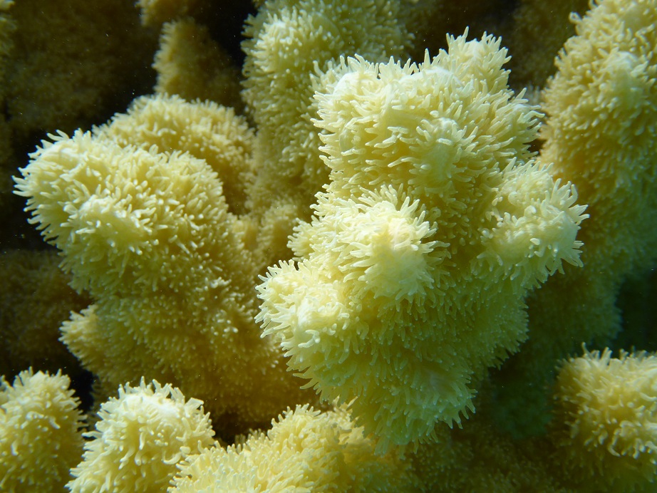
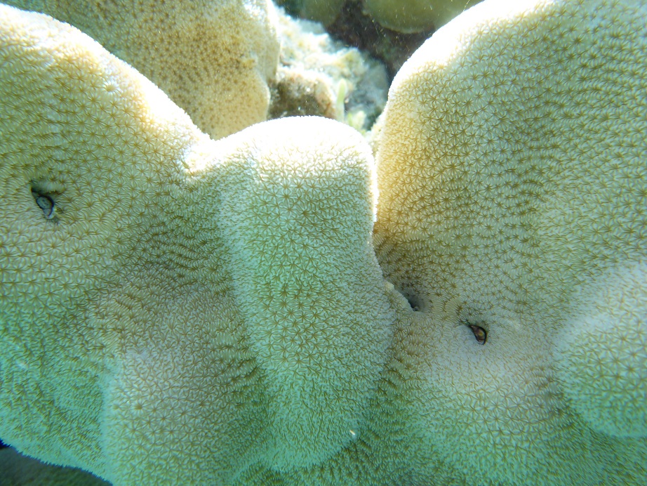
Below the waterline, we’ve been studying coral reefs, using Reef Check survey methodologies, georeferenced GoPro video footage, and general observations. New to the underwater world of the South Pacific, our only benchmarks are the reefs of the Caribbean. Those reefs have suffered dramatically in the last 20 years, losing significant amounts of coral and fish biomass. While we know that many of the same stresses are present in the Pacific, we’ve held out hopes for healthier reefs given the higher degree of remoteness of these islands. So far, we’ve seen a few locations with colorful reefs and fish – including our first soft corals, which are unique to the Pacific –but overall our findings have led to a somewhat grim mood aboard Llyr. We’ve seen a lot of rubble, reefs overcome by algae, and too few fish. In areas of French Polynesia where the coral is virtually non-existent, the dive businesses construct a spectacle to satisfy tourists by establishing feeding stations that draw fish and sharks.

Coral reefs are arguably the most biodiverse habitats on the planet, along with rainforests, even though they cover only 1% of the Earth’s sea floor. They are home to one quarter of all marine fish species and function as nurseries for offshore fish, thereby feeding millions of people. Corals, to many people’s surprise, are actually animals: they hunt for food with stinging cells, farm by raising algae, and build skeletons from minerals in seawater that form protective barriers for islands. Corals have been around for 200 million years and have survived dramatic environmental changes during that time. Though highly adaptable and tough creatures, scientists now know that corals and the reef structures they build are disappearing at unprecedented rates, largely attributable to human factors. Local human assaults on reefs include nutrient runoff in the form of sewage, agricultural fertilizers and pesticides, physical damage, and overfishing. Global vectors include warming oceans which can lead to coral bleaching and now, a change in seawater pH due to the oceans absorbing too much of the atmospheric CO2 caused by humans burning fossil fuels. As the seawater becomes more acidic, the concentration of available calcium ions decreases. Calcium carbonates are necessary for building skeletons and shells for corals, certain “good” algae and other marine organisms.

Aboard Llyr, we have a lot more to learn about what is taking place in the oceans and in these local communities, but the stories we hear, and the scenes we are witnessing all indicate that a crisis is well underway. Ultimately, this crisis will affect not only reefs and South Pacific islanders, but people around the globe. Billions of years ago, life emerged from the oceans. Today, the oceans continue to make life on Earth possible: oceans are critical to our food chain; photosynthesizing plankton provide 50% of our oxygen; our weather is a product of the inextricable link between oceans and atmospheric circulation. These are just some of the incredible life-sustaining elements of the seas.

And lest this account portrays too much an image of people helplessly standing by while their world crumbles, there are many tales we can tell of people we’ve met who speak and act passionately about their lands and seas and the legacy for future generations. In a couple of short months, we will return to our farm and the forests of Heath. The ground will stop moving beneath our feet, and the familiar horizons of our hilltown will be welcome sights. We will continue to take inspiration from these encounters so that we may keep the oceans, the reefs and these communities in our sights as well, to help guide our actions on behalf of biocultural diversity from ridge-to-reef.

Suwarrow Atoll


Suwarrow is a coral atoll in the northern Cook Islands. Declared a national park several decades ago, its status was threatened in the 90s by government plans to commercialize the atoll as a base for fish processing and a site for pearl farming. A Cook Islands conservation group, the Te Ipukarea Society or TIS, launched the Save Our Suwarrow campaign and were successful in preventing the development.


Today, the only residents of the atoll are two caretakers, Harry and Charlie. They spend about 6 months of the year living in Suwarrow where Harry handles immigration and biosecurity for arriving yachts and they oversee visitors and researchers to the atoll.

Immigration formalities with Harry in Suwarrow

Immigration formalities in Suwarrow. Note the gift of Maple Syrup for Harry, who also serves as Park Ranger.

What’s biosecurity? In part, it refers to introduced biological threats to native habitats. For example, over the past two hundred years, rats arriving on vessels have driven more bird species to extinction than in any other region of the world. Suwarrow is considered and IBA, or “Important Bird Area”. Its importance as a breeding sanctuary for seabirds is enormous. It is home to 9% of the world’s population of Lesser Frigatebird, 3 % of the world’s Red-Tailed Tropicbird and a staggering 100,000 Sooty Tern!


Each morning, we’d watch as the terns flew overhead from their night roosts across the lagoon to their daytime island. We approached the small island by tender one day, being sure to keep a good distance, and were treated to the most incredible raucous symphony of bird song, and the sight of tens of thousands of terns swarming over the tiny, low lying island.


Some months prior to our arrival, Bird Life International and TIS had sponsored a trip to Suwarrow to undertake a rat eradication program. Worldwide, over half of all threatened birds are being driven to extinction by invasive species. In oceanic islands like Suwarrow, the figure is more like 75%. The rat eradication campaign in Suwarrow is critical to the survival of these incredible birds.


Birds are not the only protected species in Suwarrow. Sharks, which we saw in good numbers, are also protected in these waters. In fact, the Cook Islands has declared all of their Exclusive Economic Zone (EEZ) waters a shark sanctuary. This region is home to over 18 species of sharks, 15 of which are threatened or endangered. Pressures upon these populations come from fishing fleets seeking pelagic fish like Tuna, as well as shark fins for the Asian market. After the sharks are caught, their fins are removed and the sharks are thrown back into the sea where they soon drown. Its known that foreign fishing vessels shelter in Suwarrow’s lagoon when the caretakers are off island.

OLYMPUS DIGITAL CAMERA


Sharks feeding inshore


The Cook Islands government has been very active in conservation projects. Further to the South begins the boundary for the Cook Islands Marine Park, established in 2012. Covering 1.1 million square kilometers and encompassing over half of the Cook’s EEZ, the park, once up and running, will be the largest one in the world. The government’s actions reflect a positive reframe available to Pacific Island states: rather than being considered small island states, they are, in fact, large ocean states. This is a much better description of the environment where most of their resources lay. Additionally, the Cooks government has made a commitment to 100% renewable energy by 2020! Pretty great!

Our stay in Suwarrow was cut shorter than we’d hoped by weather.  While on the island, we managed to complete several Georeferenced GoPro Video Transects.  We were surprised and dismayed by the overall state of coral and fish biomass, but more on that later.


OLYMPUS DIGITAL CAMERA
Llyr at Anchorage Island, Suwarrow (courtesy of Chuck)

Suwarrow coconuts


OLYMPUS DIGITAL CAMERA        One of Chuck’s great crab photos


Suwarrow coral

Up close and personal with the coral

Suwarrow hard coral


more Suwarrow coral


Rowan Scuba Rowan working on one of Llyr’s Georeferenced GoPro video transects in Suwarrow


Suwarrow Arrival


We are in Suwarrow, northern Cook Islands! We had a wild ride here with the most rugged weather we’ve had in over 5000 miles! Sustained 25-30 knot winds, gusting to 40 and 5 meter swell, though fortunately most often from our stern or back port side. At one point, we surfed down a wave at 13.5 knots!(that may not sound fast but for Llyr, that is FLYING!) Our overall speed for the trip was solidly over 6 knots.


The voyage turned really challenging in the last 24 hours. The waves became so big and fast (it isn’t only size that is an issue, but frequency and direction) that Brooks and Connor had to hand steer through the night since Llyr’s autopilot could not respond fast enough to the waves. They took 2-3 hour shifts. Arriving in Suwarrow in the dark at around 5am the winds were forecast to die, but instead picked up again to 35-40 knots in gusts. We weren’t sure we’d make the pass and even considered just heading on to Samoa, a trip of 5-6 days more. These passes into atolls can be pretty crazy, what with tides and reefs and funky currents.


We spoke by radio to a couple of boats in the anchorage who reassured us that we could do it, so we decided to give it a go.


We’d moved beyond the pass and had been hiding out in the lee of the island for a couple of hours to get out of the waves and wait for the light of day, so we had to turn back into them to return to the pass. We plunged bow-first into massive, short-period, five meter waves for over an hour, with winds gusting to 45 knots. Llyr’s bow buried in the seas as we made only 1 to 2 knots headway under full, roaring motor. Brooks wore ski-goggles and was clipped to a lifeline at the helm, working to counter forces of wind and wave and avoid broaching. Thankfully, I’d read about goggles somewhere and we’d remembered to bring a pair, since the waves regularly doused him! When we turned into the pass, it became a surf ride in at 8-11 knots, with Rowan on navigation, eyes glued to Llyr’s GPS track on our charts and google earth maps. Our relief upon entering the pass – which did turn out to be manageable despite the winds, dramatic standing waves, barely submerged reef structures and side shifting current– was immense. Hard to describe. Everyone hung in with only one case of seasickness (Gavin). Brooks and Connor were particularly magnificent at the wheel and kudos to Chuck for sitting up on deck with Brooks with a grin on his face while the waves crashed over them.


Suwarrow arrival


This is a spectacular place! Like the outer edge of the world that is never seen. Here is a google image, taken from Wiki. See that narrow pass on the northeast side?!