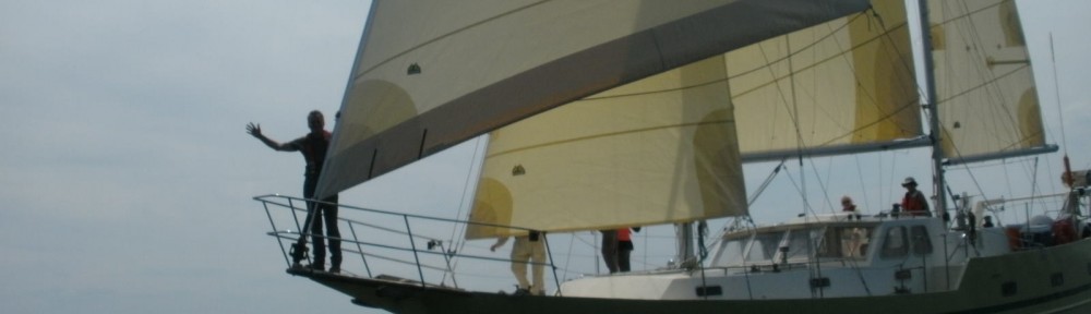
The Storm and the ITCZ

-Written by Connor and Brooks

When it’s summer north of the equator, Panama is located in the path of a global band where Southern and Northern hemisphere winds meet and then slacken. This zone has a technical name: the Inter Tropical Convergence Zone (ITCZ). The northern side of the ITCZ forms the Monsoon trough– known as the doldrums to sailors stuck with no wind–where high humidity and strong sun force convective lift and produce thunderstorms. In Spanish, they are fittingly called “tormentas.” Hot days, high humidity and no wind result in daily rain and torrential thunderstorms. As lazy winds are reformed by the force of uplift, their strength and direction changes frequently, causing sailors to go out to sea expecting poor weather and winds from any quarter.  Leaving Providencia, Colombia, bound for Bocas del Toro, Panama we knew we were entering a new weather zone known for thunderstorms.  What we were not familiar with was the unique ways such storms can operate in the monsoon trough.


The first day out was smooth sailing and we made 6-7 knots in brisk 15-20 knot winds. By the second day the winds died and we started the motor, we could already see the cumulus clouds building in the distance. With darkness falling fast, as it does at this latitude, radar began to pick up rapidly building squalls that were moving southwest like us. Wind became shiftier as the shields of multiple storms passed over us and we brought the mainsail down to its second reef and the mizzen to its first, thus reducing sail area in case of increasing winds. As the sun set behind towering clouds we could see rain cells all around us casting deep shadows on the rolling sea.


By 10 pm, 7 to 8 large thunder cells had passed over or nearby our rhumb line and  we watched them on radar merge and expand into a heavy  line approximately 15 miles wide moving towards Panama. Our winds were 10-15 knots in the same direction and we enjoyed the lack of rain as this big and growing system moved towards land ahead of us and faster than us. Around midnight, and half-way through The Wall by Pink Floyd, the storm wall abruptly stopped advancing West and began rotating to our left developing the distinct and nasty look on radar of a vortex. The rest of the crew was roused and evasive action was taken to starboard with plans to slip out the western side of the storm where it looked to be lighter. The ITCZ had other ideas though and a sudden wind reversal from the west brought the brunt of the storm crashing down on our heads. We braced ourselves for the plummet in air pressure that would lead to high winds.


Some have compared similar experiences to being inside a neon light bulb. Lighting was striking multiple time a second causing small explosions on the water’s surface all around Llyr. Cloud lightning was also continuous in tangled fillamets. Torrential rain made each flash glow like everything around the boat was going critical. Confused by what we were experiencing we turned away from the core of the lightning ahead and towards a slot in the action hard to port attempting to power out the East side of the system with Llyr’s motor and storm-reefed main and mizzen; but wherever we moved, turn after turn, the winds shifted and  slots closed and opened elsewhere as new rotating formations kept us in the epicenter of an exploding meteorological bomb. At about 1am the wind built to over 30 knots, and continued through numerous direction shifts.  The wave state became confused or lumpy, as conflicting winds pushed from all points of compass.  With sails reefed down, Llyr’s heel was around 25 degrees, sometimes more. We were trapped in that every evasive decision we made only put us right back in the middle of the storm, frustrating us and exhausting our meteorological knowledge.  Cornered,  it did not feel to much of a stretch that the storm was actively targeting us.  At about 3 in the morning lightning intensity began to back down and shift more to crazed tangles of cloud lightning as the system appeared to be ripping itself apart.  Winds set in a steady 30 knots with higher gusts from from the West, or offshore.  We made a final course decision to end maneuvers and return to our rhumb line—towards Panama–which put the winds on our bow. The reefed main kept fine form close-hauled and under motor power but the mizzen began flogging heavily and had to be brought in. With heavy wind blasting sea spray and rain across Llyr’s heaving decks Connor and Brooks donned safety gear to go and bring the mizzen down. On deck, absolute darkness alternated with explosive light often now more distant and illuminating a ghostly, electric horizon. The operation went smoothly and on returning to the cockpit, shaky smiles and deep breathes went around as everyone returned to the task at hand of making forward progress. Lightning was already beginning to slack as the storm rained out yet the strong headwind held for many hours, well into dawn, before winding down 20 miles off Panama.


On reflection in harbor, we all appreciated the strength and design of r/v Llyr who, with her high, beamy transom, Spray designed hull and heavy full-keel ,  over-sized rigging, heavy-weather sails and fine electronics, took this adventure in remarkable stride. She never pitched or rolled dramatically, split waves assertively with her bow and no wave ever broke onto her aft deck.  Doyle’s full-battened and reinforced mainsail holds our admiration. From dockside, we now feel that some of our evasive maneuvers successfully avoided cores of heavy lightning in the merging cells. However, they did not maneuver us out of the complex developing system.  As we maneuvered the worst of the cyclonic development blew itself out. In hindsight we might have ended evasive maneuvers somewhat sooner to return to course and perhaps shortened our nighttime drama.

That was our introduction into the ITCZ and the monsoon trough.  Practically every day here in Bocas Del Toro, through all of July, you can see flashes and explosions of similar slow-moving, swirling or stalled action offshore and inshore, sometimes for three days or more with minimal interruption.  In the Domincan Republic and Haiti we often watched building thunderstoms be torn apart by trade-wind shear shortly after emerging.  Not so near the ITCZ.   Infra-red Satelite images and GOES water vapor loops confirm that in the monsoon trough the tormentas often control the winds.

The more we experience the weather, on the farm and at sea, the more we learn and the more refined our questions become for those more experienced than us. We are humbled before the sometimes terrible magnificence of this planet’s energy systems. It is in the background all the time that it is at the behest of these intensities that we enjoy our world and with our industries alter her forces into an unknown future.

A Short Stop in Providencia, Colombia

Providencia was a 4 day run from Ile a Vache which began fast in 10 foot seas on a broad reach. Llyr is a great trade-wind sailboat: she loves wind off her beam at 15 to 20 knots or more. During the day we could run with all sails and 7 knots which feels screaming fast with all the noises and action of water and wind. At night we’d go to the mizzen and either staysail or genoa and Llyr would settle nicely into the waves with her power balanced and needing little adjustment. As we neared Providencia, the winds slackened as forecast.

Providencia, an old volcanic island, is part of an island archipelago, including San Andres and Santa Catalina. Though located about 100 miles offshore of Nicaragua, it belongs to Colombia. We were learned that this island was first settled in 1631 by English Puritans who arrived aboard Seaflower, a sister ship of the Mayflower that colonized Massachusetts Bay! Today, the island culture is Anglo-Caribbean and most residents descend from those early English settlers and African slaves.

Providencia is part of the Seaflower Biosphere Reserve and includes the largest MPA in the Caribbean and Latin America. The MPA is locally managed by CORALINA. Apparently, great effort has been made to include fishers in conservation efforts for the archipelago and marine zones now designate different types of activity. We were not able to stop in San Andres, the more developed of the islands, and only had a couple of days to gather our impressions in Providencia, however, we were still puzzled by the complete lack of any indication of fishing livelihoods in Providencia. There were no fishing boats in the harbor; nor did we see any fish for sale in the markets! We also learned that the island has no high school, so that after primary education–which includes significant environmental programs –the young people have no choice but to go off island to school. As we learned, not many people return to the island given the very limited options for making any kind of a living. While tourism to the archipelago is strongly promoted (“with ¾ of Colombia’s coral reefs”), there was not even that much typical tourist development in town.

Our observations and findings from our time in Providencia, including a review of the Reserve literature and website, continue to lend weight to our reflections on the challenges of building robust models which integrate biological and cultural diversity to support local development over the long haul.

A weather window opened for Panama with the prospect of high winds to follow in the central Caribbean a few days later, so we decided to move on. We anticipated a 2 day run to Bocas del Toro, with diminishing winds as we approached the Isthmus.

Ile a Vache, Haiti

Ile a Vache, Haiti

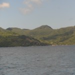
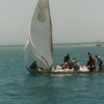
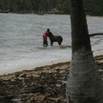
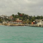
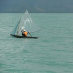
There are 36 small villages on the offshore island of Ile a Vache, Haiti, surrounded by some of Haiti’s better reefs. In early dawn light a breathtaking scene that is centuries old unfolds: the ocean is covered to the distant horizon with scores of sailing boats headed for island and offshore waters. There are no motors in this fleet. Small canoes made from single, huge mango trunks and larger handmade craft which hoist latteen rigs swiftly carry fishers to their day’s work.

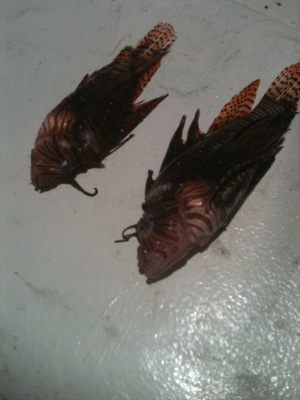
The nets of 1 inch mesh and long lines and sheer numbers of fishers mean large fish are gone. A typical catch consists of juveniles, restocking from the deep, and only between 4-6 inches in length. The villages of Ile a Vache have no power, no roads, no cars and local open well water. We anchored in the Baie A’Feret, just offshore of the village of Caille Coq. Sounds of the day carried out to Llyr: the slam of dominoes on tabletops; shouts from boys and men playing soccer games; the voices of children headed to and from school…. As darkness falls, everything quietens down. The flicker of cell phone flashlights that gained their charge from solar charging stations dotted around town can be seen wavering along the beach. Off in one far corner of town a bar-shack with a generator sometimes plays music.

On the tip of this bay is the Port Morgan Hotel where a shiny burgundy helicopter comes and goes ferrying, we are told, friends of the president and supplies for their pleasure from the capital Port au Prince. Their guards are hardened men with old, well polished shotguns.

We spread our huge and torn Universal Power Sail out by the helicopter where the ground was open and flat and traded it to two fishermen – we cut it fully in two – for lobster, potatoes, onions, carrots and mangoes. The helicopter guard with his shotgun was a friendly translator between Creole and English.

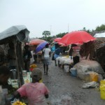
The walk to the island’s bi-weekly market, and to Sister Flora’s well known orphanage, was 7 miles by path in light rain and slick, caking clay mud. We passed through tidy thatched fishing compounds, large fields being plowed with hand swung maddox, and swamp flats of disturbing filth, garbage and odors.

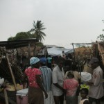
The market was intense. Dense crowds packed into narrow alleys of thick, slick mud, filthy puddles hemmed by palm frond and plastic-covered stick frames sheltering charcoal fires, frying dough, fish, fish traps, vegetables and plantains, toiletries, candies and shoes from the mainland. On the other side of the market, past dozens of pack donkeys with palm/rattan packs, we arrived at L’Oeuvre St Francois, the orphanage and school run by Sister Flora Blanchette,a French Canadian who has spent the last 35 years on the island. She is a small powerhouse, clear and political. We listened to her forceful emphasis on a need for jobs and that nonprofits are not helpful with this. It comes down to economics, she stressed. People don’t need charity; they need to earn their living in meaningful and sustainable ways. Sister Flora is well aware that the fisheries are in trouble. She spoke of her vision of bringing pistachio farming to the area, a crop with strong intrinsic artisanal value that keeps and transports well. She asserted that pushing Ile a Vache to tourism only drives up prices for the poorest and excludes them while destroying village integrity. She told us she was glad for the rain to fill the water cisterns, but concerned because cholera thrives in rain and the cooler temperatures it brings. In December, she lost 6 children to cholera.

Before leaving Ile a Vache for Providencia, Colombia we took a public launch six miles to shore to Les Cayes, Haiti’s third largest city. Winds were strong on a lee shore so surf was pounding the landing area where all boats came to town: not a dock, but smashed cement chunks and rocky shoreline crowded by side to side shacks with cement privy’s set out over the water. Stirred by driving wind the surf was a grey and brown froth of garbage and human waste. On shore waste piled high, a yard of rotting material underfoot. Lateen rigged sailboats, packed with mango baskets crowded in and dropped rebar hooks to grab the bottom. Lean old men, soaked, legs spread wide standing with long poles deftly maneuvered their smaller craft to our boat to ferry us closer to shore. They poled us to the edge of the surf where other younger men waded out to us in chest-deep water and directed us to climb on their backs. They brought all of us to shore in this fashion and for their services, everyone got a little money. An older woman, in her blue, go-to-market dress attempted her own transition from a sailboat loaded with mango baskets. She lost her footing and went underwater into the sewage. She came up, and waded ashore, revealing all in her sudden transition from elegant to undone.

We were in town to get groceries and bottled water. To get them back to the boat, we hired a young man with a cart. This consisted of a truck axle topped with planks and pull-poles. The town was buzzing with scooters, cars and pedestrian traffic. He hoisted up the loaded cart and charged off to the docks, wearing old rubber flip flops with no heels.

The following comments were written by Janis

Situated in the western end of the southern coast, Les Cayes is Haiti’s third largest city. Greg had a scheduled appointment with some UN officials and needed to be delivered to town. Les Cayes has an exposed shoreline, bearing the full effect of the E/SE tradewinds and swell. There is no harbor or safe docking area. We brought Llyr in as close as we dared and then Connor drove Greg, EJ and Romain to shore in the tender. We quickly realized that we had no interest in turning circles for the morning in all that swell with shallow sand banks all around us. We decided to head on over to our next destination, Ile a Vache, an island about 5 miles away, uncertain as to how exactly we’d recover the shore team. (Fortunately, they were able to get a water taxi over later that morning.)

Entering Baie A’Ferret, we were quickly surrounded by small canoes. People were hanging off our freeboard (Llyr’s side walls) before we’d had a chance to set our anchor! In cruising literature, Ile a Vache is the only recommended stop on Haiti’s southern coast. Most sailors typically bypass Haiti altogether, however, the few that do stop come to this small, sheltered bay. The impact of this modest amount of activity was very visible to us. People clearly understood that sailing boats represented economic opportunity and during our stay there, we had many daily visitors offering services like hull washing, laundry, prepared meals, and more. Sadly, we also had many people straight-out begging. Llyr had arrived in the last weeks of school, and among our visitors were many young men hoping to earn some money to pay for their final exams. Families have to pay for everything for their children to go to school in Haiti – from pencils to uniforms to tuition and exams.

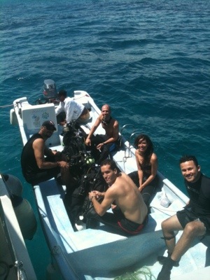
The island of Ile a Vache is home to several dozen small communities, most of which depend upon subsistence fishing and farming. There are few options for earning money. Our Reef Check surveys found some of the healthiest reefs yet and with the already present “tourism” in the area, it seemed Ile a Vache would be selected as a potential site for an MPA. There were already plans underway to open a small museum on the island with artifacts from shipwrecks as part of encouraging more tourism, and dive tourism in particular.

As elsewhere in Haiti, establishing an MPA in Ile a Vache would be a daunting task. Our interest was to listen and think aboutways to develop alternatives that might help make it possible. Based on our observations and what we discussed with Sister Flora, Ile a Vache would need a lot of careful planning in order to set the groundwork for an MPA and tourism alone clearly isn’t the answer. Tourism was already breeding some ill feelings in the community as it was perceived as benefiting only a few. We were very impressed with Sister Flora’s assessments of the problems and her vision of the possibilities.

(I was also most interested in Sister Flora’s opinion that it was a good thing that families had to pay for their children’s schooling and supplies. She felt that if these came for free, they would have no value and families would not push their children so hard at school. I don’t know enough about the education situation in Haiti to know exactly what I think of this perspective. I can say that with an average family size of 6 children on Ile a Vache, I’m not sure that all the children get an equal shot, particularly the girls. During our whole time there, I was never approached by a teenage girl asking for help with her exams, whereas this was a common occurrence with the young men. While this isn’t conclusive evidence, it certainly fits worldwide trends.)

Caille Coq was the first place Gavin got to play with any kids this summer. Three young boys–Levins, Michelin, and Israel–became regular visitors to Llyr and would sometimes take Gavin back to shore to play soccer with them. After Gavin’s first soccer game in town, he came back with huge blisters on the soles of his feet from running around barefoot on the dry dusty field. Of course, none of the boys had shoes, let alone cleats and shin guards. At first, the boys asked for money for being Gavin’s “friend” and we told them that it was not right to pay them for friendship We did, however, hire them for small jobs like carrying our garbage to shore. At the end of our visit, we shared a lunch with them and gave them some school supplies.

Our work with Reef Check came to an end in Ile a Vache and we said goodbye to Greg, EJ and Romain. We really enjoyed having them aboard Llyr, making it possible for us to visit Haiti and learn more about Reef Check (Connor and Rowan became excellent at data entry!) and just enjoy their great company. We shared some delicious feasts, adventure, starry nights and close quarters.

When they left, we felt the loss of EJ and Romain’s Creole, but by that time, we had a “fixer” to help us with any necessary tasks. Carma Cadet was a local from Caille Coq with pretty good English. Between that and my French, we were fairly well set for the remainder of our time in the area. Carma helped us get water, he accompanied us to Madame Bernard to the market and to the orphanage, and traveled with us to Les Cayes for reprovisioning before our next passage. Our conversations with Carma were great and he gave us some real insight into life on Ile a Vache. We shared stories with him about our farm and discussed our purpose and interests on this expedition. He sat through our conversation with Sister Flora and from that we had many interesting discussions about economic opportunity.

Les Cayes

In order to reprovision for our next passage, we would have to make a trip to the city of Les Cayes. Brooks and I left Connor, Rowan and Gavin with Llyr and were joined by Carma for the 45 minute ride by water taxi to the mainland. The water taxis are 20 ft open,narrow boats with 40 hp outboard motors. Passengers can sit three abreast.

As soon as we came out of Baie A’Ferret, we hit the waves and the ride to shore was wild. As we got near the town, the waters were so turbulent that we were met by smaller boats that could bring us closer to shore. Trying not to get dumped, we clambered from one boat to the next as they heaved side by side. These smaller boats were operated by wiry old men who poled the boats closer to shore. When these also could not make a landing, we were met by young men who walked out waist deep in the swell and they piggy-backed us to shore! The shoreline was just a gap in the line of housing that stuck out over the water. The ground was covered in litter and other human waste. Carma quickly led us into the streets of Les Cayes so that we could do our shopping

Les Cayes has featured prominently in national and international news since the earthquake in 2010. Briefly, shortly after the earthquake, there was a riot in the prison in which many prisoners were killed and wounded. Initial reports claimed that it was prisoners who had killed other prisoners, but evidence began to mount that this was not the case. This January, almost two years after the slaughter, a 3 month trial concluded finding 8 prison officials guilty. In a rare occurrence, the highest ranking officials – the former Les Cayes prison warden and the city’s riot police chief, who was tried in absentia – were given the stiffest sentences. This trial was hailed as a landmark case in Haiti, where corrupt officials are not often punished. For many people it is a hopeful sign that some things are changing in this strife-torn country.

You can read more about this amazing story at the following link.

http://www.nytimes.com/2012/01/20/world/americas/7-haitian-policemen-convicted-in-2011-les-cayes-prison-killings.html?pagewanted=all

We finished our shopping and then stopped in a local restaurant for lunch to wait for our return launch to Ile a Vache. Carma found the  young man with the cart and worn flip flops who hauled our groceries and water bottles back to the boat. The seas had not calmed down. We watched the wild shoreside scene as we waited for our piggy-back rides back out to the poling boat, and from there to the water taxi. The return trip had us into the wind and waves so we all covered ourselves with plastic tarp and sat in darkness all the way back to Ile a Vache

Time was coming for us to leave Haiti. This would be our first offshore passage with just our family on board. Our access to weather forecasts was spotty as the only source for internet was at the hotel and they were having trouble getting on line, but the weather reports we were able to obtain indicated favorable winds and seas for our passage south. We decided that we’d head for Providencia, Colombia, an island well off the coast of Nicaragua. We figured it would take us about 4 days to get there, leaving another 2 day passage to Panama.

Below is the link to the New York Times Haitian EcoDivers Video

http://video.nytimes.com/video/2011/09/01/world/americas/100000001030590/ruin-and-hope-on-haitis-reefs.html

Additionally, this is a link to a New York Times video raising concerns about USAID policy in Haiti and highlighting the tensions about economic development in Haiti and conservation of biological and cultural resources.

http://video.nytimes.com/video/2012/07/05/world/americas/100000001632553/a-factory-grows-in-haiti.html

Poverty, Consumption and Conservation

Perhaps it’s inevitable that one arrives in Haiti with preconceived notions about the country, given how frequently Haiti appears in the news media with regards to social, political and environmental upheaval. It is the poorest country in the Western hemisphere, and widely referred to as the “Republic of NGOs.” Everyone wants to “fix” Haiti. Indeed, for us much of Haiti does seem mired in tragedy and sometimes being there feels like witnessing humanity at an end of time. One wonders exactly what state of affairs it takes for people to live amidst mounds of their waste and filth?

 Haiti poses one of the greatest conundrums. Can alleviation of severe poverty occur in conjunction with environmental regard? In a place like Haiti where such basic human needs as clean drinking water are not often met and cholera is still widespread, isn’t it an indulgence to care about reefs? Shouldn’t that come way down the line?

Clearly, people need clean water, food and shelter. But from those basic needs, and perhaps in order to meet those needs, humans build culture and continue to interact with their environments. Means of subsistence are most sustainable if they come with long term vision that supports biocultural diversity. Haiti has a plethora of projects introduced by NGOs that lie strewn about the country with broken parts, abandoned goals, and people still suffering from the lack of basic provisions. In concert, the land and fish thin and cease to be robust and giving.

Haiti has been confounding to us – or at least the parts of it we saw confounded us. Amidst all this loss and deprivation, we also witnessed perseverance and playfulness, and remarkable skill and capacity among Haitians we met and saw at work. How might a development/conservation project support, defer to, and build upon those qualities?

Being in Haiti, the question of poverty and conservation invokes its twin: can environmental regard coexist in a setting with affluent consumption? Our footprint on the planet is much larger than that of practically everyone we met in Haiti and we are also culpable of fouling our own nest. The crisis of our consumption sometimes also feels like witnessing humans at the end of time.

Haiti Part 1

Since this blog was last updated, we have worked on the south coast of Haiti surveying reefs and learning about the challenges for biocultural diversity in this region that has suffered so many social and environmental upheavals. There, we had the pleasure of working with and learning from a great team from Reef Check. From Haiti, our family undertook its first “solo” passage to the offshore islands of Colombia where lies the Seaflower Protected Area and then onto Panama, and then by land to Costa Rica. It has been an incredibly eventful and stimulating couple of months.


After a productive and pleasurable few weeks in DR, we were both eager and anxious to get underway to Haiti to work with Reef Check on surveying the country’s south coast. For the past 2 years, Dr.Greg Hodgson, the executive director of Reef Check, has been working with associates in Haiti under a MacArthur grant and the auspices of the Haitian government surveying the coastlines to identify reefs that might be set aside as marine protected areas. This was their first investigation in this area.


Coral reefs, along with rainforests, are considered the most biodiverse habitats on Earth. Scientists are only beginning to understand these complex ecosystems, and ocean conservation actions in general lag far behind land-based ones. We do know that coral reefs are nurseries for tropical oceans and are estimated to feed over 1 billion people worldwide, along with providing many other ecosystem services. Reef Check research along Haiti’s other coastlines had confirmed that fish stocks were depleted and subsistence fishers rarely find fish over 6 inches anymore. Local and global stressors combine force to erode these ecosystems. Scientists and reef managers debate where best to apply energy to save coral reefs, and even whether or not reefs can be saved at all.


We left DR with Reef Check member Edward J. Beucler. EJ has been working with Reef Check in Haiti from the beginning of their project, bringing his many skills including computer mapping expertise and speaking Creole. In addition, he has worked with Reef Check to train a group of Haitians as SCUBA divers and then Ecodivers, as part of building a local constituency of people who can continue reef conservation efforts in Haiti over the long term. Working with Google Earth images, we had several sites along the south coast that were of interest for investigation. This data also suggested, however, that we might find high turbidity on the eastern end of the coast. We anchored in a beautiful area called Pointe de l’Acul. The coast had white limestone cliffs at sea’s edge, framed by a massive mountain range inland. At our anchorage, there was an incredible limestone formation bearing striking resemblance to a pair of polar bears. The setting was stunning.


Connor, Janis, Rowan and EJ headed out in Llyr’s tender (dinghy), “Nereus” to conduct our first manta tow. This involves a surveyor being towed behind the tender on a board which they use like an airplane wing to adjust their depth. A GoPro camera is attached to the front and aids the researcher in data collection. The process is efficient, gathers a lot of data rapidly, provides an overall picture of what lies below the surface and helps determine sites for in depth surveys on SCUBA. Data collected is a rough calculation of substrate and fish species diversity, size and quantity. Points along the tow are recorded with GPS and uploaded to Reef Check GoogleEarth maps.


Our manta tow findings confirmed high turbidity, possibly due to the limestone, agitated sea state, and poor reef habitat. We saw very few fish, low coral coverage, and overall poor visibility.


Aboard Llyr that afternoon, we were visited by some fishermen in their dugout canoe. They had caught lobster, shrimp and a surprisingly large red snapper! We purchased the lobster and shrimp and declined the snapper which was too much food for the six of us. Spiny Caribbean Lobster are an indicator species in Reef Check surveys. That means that their presence or absence is an indication of fishing pressures. We were sensitive to the paradox of enjoying our fine lobster grill aboard Llyr while researching effects of fishing pressures on this species. This would not be our last lobster dinner on the coast.


Eastern Haiti has few protected anchorages for boats and the sturdy southeast trade winds bring swell directly to shore which made it challenging for the crew to conduct our research. Large waves rolled in constantly and the cliff-lined shore sent them right back out creating large standing waves or “lumpy seas” and pitching the boat in unexpected ways. At one point EJ and Connor dropped below on SCUBA to attempt a survey in an area understood to be 30 feet deep according to charts. The dive team quickly resurfaced; they’d crunched unexpectedly into the bottom at about 8 feet with zero visibility!


As we progressed towards Jacmel where we’d be joined by the rest of the team, each morning we were met by the site of many small fishing boats heading out in their dugout canoes, some equipped with sails made from scavenged cloth and plastic. We spent a significant amount of time dodging fishing nets and long lines supported by plastic water bottle floats. We were reminded of evasive maneuvers we made in the Gulf of Maine last summer, dodging dense fields of lobster pots. There seems to be little open ocean for fish or boats anymore near the fishing coasts. Notably, we did not see any FADs (fish aggregation devices) such as we had encountered along the coast of DR. (Those FADS were made by tying many bottles into a bundle and attaching them to palm fronds to provide cover where fish like to gather and can be more easily collected with nets.)


We arrived in the harbor of Jacmel where we were joined by Dr. Greg Hodgson, Reef Check’s executive director, and Romain Louis, a graduate of the Haitian Ecodiver program and a teacher in Port Au Prince. Jacmel is located at the end of a large bay and its architecture is a legacy of the French colonial era. Today, its buildings are worn and the city was a casualty of the recent earthquake with much debris still to be removed. We found fairly good anchorage right off the town, although the constant wave action made each foray to shore a somewhat stressful one as we tried to avoid tearing up Nereus’ bottom on the rocks, metal and trash along the broken docks the earthquake and poverty had brought to ruin. With EJ and Romain’s skills and Creole, we were able to employ a local “fixer” to mediate and buffer for us during our 3 day stay.


We explored Jacmel bay for possible survey sites but found little to pursue. We took Llyr out to the mouth of the bay where Greg and EJ completed a Reef Check survey below the cliffs on what they described as a fairly healthy reef, even though it was also short on fish. While the rest of us circled on Llyr, Janis caught site of a large object in the water. Thinking at first it was a manatee, we all quickly realized we were privileged to be seeing a massive Leatherback turtle. Brooks determined that his sighting of a large “body” in the water a couple of days previous was also a Leatherback. Leatherbacks are the largest of all living sea turtles and their range is extensive across the world. Although they are hunted less than other sea turtles for their meat, which is fatty and oilier, habitat loss, predators, and other factors have placed them on endangered species lists.


On the eastern shores of the Baie d’Aguin we found a beautiful and sheltered anchorage. Brooks, EJ, and Romain set off on the tender to visit a small village nearby to inquire about fish. It turned out not to be a fishing village but rather a rugged spot where men were turning mangroves into charcoal! They had left a small patch of mangrove in front of the village for storm protection—which is what mangroves do worldwide– but were in the process of taking everything else around them.


More to come….

Reflections on Offshore Passage Making

Crossing an ocean on a sailing vessel is not an original venture, but neither is it a common one. Though more than 7 billion of us live on this water planet, out on the seas on a small boat, you might well think you have this blue planet all to yourself. By and large, we humans think of ourselves as terrestrial creatures, even though science reveals that the massive oceans govern so many of our life-support systems on land. In spite of the facts, most of our apparent interests lie ashore and we turn our backs to the sea.


Still, throughout the ages there have been those who’ve fared the sea, people driven by such motives as curiosity, necessity, and glory, as well as those forced to sea. Sea tales include some of the most exciting, dangerous and fantastical adventures. From Odysseus to Melville’s Ishmael and Hemingway’s Santiago, the sea is an excellent stage for human dramas with nature and within ourselves. In casting our gaze and all our senses seaward during our offshore passages aboard Llyr, nothing familiar or particularly comforting fills our fields of vision. And as EB White wrote, “the sound of the sea is the most time-effacing sound there is.” It is an opaque world of blues and silver, salty smells and salt-encrusted skin, where time is marked by watch duty in a rolling cascade of night and day. The occasional visit some 800 miles or more offshore by large pods of dolphins riding our bow wave or the graceful flights of flying fish breaking away from our dark water shadow brings a frolicking reminder of all that lies below us and a whimsical wish for inter-species conversation.


If being offshore is our liminal period, the environment that is neither the ridge nor reef of this expedition but the border-zone between, our activity around coastal waters, the nexus of land and sea, constitutes the field sites for our expeditionary studies and work on behalf of defining and building sustainable markets that support biocultural diversity.

Boca Chica, June 1

We’re all together again with the return of Janis from the farm and the Memorial Day weekend market in New Paltz, NY, accompanied by Rowan, who has been healing well and finishing his school year.

As Janis shared with customers the latest on our Ridge to Reef project, Brooks, Connor and Gavin were very active with Dr. Ruben Torres, head of Reef Check DR.

This week, Brooks and Connor worked with Dr. Torres to become Reef Check EcoDiver trainers. This training builds upon our family trip in December of 2011 to Key Largo FL where we all received our EcoDiver certification from Jessica Pfulfer . Although Gavin was too young to actually do that whole program, he studied with us and enhanced his skills in fish and invertebrate identification. Here in DR, Brooks and Connor have gained the skills to train others in these citizen science methods that provide front line data on the health of coral reefs to researchers, organizations and governments worldwide.

Ruben has shared many stories about his work here in DR and his travels abroad. He offered us a useful and poignant description of what we’re all up against, which is that so many people have their backs to the sea. We have been pondering this image, exploring it in ourselves and thinking about its value for talking with others. Connor used it in his Skype presentation to his school, described below.

We’ve made a couple of visits to the Capital. Our first trip in was to purchase charts of the coastline of Haiti– in anticipation of our work there– from an incredible map store in the Colonial district called Mapas Gaar. Santo Domingo is the oldest city of European origin in the “new world.” Our first visit there took place two days before the national elections and the city was abuzz with the impending vote. On the main roads the candidates had huge billboards every ½ mile or so! The candidate for the incumbent party won by a narrow margin.

In addition to Brooks’ and Connor’s Reef Check training, they joined Dr. Torres in a variety of other activities, giving them the opportunity to see more of the Dominican Republic and meet more people. On the 25th they performed a reef assessment as part of a resort’s certification process for recognition of “green” environmental practices. On May 26th, Brooks, Connor and Gavin motored Llyr over to La Caleta Marine Park, the MPA managed by Dr. Torres, to perform a Reef Check survey with a group of new trainees who came aboard Llyr and talked about their enthusiasm for working with Reef check and heard about our project and goals. Then they all got to drive across the island with Ruben to the northern side of the DR to the Samana Peninsula to do beach erosion surveys and water quality tests. They also helped Ruben with a coral gardening project at a resort, where rebar plots have been set up and laced with pieces of coral to help rehabilitate their reefs. The usefulness of such restoration projects is highly debated, a topic we’ll address in a later entry. The interior of Dominican Republic is mountainous with thick jungle. As one drives further north, the mountains quickly give way to extensive rice fields that stretch to the coast.

While doing survey dives, they’ve also been taking part in Lionfish control. Lionfish are abundant here, as they are across the Caribbean. They’ve also been making their way up the Eastern seaboard. Lionfish are a Pacific fish, likely introduced to this ocean through the aquarium trade. They have no predators here, reproduce rapidly, and eat all the fish around them. They do make good eating themselves, fortunately, and there is an effort to introduce them to menus everywhere. They can only be caught by spearing them, however, so that limits their capture to fishers who swim. We’ve found them to be an absolutely delicious, white-meat fish, as long as you remove the incredibly poisonous spines from their backs, best done underwater with shears.

Of great note, Gavin has found 2 seahorses while here in the DR! The rest of us have never seen one before and his sharp eyes have found two.

Connor gave a Skype presentation yesterday to an assembly at his school, Mohawk Trail Regional High. Present were Mrs. Dearborn’s Mad Science class, Mr. Lussier’s Ecology class and Ms. Schefflen’s Spanish class. He shared his experiences on the expedition, talked about Reef Check, travel abroad, and life at sea in general. He borrowed Ruben’s image of people with their backs to the sea and raised the question with his peers about how we can live our lives in ways that allow us to pursue our personal interests and which build our curiosity and responsibility in the larger world.


These are our last few days in Dominican Republic. We’ve really enjoyed our time here, including getting to know Tony and Lisa Torres (Tony and Ruben are brothers) who run the boatyard here. The staff here at Marina Zar Par have all been very helpful; we offer special thanks to Raoul, dockmaster at the Marina, who has helped us with many logistics, including calmly guiding us to our berth on the day of our arrival. Brooks is really getting the hand of moving Llyr in tight places!

During our work in Haiti, we anticipate that we won’t have full access to internet, perhaps until we reach Ile-la-Vache. Look for a blog update in a couple of weeks!


20120603-194554.jpg

20120603-194606.jpg

20120603-194627.jpg

20120603-194639.jpg

20120603-194701.jpg

The Bermuda-Dominican Republic Passage

And so the first leg of our Caribbean passage making comes to a close with our arrival in the Dominican Republic! Monday afternoon saw the Eastern Coast of the DR growing through the haze and by the evening we had docked Llyr on a short stretch of pier at Marina Casa de Campo. Our boat was soon host to half a dozen officials, including immigration, the Navy and the Office of Agriculture. After 8 days at sea it was strange to be so over-run with people; that being said, we managed quite well with out spotty Spanish and their minimal English.
The first 3 days out of Bermuda were a hard push to get below the 25th parallel by Thursday, May 10th as a front and gale were going to develop along the eastern seaboard. This would mean that winds above that latitude would be pulled into strong Southwest headwinds. we needed to average approximately 6 kts,or 150 miles per day in order to do this and so kept the motor on to augment the sails in relatively light winds. The water and air around us warmed the further South we travelled and we commonly sailed past Portugese Man of Wars These small irridescent jelly fish which cruise with their “sail” along the surface of the sea like small ships. Sargasso became as common as grass and commonly fouled the fishing lines; Gavin would rush up the stairs multiple times a day as he heard the line go out and would return dejected with a clump of Sargasso. Luke’s birthday also came and we celebrated with a delicious breakfast of eggs, toast, and bacon and a blueberry crisp for evening dessert. Heath blueberries and BSGFarm maple syrup had us thinking of home as we sailed along, east of the Bahamas. Able to average 130 miles per day we cought the SW headwinds for 12 hours of rough building seas. With our arrival on the morning of the 5th day at the 25th parallel the water topped 80 degrees and the wind finally turned more favorably to the East. We turned the engine off for the last time until the Mona Passage. During this passage a large pod of 20-30 dolphins, some 8-10 ft in length, swarmed Llyr for around half an hour. Four or so would cluster tight right under her bow keel and ride that wave while others zoomed in and around. We were just above them and could hear their talk to each other!
The coming days were absolutely perfect sailing. Initially we modified our course to bring us to Samana, Dominican Republic, a port further West than our original destination, in order to catch a better reach with the wind. But as the wind backed from SouthEast to East, our course was corrected back to the Mona passaged and we continued on at 5-7 knots.
At one point off the Bahamas we found ourselves on a near-miss course with the cargo ship Overseas Maremar. After correcting our heading to pass to their stern, we were hailed by Second Mate, Andi Burttschell, as a courtesy to verify our path and recognize our presence. We fell to talking and learned she was a marine biologist and talked about the project and were excited to get an e-mail from her on arrival in the DR!
The night before the Mona Passage was certainly the roughest, 25 knot winds grew beam seas which rolled the boat as she plunged along at approximately 7 knots under only sail. Frequent thunderstorms and almost constant lighting had us dodging squalls throughout the night. The Mona Passage itself was easy, despite the many warnings we received about conflicting currents and winds. We reached our port of entry, Casa de Campo, Monday evening.

Marina Casa de Campo is located in the world’s top rated Golf Resort. As high season has ended, the place was empty and had a somewhat odd, theme-park feel. We cast off next morning and spent all day sailing along the Dominican coast. Lucy spotted a turtle and we saw many schools of flying fish (forgot to mention that on several mornings of the passage, we’d find flying fish on deck, victims of nights flights that landed them on dry deck.) At last we arrived at our final destination, Marina Zar Par in Boca Chica. Brooks, who has become quite the master behind the wheel, deftly piloted Llyr in a 180 degree spin around a mega yacht and into a bow-in slip in a feat we all thought impossible. The feeling of stepping off the boat onto solid dock is one that, after 8 days, feels pretty good and we sat down to a traditional Dominican dinner and celebrated the conclusion to the first big step of our cruising careers!
We’re faced with continued work though, as a major ocean passage has left Llyr ecrusted with salt and with stiffened rhodes. Corrosion on a steel boat is always an issue and small dings in the paint become rust stains with continuous salt water exposure. Additionally, one triple block serving the main sheet broke en route, the mizzen outhaul chaffed through and we sadly lost our Universal Power Sail to flogging as it tangled on deployment. So a full boat bath and tune up now as Connor and Brooks prepare to undergo training to become Reefcheck trainers while Janis returns to do our Spring market in New Paltz,NY.

20120517-131515.jpg

20120517-131524.jpg

Bermuda

Bermuda May 3-6th
The winter layers finally began to fall off as Llyr crossed the Gulf Stream and into 70 degree, light blue Caribbean waters. Like all good things, the calm seas and open ocean swimming in 17,000 ft of water came to an end and gave way to building winds and by Wednesday we were in 12 ft confused seas with wind gusts just under 30kts. The majority of the crew split their time between watch duty and being nauseous, save Luke who either had an iron stomach or was just good at acting.
Our passage to Bermuda took 6 days and when we arrived we stumbled around the docks for a couple days before we finally got our land legs back.

Bermuda is a lovely country with sparkling blue waters and white beaches that we’ve been too tired to thoroughly explore. We’ve spent a majority of the time re-provisioning and preparing for the next leg of the trip. Thankfully, our relaxed adventures have left us energetic and excited for the passage ahead! Our plan is To travel along the eastern part of the Dominican Republic and along the Mona passage, a stretch that is notorious for strong currents, the alternative however is an extra 400 miles of sailing along the southern coast of Hispaniola.
We set sail for the Dominican Republic tomorrow morning!
Until then!
The Llyr Crew

Llyr is underway!

Llyr is finally underway, after so many months of preparation and anticipation! It appears we have a fine weather window for our trip across the gulf stream and on to Bermuda. We left Salem this morning, a crew of six onboard, sorely missing Rowan who broke his collar bone on Tuesday night. He will fly down to the DR after he and Janis attend the Quail Hollow craft show in New Paltz, NY, Memorial Day weekend. Luke and Lucy, two additional crew are with us. They will sail with us to the DR, at which point they return to the US en route to Palmyra Atol in the Pacific, where they work for the Nature Conservancy. We were excited to have porpoises surfing and fishing off our bow the first day out! In the past weeks we’ve been busy preparing to leave the farm and finishing our refit and provisioning of Llyr. Brooks and Connor dove on the hull to remove barnacles, algae, and other growth below the waterline. Slackening winds are bringing us along the eastern beaches of Cape Cod as we write. More to come after we cross the gulf stream and enter Bermuda!

20120428-182147.jpg

20120428-182156.jpg

20120428-182334.jpg